Winter Hiking Trail Niedertal - Mountaineering Village Vent

Winter hiking


- Brief description
-
MOUNTAINEERING VILLAGE VENT -> NIEDERTAL
- Difficulty
-
easy
- Rating
-
- Starting point
-
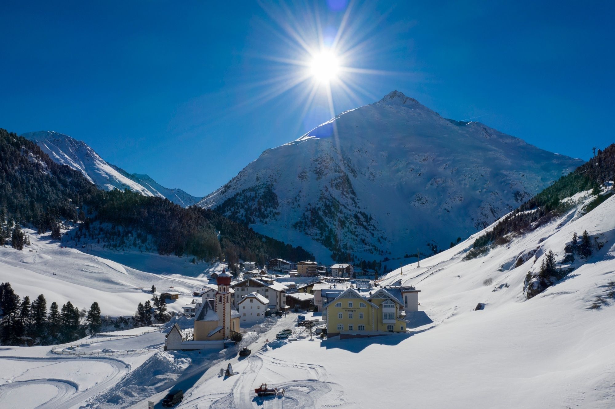
Church - Vent
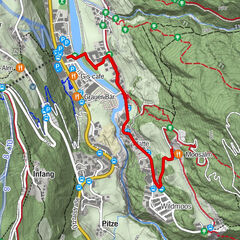
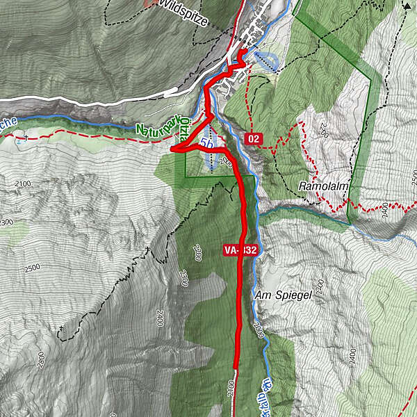
- Route
-
VentGasthaus Pension Obervent0.1 kmOchsenkopflift0.5 km
- Best season
-
AugSepOctNovDecJanFebMarAprMayJunJul
- Description
-
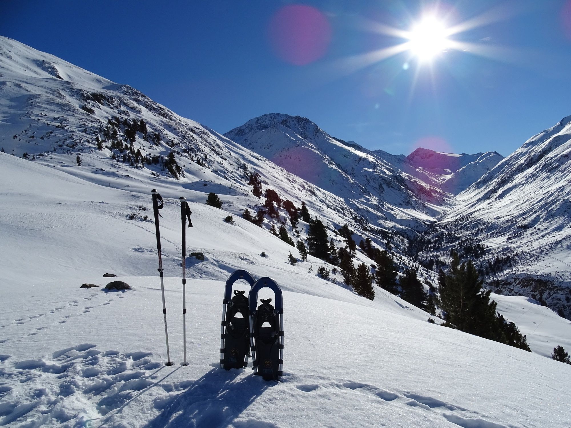
Walking through the village you turn right after the bridge. Across the next bridge to Ochsenkopf lift and further on towards the ski lift top station. Turn left into the trail to Niedertal (approx. 1 hr towards theupper valley). After 1 hour back to Vent as the cleared trail ends here.Refreshment stopover at various inns and restaurants in Vent.(Time: 2.5 hrs)
No safety barriers
Please check the Avalanche Hazard Scale! - Directions
-
Walking through the village you turn right after the bridge. Across the next bridge to Ochsenkopf lift and further on towards the ski lift top station. Turn left into the trail to Niedertal (approx. 1 hr towards theupper valley). After 1 hour back to Vent as the cleared trail ends here.Refreshment stopover at various inns and restaurants in Vent.(Time: 2.5 hrs)
Please check the Avalanche Hazard Scale! - Highest point
- 2,094 m
- Endpoint
-
Niedertal
- Height profile
-

- Equipment
-
Appropriate equipment such as breathable suitable outdoor clothes for the weather, wind-, rain-, snow- and sun protection, hat and gloves is for all hikes and tours necessary. Please bring a first-aid box, a mobile phone, a walking map and if there is no hut on the way a snack and enough to drink.
- Safety instructions
-
Please inform yourself about the conditions and status of the winter hiking trail Niedertal at Hotel Alt Vent:
T + 43 (0) 5254 8130
email: info@hotel-vent.at
- Tips
-
Beautiful view at the peak Similaun.
- Additional information
- Arrival
- Public transportation
- Parking
-
The following parking options are available in the mountaineering village Vent:
In wintertime only at the chairlift Cost: € 6,00 per day/car


- Author
-
The tour Winter Hiking Trail Niedertal - Mountaineering Village Vent is used by outdooractive.com provided.
GPS Downloads


General info
Insider tip
Other tours in the regions
-
Vinschgau
55
-
Schnalstal
17
-
Vent
20