- Brief description
-
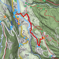
CAR PARK SENNHOF->football ground->WIESLE
- Difficulty
-
easy
- Rating
-
- Starting point
-
car park Sennhof
- Route
-
LehenWiesle Alm1.5 km
- Best season
-
AugSepOctNovDecJanFebMarAprMayJunJul
- Description
-
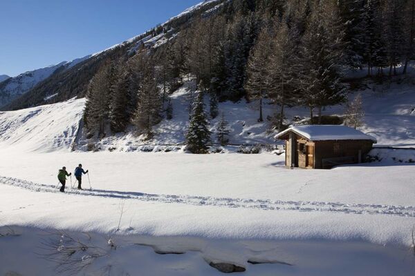
From the car park you walk the winter hiking trail in the direction to the district Tellerboden. After 50 m you turn left and walk the signposted hiking trail "Wiesle"up until you get again to a crossover. There you turn left and walk further to the "Mauslasattel", from there straight ahead and down to the Jausenstation Wiesle.
- Directions
-
Walk to the right towards Ennebach / Überfeld / Lehen (hamlets). Turn left at the football field, walk across the forest to Mauslassattel saddleback. Downhill trail to Wiesle snack station, not serviced in winter.
- Highest point
- 1,637 m
- Endpoint
-
Wiesle
- Height profile
-

- Equipment
-
Appropriate equipment such as breathable suitable outdoor clothes for the weather, is for all hikes and tours necessary.
- Safety instructions
-
Please pay attention to the current weather- & avalanche report: https://www.oetztal.com/de/ & https://lawinen.report/bulletin/latest
The Ötztal Tourismus team will be happy to inform you personally about the nature of the winter hiking trails.
Oetztal tourism T +43 5 72 00 300 - info@laengenfeld.com
- Additional information
- Directions
-
The car drive to the Ötztal valley. Situated in Tirol, the Ötztal valley set off in southerly direction and is the longest side valley in the Eastern Alps. The journey with the car leads you through the Inntal valley to the entrance of the vallly and further on through the valley. Among the toll motorways you can also use the country roads. A route planner will show you the easiest and most convenient way: https://www.google.at/maps.
- Public transportation
-
Travel safe and comfortable with the train to the Ötztal Bahnhof train station. Last stop and exit point is the train station Ötztal Bahnhof. Afterwards you can travel smoothly and quick with the public transport or out local taxi companies through the valley to your desired destination. Please find the current bus timetable here: http://fahrplan.vvt.at
- Parking
-
The following parking facilities are available in Niederthai:
- parking space Sennhof, payable from 07:00 to 18:30

- Author
-
The tour Wiesle - Umhausen-Niederthai is used by outdooractive.com provided.
GPS Downloads


General info
Refreshment stop
A lot of view
Other tours in the regions
-
Ötztal
89
-
Niederthai
53