- Brief description
-
LÄNGENFELD WINKLEN -> Winkelbergsee -> WURZBERGALM
- Difficulty
-
medium
- Rating
-
- Starting point
-
Winklen
- Route
-
Wurzbergalm4.3 km
- Best season
-
AugSepOctNovDecJanFebMarAprMayJunJul
- Description
-
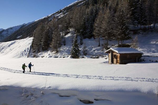
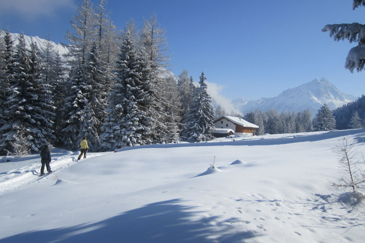
Neither difficult nor steep is the Almtour up to the Wurzbergalm and therefore suitable for children, especially as a tobogganing party elegantly shortened the return journey. From the Längenfelder part of Winklen (car park at the edge of the forest) a wide forest road runs in long serpentines up to the Wurzbergalm (1.575m). Through the bright, sunny forest terrain of the Köfler Bergsturz, one of the largest of the Alps, one climbs rapidly, until finally the trees at a height of 1,600m surprisingly open a clearing. Now it is only a few steps to the wood-clad building of the Alm with its sun terrace. Well, the one who has a sled and can now hike down the groomed down to the valley. If you do not have one, you simply borrow one from the family family Holzknecht. Of course not without a good break before - best with Ramona's apple strudel, blueberry punch or a glass of fresh milk from the farm in the valley.
- Directions
-
From the Längenfelder district Winklen (parking lot at the edge of the forest), a wide forest road to the Wurzbergalm (1.575m) pulls up. Due to the serpentine the slope is rather moderate. (Except the first piece)
- Highest point
- 1,570 m
- Endpoint
-
Wurzbergalm
- Height profile
-

- Equipment
-
Appropriate equipment such as breathable suitable outdoor clothes for the weather, is for all hikes and tours necessary.
- Safety instructions
-
Please pay attention to the current weather- & avalanche report: https://www.oetztal.com/de/ & https://lawinen.report/bulletin/latest
The Ötztal Tourismus team will be happy to inform you personally about the nature of the winter hiking trails.
Oetztal tourism T +43 5 72 00 300 - info@laengenfeld.com
- Tips
-
Toboggan rental at the cottage.
- Additional information
-
More details about winter hiking in Ötztal:
https://www.oetztal.com/winter-hiking
- Directions
-
The drive to the ÖTZTAL
Arriving by car leads holidaymakers over the Inntal to the valley entrance and further along the Ötztal. In addition to the motorway can also be used on rural roads. With the route planner, your journey can be quickly and easily determined. To the route planner: https://www.google.at/maps
- Public transportation
-
Travel comfortably and safely by train. Endstation or exit point is the station ÖTZTAL. Then you drive comfortably and quickly by public transport or the
local taxi company through the entire valley to your desired destination. The current bus timetable can be found at: http://fahrplan.vvt.at
- Parking
-
The following parking facilities are available in Längenfeld:
Parking between Winklen and Unterried - free parking (starting point of the hike)
- Author
-
The tour Wurzbergalm - Längenfeld 206 is used by outdooractive.com provided.


General info
-
Pitztal
95
-
Umhausen im Ötztal
53