- Brief description
-
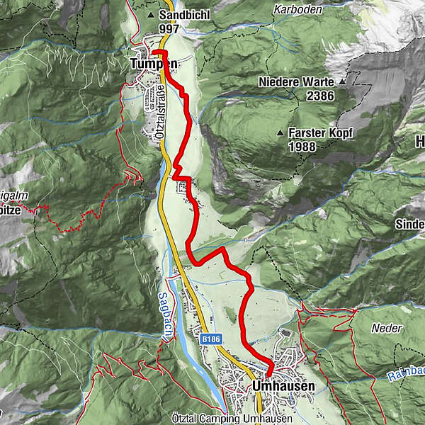
TUMPEN->Lehn-Platzl->chapel "Maria Schnee"->UMHAUSEN
- Difficulty
-
easy
- Rating
-
- Starting point
-
car park of primary school Tumpen
- Route
-
Tumpen0.3 kmÖsten2.1 kmSt. Vitus5.4 kmUmhausen (1,031 m)5.5 kmGasthof Krone5.5 km
- Best season
-
AugSepOctNovDecJanFebMarAprMayJunJul
- Description
-
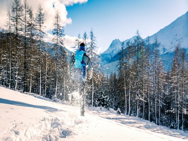
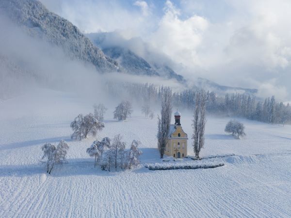
At the car park you cross the main road and the bridge, then walk through the hamlet of Ried and straight on through the snowy meadow road to the hamlet of Lehn-Platzl. Past the beautiful "Maria Schnee" chapel you cross a small wooded area and follow the signs to Umhausen.
- Directions
-
At the car park you cross the main road and the bridge, then walk through the hamlet of Ried and straight on through the snowy meadow road to the hamlet of Lehn-Platzl. Past the "Maria Schnee" chapel you cross a small wooded area and follow the signs to Umhausen.
- Highest point
- 1,035 m
- Endpoint
-
Umhausen
- Height profile
-

- Equipment
-
Appropriate equipment such as breathable suitable outdoor clothes for the weather, wind-, rain-, snow- and sun protection, hat and gloves is for all hikes and tours necessary. Please bring a first-aid box, a mobile phone, a walking map and if there is no hut on the way a snack and enough to drink.
- Safety instructions
- Additional information
-
More details about winter hiking in Ötztal: www.oetztal.com/winter/the-full-winte...
- Directions
-
The car drive to the Ötztal valley. Situated in Tirol, the Ötztal valley set off in southerly direction and is the longest side valley in the Eastern Alps. The journey with the car leads you through the Inntal valley to the entrance of the vallly and further on through the valley. Among the toll motorways you can also use the country roads. A route planner will show you the easiest and most convenient way: https://www.google.at/maps.
- Public transportation
-
Travel safe and comfortable with the train to the Ötztal Bahnhof train station. Last stop and exit point is the train station Ötztal Bahnhof. Afterwards you can travel smoothly and quick with the public transport or out local taxi companies through the valley to your desired destination. Please find the current bus timetable here: http://fahrplan.vvt.at
- Parking
-
The following parking facilities are available in Tumpen:
- Car park of primary school Tumpen, free of charge

- Author
-
The tour Tumpen - Umhausen-Niederthai is used by outdooractive.com provided.


General info
-
Pitztal
95
-
Umhausen im Ötztal
53