- Brief description
-
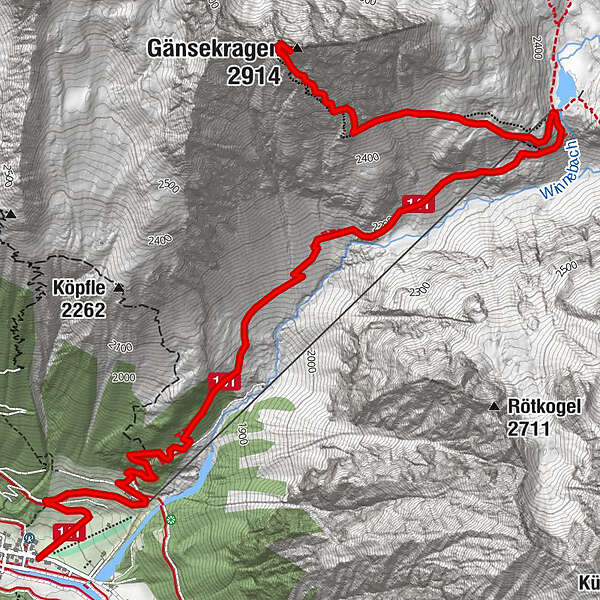
GRIES IM SULZTAL -> Weiler Winnebach -> Winnebachseehütte -> GÄNSEKRAGEN
- Difficulty
-
medium
- Rating
-
- Starting point
-
Gries
- Route
-
Gries (1,569 m)Pension Winnebach0.8 kmWinnebachseehütte4.6 kmGänsekragen (2,914 m)6.4 km
- Best season
-
JanFebMarAprMayJunJulAugSepOctNovDec
- Description
-
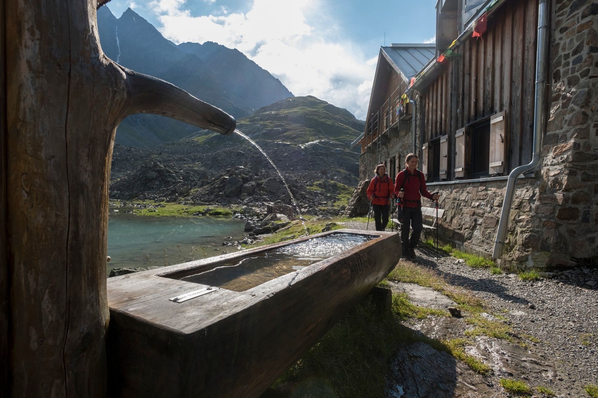
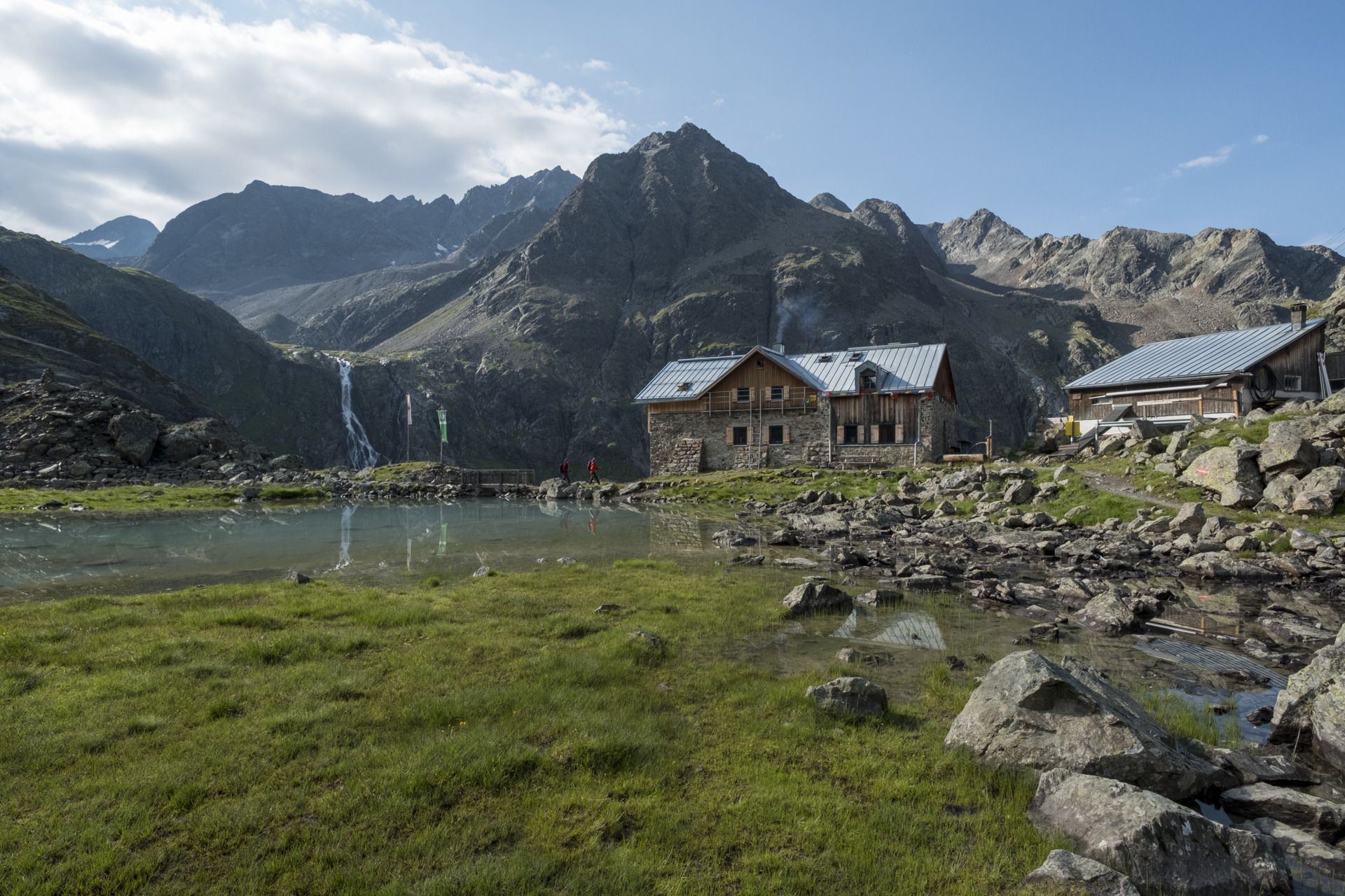
From the car park at the edge of Gries you follow the road to Winnebach, then turn into the path in the direction of Winnebachseehütte. Leaving behind the wood-covered region, you pass several avalanche-prone areas. The perfectly maintained trail winds its way steeply uphill to Winnebachseehütte. From Winnebachseehütte you walk in western direction to the lift towers of the goods lift. Here you continue on the rising trail leading across the southern flank of Gänsekragen. On its south-eastern ridge the steep path travels on grass-covered terrain. Transverse a small ravine on the left, then keep to the right and continue uphill along the jagged rocks. The last part of this precipitous peak hike leads over huge slabs of rock to the summit cross.
- Directions
-
From the parking lot at the end of Gries the ascent to the hamlet Winnebach takes place. From here a trail leads through the forest later through barren terrain to the Winnebachseehütte. From the hut, the well-marked trail climbs very steeply. Although it seems that the summit is almost within reach, the approaching path is still quite protracted. Just before you reach the goal, you reach a gap from which you then climb slightly to the summit.
- Highest point
- 2,864 m
- Endpoint
-
Gänsekragen
- Height profile
-

- Equipment
-
Appropriate equipment such as breathable suitable outdoor clothes for the weather, is for all hikes and tours necessary. Please bring a first-aid box, a mobile phone, a walking map and if there is no hut on the way a snack and enough to drink.
- Safety instructions
-
Moderate mountain trail; for sure-footed and experienced hikers. Good physical condition, mountain experience & mountain equipment (see notice equipment) necessary. Please pay attention to the current weather report
- Additional information
- Directions
-
The car drive to the Ötztal valley. Situated in Tirol, the Ötztal valley set off in southerly direction and is the
longest side valley in the Eastern Alps. The journey with the car leads you through the Inntal valley to the
entrance of the valley and further on through the valley. Among the toll motorways you can also use the country
roads. A route planner will show you the easiest and most convenient way: https://www.google.at/maps
- Public transportation
-
Travel safe and comfortable with the train to the Ötztal Bahnhof train station. Last stop and exit point is the
train station Ötztal Bahnhof. Afterwards you can travel smoothly and quick with the public transport or our local
taxi companies through the valley to your desired destination. Please find the current bus timetable here:
http://fahrplan.vvt.at
- Parking
-
The following parking facilities are available in Gries:
Gries at the end of the village - (chargeable)
- Author
-
The tour Gänsekragen 2914m - Längenfeld/Gries is used by outdooractive.com provided.


General info
-
Ötztal
1107
-
Längenfeld - Huben - Gries
354