
- Brief description
-
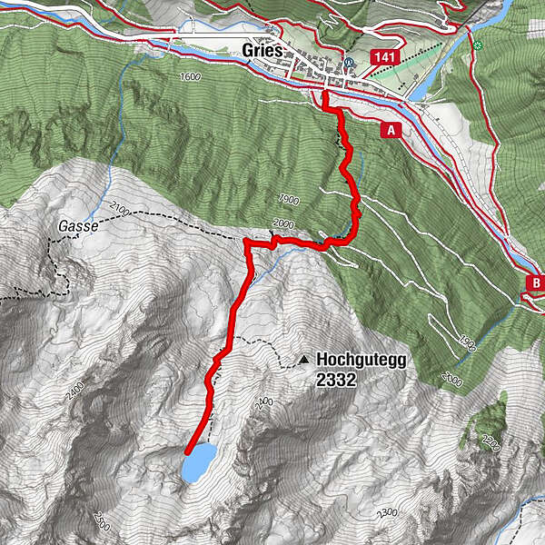
GRIES PARKPLATZ -> Center Gries -> steep track in direction Nissl Alm -> Nissl Alm -> steep track in direction Schönrinnenkarsee -> SCHÖNRINNENKARSEE
Increased truck and car traffic on the entire Sulztalweg.
Driving times:
Trucks: Mon - Fri from 06:00 a.m. - 10:00 p.m
Car: all day
- Difficulty
-
medium
- Rating
-
- Starting point
-
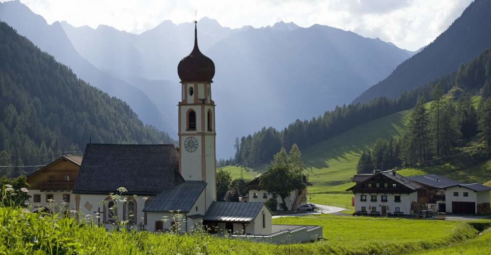
Gries, parking at the end of the village
- Route
-
Gries (1,569 m)Nisslalm (2,051 m)1.3 kmGries (1,569 m)5.3 km
- Best season
-
JanFebMarAprMayJunJulAugSepOctNovDec
- Description
-
In the village center of Gries you turn off to the south, over the wooden bridge to the edge of the forest. The trail leads steeply through the forest in the height to the Nissl Alm. A more comfortable, but longer access to the hut can be found in the forest track, which turns right at the entrance of the Sulztales. Arriving at the Nisslalm, the trail leads past the hut to the wonderfully situated lake. The trail leads west past the hut, then steeper over overgrown slopes up into Schönrinnenkar and over two further steps to the lake. Return on the same route.
- Directions
-
The start is in the village center of Gries. Here you turn to the south, cross the wooden bridge and take the trail at the edge of the forest which leads steadily uphill to the Nissl Alm. A simpler variant leads over the wide forest road to Nisslalm. From the Nisslalm a trail then leads steeply over overgrown slopes to Schönrinnenkarsee.
- Highest point
- 2,358 m
- Endpoint
-
Gries, parking at the end of the village
- Height profile
-

- Equipment
-
Appropriate equipment such as breathable suitable outdoor clothes for the weather, is for all hikes and tours necessary. Please bring a first-aid box, a mobile phone, a walking map and if there is no hut on the way a snack and enough to drink
- Safety instructions
-
Moderate mountain trail; for sure-footed and experienced hikers. Good physical condition, mountain experience & mountain equipment (see notice equipment) necessary. Please pay attention to the current weather report
- Tips
-
Bronze relief section of the Ötztal Nature Park at the start of the trail: Here you can learn about the habitat "Wild Water" or the history of Gries.
- Additional information
- Directions
-
The car drive to the Ötztal valley. Situated in Tirol, the Ötztal valley set off in southerly direction and is the
longest side valley in the Eastern Alps. The journey with the car leads you through the Inntal valley to the
entrance of the valley and further on through the valley. Among the toll motorways you can also use the country
roads. A route planner will show you the easiest and most convenient way: https://www.google.at/maps
- Public transportation
-
Travel safe and comfortable with the train to the Ötztal Bahnhof train station. Last stop and exit point is the
train station Ötztal Bahnhof. Afterwards you can travel smoothly and quick with the public transport or our local
taxi companies through the valley to your desired destination. Please find the current bus timetable here:
http://fahrplan.vvt.at
- Parking
-
The following parking facilities are available in Gries:
Parking at the end of the village - (chargeable)
- Author
-
The tour Lake Schönrinnenkarsee is used by outdooractive.com provided.


General info
-
Ötztal
1107
-
Längenfeld - Huben - Gries
354


