- Brief description
-
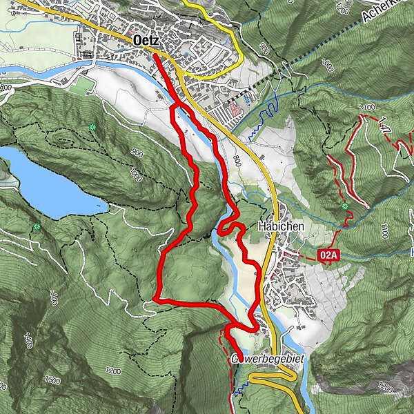
Oetz -> Wellerbrücke -> Habicher See -> Elsinger Weg -> Brandach Brücke -> OETZ
- Difficulty
-
easy
- Rating
-
- Starting point
-
Oetz central parking
- Route
-
Oetz (812 m)Eiskeller2.9 kmKohlstatt3.6 kmBurgstallkapelle4.6 kmOetz (812 m)5.3 km
- Best season
-
JanFebMarAprMayJunJulAugSepOctNovDec
- Description
-
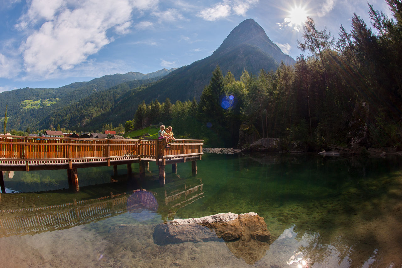
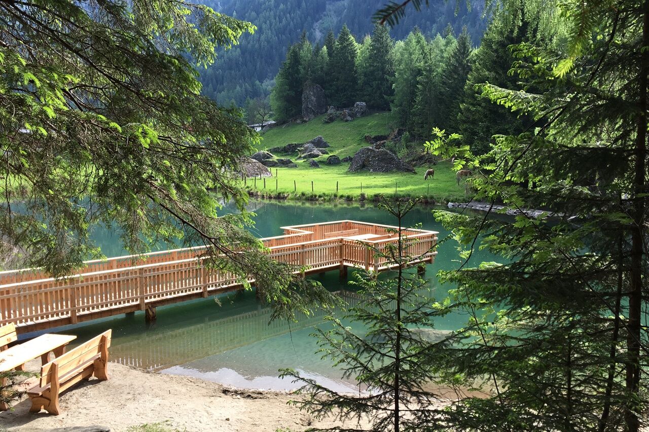
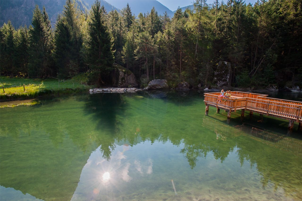
This hike starts in Oetz. You walk beside the river to Weller-Bridge. At the bridge you walk up at the left hand side to Habichen. At the crosspoint you walk right through the fields. At the next corsspoint you turn right again on the aspahlt road. Walk over the wooden bridge and reach the old house of family "Grassmayr". The paintings are very interesting. About 100 meters next to the house is the corsspoint to "Habicher See". Take your time to enjoy the silence at the small lake and take a look at the ice-cellar.
On the way back you first walk to the last crosspoint and there turn left. Through the forest is a steep forest road up to "Elsinger Weg" and down to Oetz.
- Directions
-
This hike starts in Oetz. You walk beside the river to Weller-Bridge. At the bridge you walk up at the left hand side to Habichen. At the crosspoint you walk right through the fields. At the next corsspoint you turn right again on the aspahlt road. Walk over the wooden bridge and reach the old house of family "Grassmayr". The paintings are very interesting. About 100 meters next to the house is the corsspoint to "Habicher See". Take your time to enjoy the silence at the small lake and take a look at the ice-cellar.
On the way back you first walk to the last crosspoint and there turn left. Through the forest is a steep forest road up to "Elsinger Weg" and down to Oetz.
- Highest point
- 892 m
- Endpoint
-
Oetz central parking
- Height profile
-

- Equipment
-
Appropriate equipment such as breathable suitable outdoor clothes for the weather, ankle-high walking boots, wind-, rain- & sun protection, hat, possibly gloves, is for all hikes and tours necessary. Please bring a first-aid box, a mobile phone, a walking map and if there is no hut on the way a snack and enough to drink.
- Safety instructions
-
Easy hiking trail, particularly suitable for beginners. Please mind the current weather forecast at www.oetztal.com
Ötztal Tourismus T +43 5 72 00 500
- Tips
-
The lake is one of the 9 treasures. A treasure-book waits for special entries.
- Additional information
- Arrival
- Public transportation
- Parking
-
The following parking facilities are available in Oetz:
- Parking Acherkogelbahn - free for guests of the gondola lift, camping prohibited
- Parking lot Raftingeinsteinstelle (at the end of Oetz on the right side) - free, but limited parking (alternatively Acherkogelbahn 150 m), camping prohibited
- Oetz parking area (subject to a charge)
- Parking at night during several days' tours: Central parking place Oetz, The ticket is available at the information office Oetz.

- Author
-
The tour "9 treasures" Lake Habicher See is used by outdooractive.com provided.