- Difficulty
-
medium
- Rating
-
- Route
-
Kapelle11.5 kmGroße Mittergrathütte11.6 kmKleine Mittergrathütte11.6 kmHemerwaldalm11.6 km
- Best season
-
JanFebMarAprMayJunJulAugSepOctNovDec
- Description
-
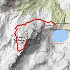
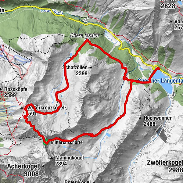
Start at the water reservoir of Kühtai, continue through Mittertal valley towards Mittertaler Scharte ridge to Wetterkreuz. Return through Wörgetal valley to Obere Issalm, then to Mittergrathütte and back to the starting point.
- Directions
-
Start at the water reservoir of Kühtai, continue through Mittertal valley towards Mittertaler Scharte ridge to Wetterkreuz. Return through Wörgetal valley to Obere Issalm, then to Mittergrathütte and back to the starting point.
- Highest point
- 2,630 m
- Endpoint
-
Stausee Kühtai
- Height profile
-

- Equipment
-
It is recommended to wear hiking equipment such as breathable and weather-adapted outdoor clothing, ankle-high mountain boots, wind, rain and sun protection, cap and possibly gloves. It is also important to have enough food, as well as a first-aid package, a cell phone and a hiking map.
- Directions
- Parking
-
Kühtai Hochalterbahn

- Author
-
The tour Mittertal - Wetterkreuz is used by outdooractive.com provided.
GPS Downloads


Other tours in the regions
-
Mieminger Plateau & Inntal
1686
-
Kühtai
344