Tour data
9.9km
1,022
- 2,202m
1,204hm
431hm
02:28h
- Brief description
-
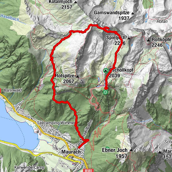
Von Maurach - Dalfazalm - Steinernes Tor - Streichkopf - Hochiss - Mauritzalm - Rofan Seilbahn
- Difficulty
-
medium
- Rating
-
- Starting point
-
Rofanseilbahn
- Route
-
MaurachDurraalm2.5 kmDalfazalm4.1 kmStreichkopf (2,243 m)6.6 kmHochiss (2,299 m)7.0 kmJausenstantion Mauritzalm9.6 kmAir Rofan9.9 km
- Best season
-
JanFebMarAprMayJunJulAugSepOctNovDec
- Highest point
- 2,202 m
- Endpoint
-
Hochiss
- Rest/Retreat
-
Dalfazalm, Mauritzalm
GPS Downloads


Trail conditions
Asphalt
Gravel
Meadow
Forest
Rock
Exposed
Other tours in the regions
-
Achensee
1390
-
Maurach - Eben am Achensee
453