
- Brief description
-
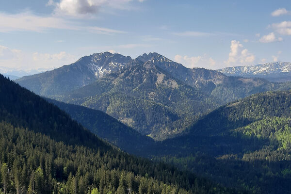
Medium mountain tour with beautiful views into the Inn Valley.
- Difficulty
-
medium
- Rating
-
- Starting point
-
parking lot Gasthof Schneeberg
- Route
-
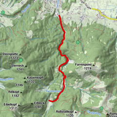
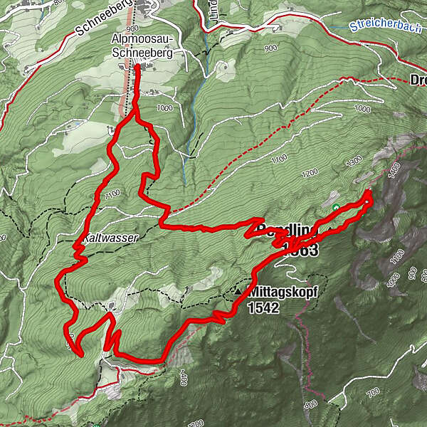
Alpmoosau-SchneebergGasthaus Schneeberg0.0 kmKaltwasser (1,170 m)1.2 kmBärenhöhle (1,485 m)3.0 kmPendlinghaus (1,537 m)3.4 kmPendling (1,563 m)3.7 kmMittagskopf (1,542 m)4.5 kmKala Alm (1,360 m)6.1 kmGasthaus Schneeberg8.7 kmAlpmoosau-Schneeberg8.7 km
- Best season
-
JanFebMarAprMayJunJulAugSepOctNovDec
- Description
-
This mountain hike with summit takes you from Schneeberg in Thiersee along a narrow trail to Pendlinghaus (Kufsteinerhaus). A wonderful and unique panoramic view and the cosy lounges invite you to stay a while. The path leads partially via forestry roads and via the Kala Alm back to the starting point.
- Highest point
- 1,555 m
- Endpoint
-
parking lot Gasthof Schneeberg
- Height profile
-

- Equipment
-
Outdoor clothing appropriate to the weather (good footwear, rain protection, breathable clothing...)
Snacks (e.g. fruit, muesli bars, wholemeal breads) and drinks (allow for sufficient liquid)
First aid equipment
Mobile phone with full battery
Hiking map and guide literature
Sun protection (sunscreen and glasses, cap)
Bivouac bag - Directions
-
Via Kufstein and Vorderthiersee you can reach the Alpengasthof Schneeberg by car.
- Public transportation
-
Bus line 4046 to the bus stop "Thiersee Pfarrwirt Mitterland". From here an additional 180 metres in altitude difference can be covered to Alpengasthof Schneeberg. There and back it is approx. 1 1/4 hours more time to plan. With the KufsteinerlandCard within the region bus free of charge.
- Parking
-
Alpengasthof Schneeberg, subject to a charge.
- Author
-
The tour Summit hike Pendling is used by outdooractive.com provided.


-
Kufsteinerland
2117
-
Thierseetal
461