
- Brief description
-
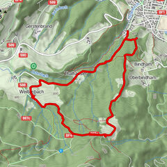
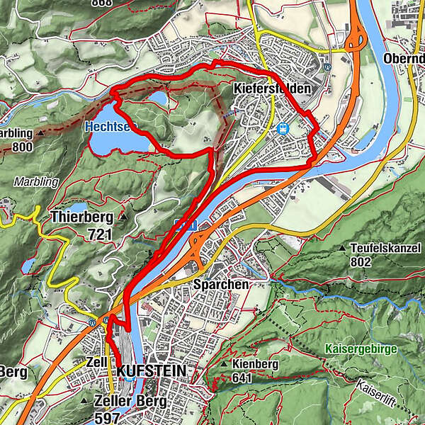
From Zell to Hechtsee, via Kiefersfelden and the Innweg back again.
- Difficulty
-
medium
- Rating
-
- Starting point
-
Schmankerlstube Kufstein
- Route
-
KufsteinZell0.0 kmPfarrkirche Zell0.1 kmKlausfeld3.5 kmUnterkiefer3.7 kmKapelle Maria Hilf4.5 kmKiefersfelden5.5 kmHl. Johannes Nepomuk5.8 kmEngelstein8.4 kmRestaurant Hechtsee8.8 kmPfarrkirche Zell13.2 kmZell13.4 kmKufstein13.4 km
- Best season
-
JanFebMarAprMayJunJulAugSepOctNovDec
- Description
-
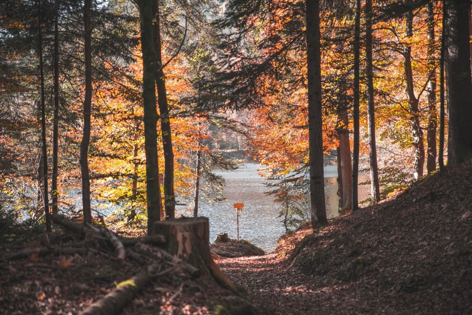
From the start at the parish church in Zell, the route first heads north, past the Walter truck, under the highway bridge to the right into Münchner Straße and further down to the Innweg. Left along the Inn to the highway bridge at Kiefersfelden, here left to the stamp station at the "Blaahaus" museum. Through Kiefersfelden, always following the Kieferbach. Continue along the wooded ridge until the ascent to the Hechtsee begins. Here ascend to the left, along the Hechtsee shore to the Seearena to the next stamp station. From here, descend along the hiking trail in the direction of Kufstein and return to Zell to the club restaurant of the Kufstein hiking group in the Schmankerlstube.
- Highest point
- 559 m
- Endpoint
-
Schmankerlstube Kufstein
- Height profile
-

- Equipment
-
Outdoor clothing appropriate to the weather (good footwear, rain protection, breathable clothing...)
Snacks (e.g. fruit, muesli bars, wholemeal breads) and drinks (allow for sufficient liquid)
First aid equipment
Mobile phone with full battery
Hiking map and guide literature
Sun protection (sunscreen and glasses, cap)
Bivouac bag - Directions
-
Arrival is possible by car or by public transport. The train station Kufstein is only a few minutes' walk from the starting point.
- Public transportation
-
Take the bus to the bus stop Kufstein Zell Kirche or walk from the train station Kufstein in 10 minutes to the starting point. With the KufsteinerlandCard within the region bus free of charge.
- Parking
-
Park & Ride Kufstein Bahnhof, subject to a charge.
- Author
-
The tour Kaiser Max Path is used by outdooractive.com provided.


-
Kufsteinerland
2125
-
Kufstein
566