- Brief description
-
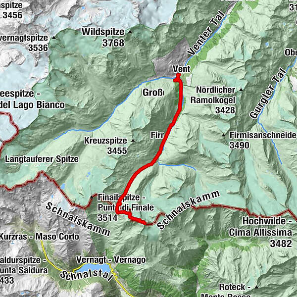
Vent - Martin-Busch-Hütte - Similaunhütte - Similaun - Vent
- Difficulty
-
difficult
- Rating
-
- Starting point
-
Vent
- Route
-
Berghotel Gasthof GstreinVentOchsenkopflift0.2 kmMartin-Busch-Hütte7.5 kmSimilaunhütte12.1 kmNiederjoch (3,012 m)12.2 kmSimilaun (3,606 m)14.8 kmNiederjoch (3,012 m)17.5 kmSimilaunhütte17.6 kmMartin-Busch-Hütte22.0 kmOchsenkopflift29.6 kmVent29.7 kmBerghotel Gasthof Gstrein29.8 km
- Best season
-
JanFebMarAprMayJunJulAugSepOctNovDec
- Description
-
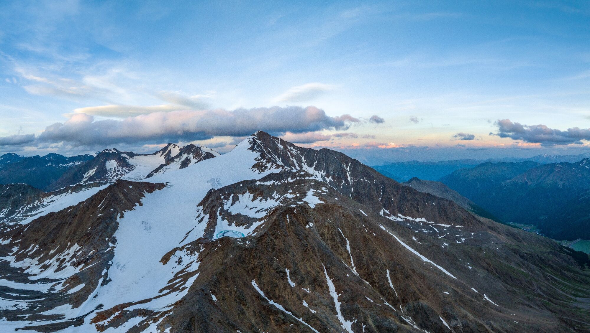
Similaun peak stretches up to an altitude of over 3600 meters and is therefore not only one of the highest mountains in the Ötztal Alps, it is also listed as Austria’s eighth highest mountain. Although it is covered by glaciers in the north (Marzellferner), east and south (Grafferner), it is considered a suitable destination to get in touch with glacier tours for the first time because the ascent is quite easy in terms of hiking technique: of course only if accompanied by a professional mountain guide and with the appropriate equipment!
Located on the Italian-Austrian border, the eye-catching three thousand meter high mountain not only attracts beginners, the magnificent view from its summit also inspires mountain professionals time and again. In addition, its ancient paths crossed the traces of a true celebrity. More than 30 years ago, the glacier mummy Ötzi - the "Iceman" - was discovered on nearby Hauslabjoch saddle. Visiting the place of finding, only 1¼ hours from Similaunhütte, is almost a must for experienced hikers.
What’s important: surefootedness, fitness and a very good physical condition are absolutely required for the long tour up to Similaun, but there are two base camps along the route for regenerating overnight stay or refreshment stop at Martin Busch Hütte (2501 m) and Similaunhütte (3019 m). No matter if you conquer the peak in stages or in one go, the well-deserved "Berg Heil" greeting among mountaineers at the summit against the backdrop of this magnificent alpine scenery will remain a precious memory forever.
- Directions
-
Vent - Martin-Busch-Hütte
From Vent to Ochsenkopf lift, halfway up the lift turn left into Niedertal side valley. On a wide trail past the mountain guide chapel and the shepherd's hut on a moderately ascending path towards Martin Busch Hütte; walking time: 2 ½ - 3 hours.
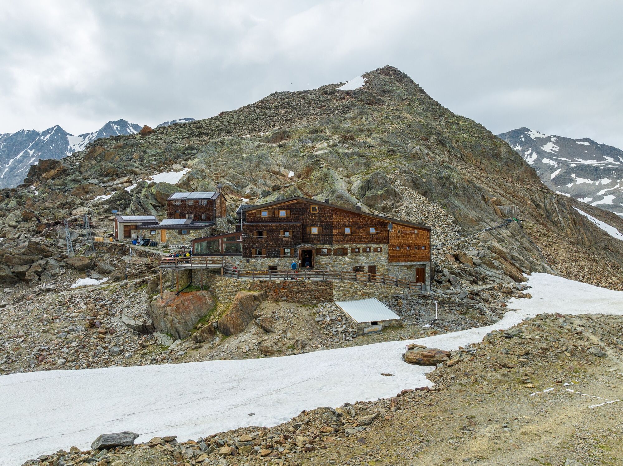
Martin-Busch-Hütte - Similaunhütte
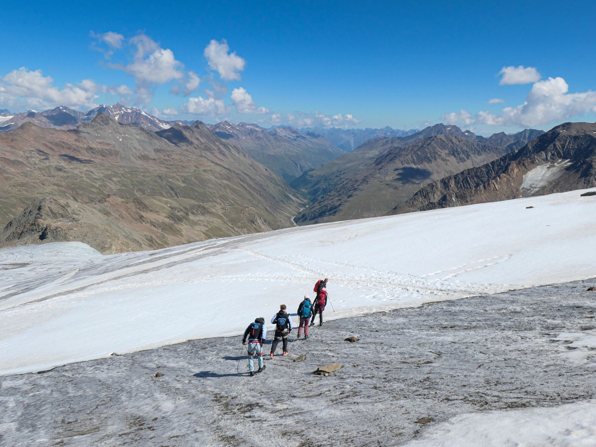
From the hut first continue on a flat trail in the direction of Niederjoch col, after about 30 minutes ascend straight up to the lateral moraine of Niederjochferner glacier, crossing the crevasse-free glacier during the last 30 walking minutes towards Similaunhütte; walking time: 2 hours.
Similaunhütte - Similaun auf 3.606 m
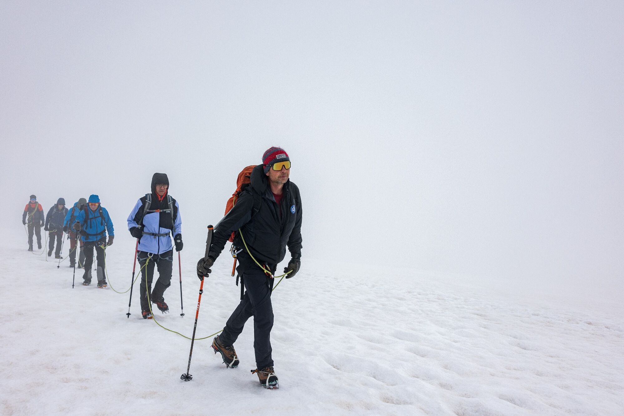
From Similaunhütte over the moraine ridge in a few minutes to Niederjochferner glacier. Cross the glacier near the rocks and continue to the ridge, which protrudes into the glacier field. Follow the narrow footpath up to the rocky ridge and the glacier located behind it (caution: crevasses!) until you get to the even steeper summit ascent. Then continue either over corn snow (“firn”) or – if it is icy – on the right side over rocks to the ridge. Cross the ridge, the last few meters are quite exposed, and continue to the summit cross; walking time: approx. 2 ½ hours.
Similaun - Vent
Descent on the same route back to Similaunhütte and via Martin-Busch-Hütte to Vent. Alternative descent branches off to the right from Niederjochferner glacier towards Marzellkamm ridge. A little steeper over the ridge to Martin-Busch-Hütte and back to Vent (1,900 m). Walking time: approx. 5 ½ hours.
Total walking distance
Ascent: from Vent to the summit - approx. 7 - 7 ½ hours walking time
Descent: from the summit to Vent - approx. 5 ½ hours walking time
- Highest point
- 3,586 m
- Endpoint
-
Vent
- Height profile
-

- Equipment
-
It is recommended to wear hiking equipment such as breathable and weather-adapted outdoor clothing, ankle-high mountain boots, wind, rain and sun protection, cap and possibly gloves. It is also important to have enough food, as well as a first-aid package, a cell phone and a hiking map.
- Safety instructions
-
For high alpine experienced mountaineers that are free from vertigo & surefooted. Excellent physical condition, extensive mountain experience, alpine climbing gear, safety- and orientation guide, good weather conditions recommended. Please pay attention to the current weather report: www.oetztal.com
- Tips
-
Glacier tour - glacier equipment necessary.
Reservation of the hut sleeping places necessary.
Tipp: Visit to Ötzi’s finding site, 1¼ hiking hours from Similaunhütte.
- Additional information
- Directions
- Public transportation
- Parking
-
The following parking options are available in the mountaineering village Vent
- In summertime in front of the village (parking machine, only coins or EC card) and at the chairlift (at the ticket office of the mountain railways)
- In wintertime only at the chairlift
Cost: € 6,00 per day/car

- Author
-
The tour From Vent to Similaun at 3,606 m is used by outdooractive.com provided.


General info
-
Vinschgau
130
-
Schnalstal
99
-
Vent
56