- Brief description
-
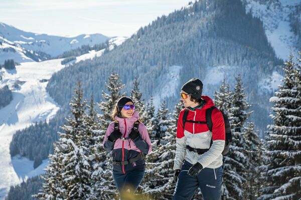
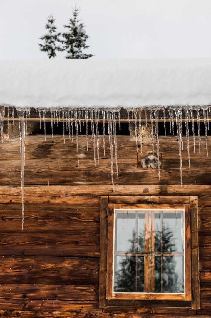
Atmospheric winter hike right into the Wilder Kaiser.
- Difficulty
-
medium
- Rating
-
- Starting point
-
Bathing lake, Going (742 m)
- Route
-
Aschingerkapelle1.6 km
- Best season
-
AugSepOctNovDecJanFebMarAprMayJunJul
- Description
-
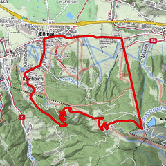
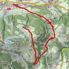
This hike starts at the bathing lake car park in Going and takes you a short way up into the majestic Kaisergebirge mountain range. Follow Aschauerweg across the bathing lake and enjoy the spectacular view of Going. From here, you can also marvel at the Kitzbüheler Horn mountain. Stay on the trail, passing traditional, family-run farms. Take the turnoff at “Moor & more” and then continue walking uphill through the winter forest in the direction of the Graspoint-Niederalm. On the way, you will pass the impressive Aschingerkapelle chapel, which was built from local pine wood in 2008 and is certainly worth a look inside. The wide route leads gently to Graspoint-Niederalm at 1,075 metres. The mountain hut nestles among dark fir trees and lies sheltered in front of the snowy rock faces of the Wilder Kaiser. Landlady Sabine serves homemade refreshments in the hut’s traditional Tirolean parlour.
- Directions
-
This hike starts at the bathing lake car park in Going and takes you a short way up into the majestic Kaisergebirge mountain range. Follow Aschauerweg across the bathing lake and enjoy the spectacular view of Going. From here, you can also marvel at the Kitzbüheler Horn mountain. Stay on the trail, passing traditional, family-run farms. Take the turnoff at “Moor & more” and then continue walking uphill through the winter forest in the direction of the Graspoint-Niederalm. On the way, you will pass the impressive Aschingerkapelle chapel, which was built from local pine wood in 2008 and is certainly worth a look inside. The wide route leads gently to Graspoint-Niederalm at 1,075 metres. The mountain hut nestles among dark fir trees and lies sheltered in front of the snowy rock faces of the Wilder Kaiser. Landlady Sabine serves homemade refreshments in the hut’s traditional Tirolean parlour.
- Highest point
- 978 m
- Endpoint
-
Graspoint-Niederalm, Going (981 m)
- Height profile
-

- Equipment
-
Sturdy high mountaineering boots with anti-slip treaded soles (waterproof), weather-appropriate outdoor gear (breathable), sun protection (sunglasses, sun cream, lip protection, headgear), waterproofs (rain jacket/poncho, pocket umbrella, rucksack protector), cold protection (hat, gloves), sufficient food and hot drinks, hiking poles (height adjustable) if required, mobile phone with fully charged battery, headlamp, plastic bag for waste, hiking map, route description and information materials (GPX track), ID card, insurance card, cash
- Directions
-
Heading from St. Johann on the B178 road, take the Going Prama exit immediately after passing the Stanglwirt hotel. When you reach the first junction, turn right in the direction of the bathing lake. Keep following the road and make another right turn towards the bathing lake after approx. 400 m. The car park is located on the right-hand side.
Heading from Wörgl or Kufstein on the B178 road, take the Going Prama exit before you reach the Stanglwirt hotel. When you reach the first junction, turn right in the direction of the bathing lake. Keep following the road and make another right turn towards the bathing lake after approx. 400 m. The car park is located on the right-hand side. - Public transportation
-
Skibus and Postbus stop “Stanglwirt”.
More information at: www.wilderkaiser.info - Parking
-
Bathing lake car park, Going (742 m) - pay & display - limited parking
Camping and permanent parking is prohibited on this car park.

- Author
-
The tour Graspoint-Niederalm winter hiking route is used by outdooractive.com provided.