© Hotel Brandstetterhof - Bergwanderführer Hotel Der Brandstetterhof
- Route
-
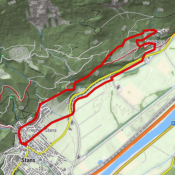
StansTratzberg3.6 kmLaurentiuskirche5.7 kmStans5.9 km
- Best season
-
JanFebMarAprMayJunJulAugSepOctNovDec
- Highest point
- 685 m
- Endpoint
-
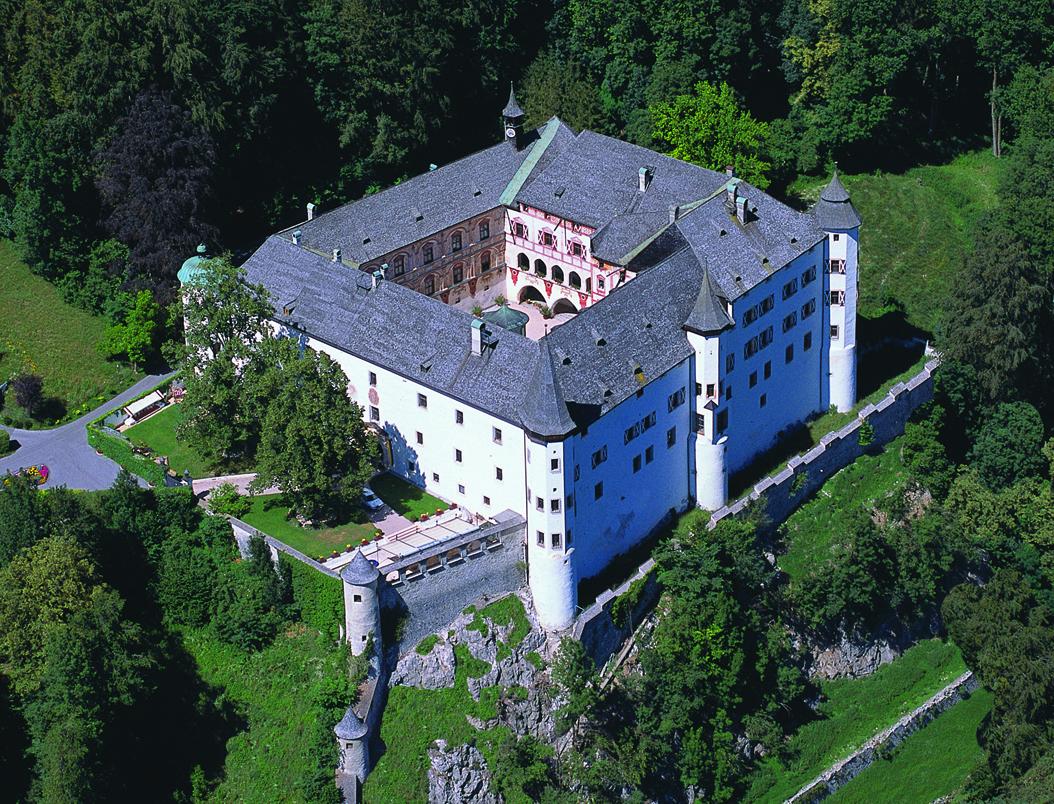
Schloß Tratzberg
- Height profile
-

-

-
AuthorThe tour Wanderung zum Schloß Tratzberg is used by outdooractive.com provided.
GPS Downloads


General info
Refreshment stop
Cultural/Historical
Other tours in the regions
-
Silberregion Karwendel
1365
-
Stans
452