
- Brief description
-
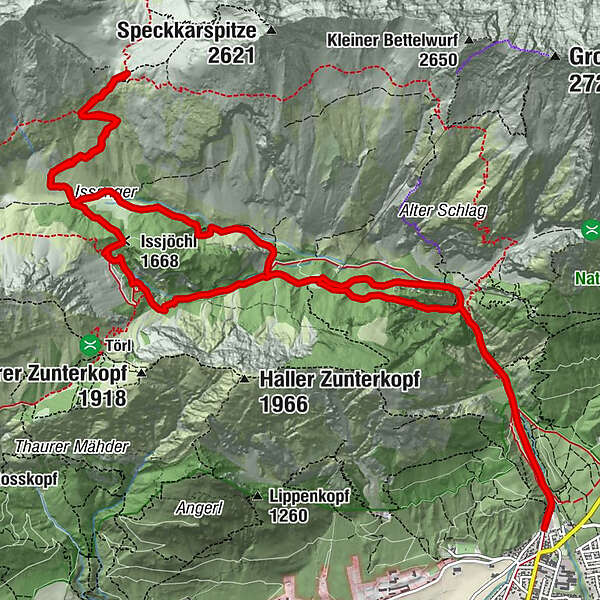
Trough the rough Halltal up to the Lafatscherjoch.
- Difficulty
-
difficult
- Rating
-
- Route
-
Bergerkapelle0.9 kmEibental2.4 kmEibenkopf (1,275 m)2.7 kmJausenstation St. Magdalena (1,287 m)3.4 kmHirschbad4.8 kmKohlstatt (1,978 m)9.0 kmIssjöchl (1,668 m)11.2 kmRuppertikapelle12.3 kmErzherzogberg (1,424 m)12.6 kmJausenstation St. Magdalena (1,287 m)13.9 kmKohlanger14.4 kmJakobibründlquelle15.3 kmBettelwurfeck15.3 kmBergerkapelle16.4 km
- Best season
-
JanFebMarAprMayJunJulAugSepOctNovDec
- Highest point
- 2,082 m
- Endpoint
-
Halltal Parkplatz
- Height profile
-

-

-
AuthorThe tour Durch das Halltal auf das Lafatscherjoch is used by outdooractive.com provided.
GPS Downloads


General info
Refreshment stop
Insider tip
Flora
A lot of view
Other tours in the regions
-
Ferienregion Hall - Wattens
1491
-
Absam
347


