
- Brief description
-
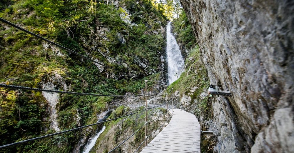
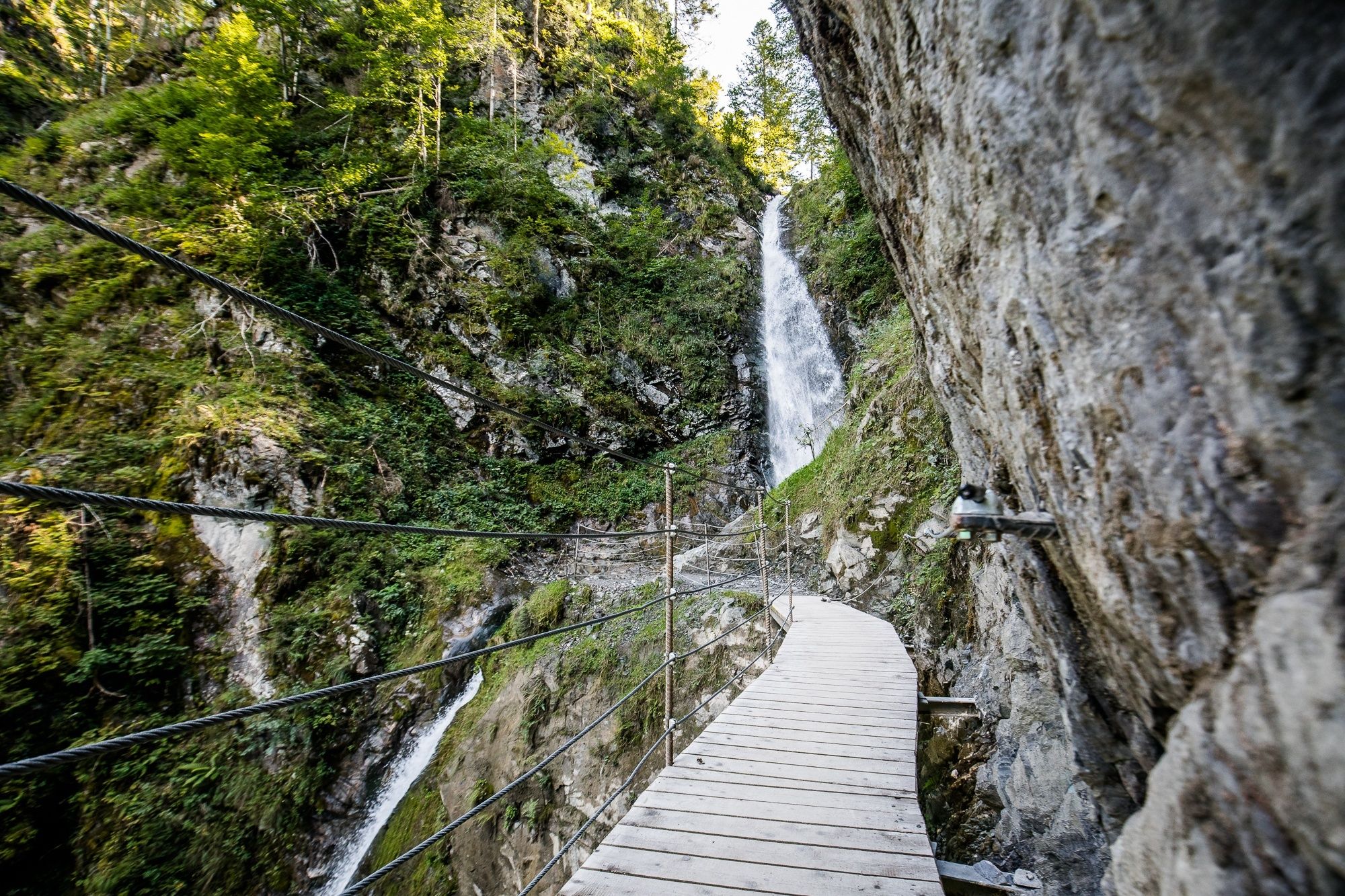
An invigorating hiking destination - the water tumbles down 25 m into the valley!
- Route
-
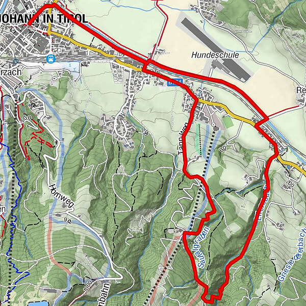
St. Johann in Tirol0.0 kmPfarrkirche0.0 kmSchwarzenbacher0.0 kmWeberhäusl0.1 kmSchneidern0.2 kmDrechslerbäck0.2 kmBruggbäck0.3 kmEibl0.3 kmRoaner1.0 kmMoar1.0 kmSamer-Badl3.1 kmTheresienbad3.1 kmSamer Talmühle3.1 kmAiffersbachermühle3.1 kmHinterbichl3.1 kmTheresienkapelle3.1 kmEifersbacher Wasserfall4.2 kmLahnstreif4.7 kmEichenhof 24.9 kmGrander Schupf5.0 kmEichenhof 15.1 kmGrandern in Alpendorf6.9 kmBeim Mair6.9 kmZellern6.9 kmFiechtern6.9 kmBrünntal-Häusl6.9 kmEvangelikale Freikirche6.9 kmRoaner6.9 kmEibl7.6 kmBruggbäck7.6 kmWeberhäusl8.0 kmSchwarzenbacher8.1 kmDrechslerbäck8.1 kmSchneidern8.2 kmSt. Johann in Tirol8.3 kmPfarrkirche8.3 km
- Description
-
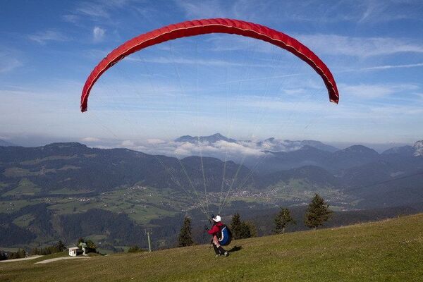
Hikers will find refreshment on hot days during a foray amid woodlands and pastures, as they pass Eifersbacher Waterfall in Winkl-Schattseite near St. Johann in Tirol. Start at the car park at the Eichenhof lifts and take a left, heading for St. Johann until you reach the Tannweg. At the end of the Tannweg, bear left. From Tann farm, hike via a flat pasture trail to Bichln farm, and then through the forest down to Theresienbad chapel. From there, follow a forest trail again, which climbs slightly, proceeding up along the Eiferbach. The bridges and jetties along the last few metres make the waterfall negotiable. Then finally the waters of the waterfall, which are right next to you, cascade over 25 m down into the valley. This is an ideal place for letting nature wash over you, and a place to enjoy the invigorating crystal-clear, cool spring water. From the waterfall there is a short, steep climb (secured paths) up to the forest road, which takes you down into the valley to Grander Schupf (1000 m). From there it is around 25 minutes walk on the path to the car park, our starting point.
- Highest point
- 874 m
- Height profile
-

- Author
-
St. Johann / TirolThe tour Eifersbacher Waterfall is used by outdooractive.com provided.