- Brief description
-
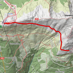
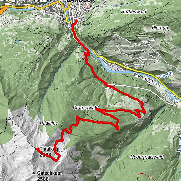
Von Landeck aus über die Perfuchser Schihütte bis hinauf auf den Thialkopf 2.398m. Hinunter führt der Weg über Hochgallmigg zurück nach Landeck.
- Route
-
Hubertuskapelle3.3 kmHochgallmigg7.5 kmPfarrkirche Hochgallmigg7.7 kmBerggasthof Alpenrose7.7 kmKellerle8.7 kmHeimkehrerkapelle8.8 kmLandeck (817 m)11.8 kmStadtpfarrkirche Maria-Himmelfahrt Landeck11.8 km
- Highest point
- 2,374 m
- Endpoint
-
Stadtpfarrkirche Landeck
- Height profile
-

- Author
-
The tour Landeck - Thialkopf - Hochgallmigg is used by outdooractive.com provided.
GPS Downloads


Other tours in the regions
-
Tirol West
898
-
Landeck
313