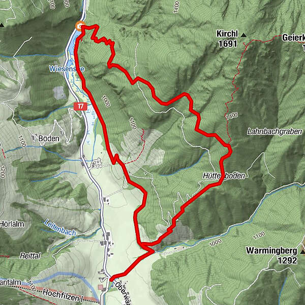
Tour data
7.1km
945
- 1,310m
581hm
581hm
03:00h
- Brief description
-
wunderschöne Rundwanderung
- Difficulty
-
medium
- Rating
-
- Starting point
-
Warming
- Description
-
After the Bridge follow the forest road upstream for about 300 meters - at the first junction turn left and after the first ascent follow the Trail keeping right. At the top turn left and walk pn until reaching the Wiesensee. From here walk pn the circular Trail back to the starting point.
- Highest point
- 1,310 m
- Rest/Retreat
-
Warminger Hof, Gasthof Wiesenseehof
- Ticket material
-
in allen Tourimusverbänden im Pillerseetal


- Info phone
-
+43 (0)5354 / 56304
- Link
- https://maps.pillerseetal.at/#resourceDetail,62...
GPS Downloads


Trail conditions
Asphalt
Gravel
Meadow
Forest
Rock
Exposed
Other tours in the regions
-
Pillerseetal
1767
-
Hochfilzen
410