


- Brief description
-
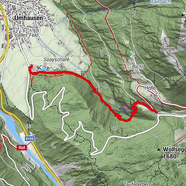
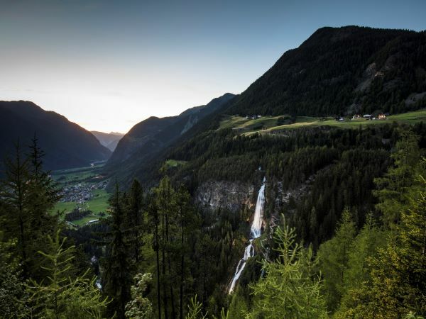
UMHAUSEN -> car park Bischoffsplatz -> Waldcafé Stuböbele -> Gasthof STUIBENFALL
- Difficulty
-
easy
- Rating
-
- Starting point
-
car park "Bischoffsplatz"
- Route
-
Stuibenfall Platform 11.7 kmStuibenfall Platform 32.1 kmStuibenfall2.4 kmStuibenfall Platform 52.4 kmHöfle2.7 kmMühlkapelle2.8 kmGasthof Stuibenfall2.9 km
- Best season
-
JanFebMarAprMayJunJulAugSepOctNovDec
- Description
-
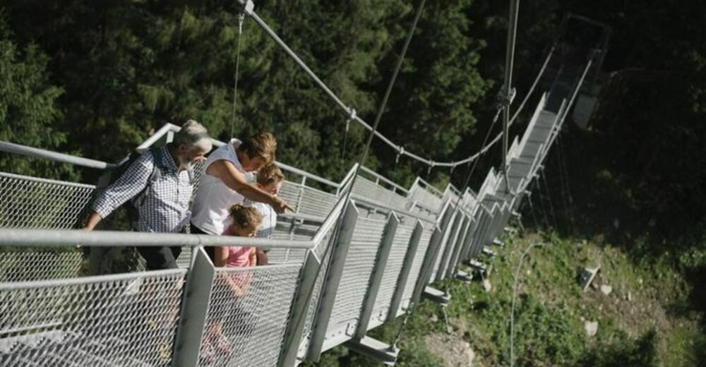
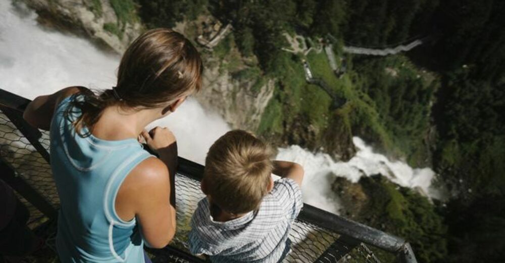
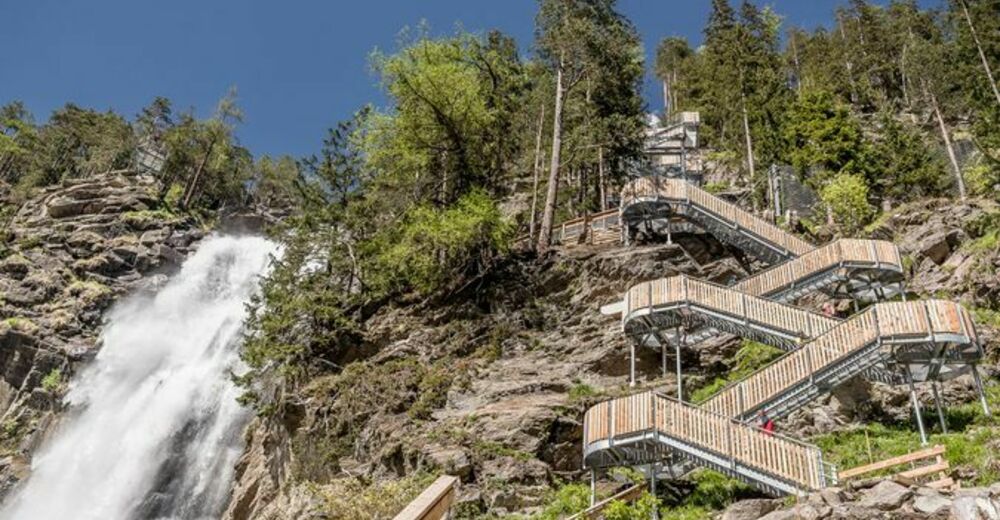
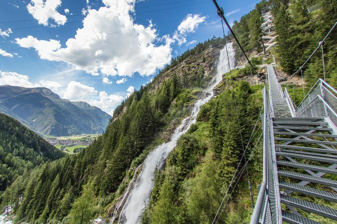
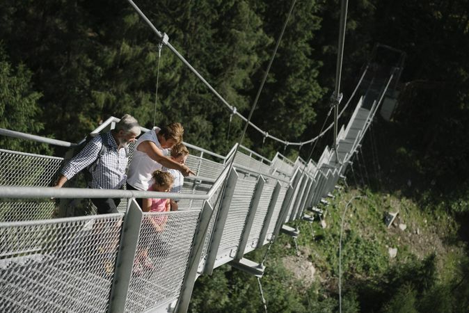
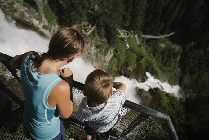
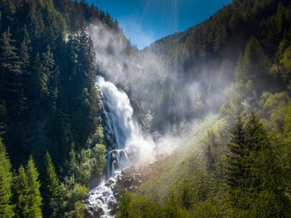
From the car park “Bischoffsplatz” in Umhausen the way leads past the Ötzi village, birds of prey park and forest cafe “Stuböbele” to the foot of the Stuibenfall. The walk from the car park to the foot of the Stuibenfall (gravel place with benches) takes about 30-40 minutes and is also ideal for children and strollers. From the gravel place you walk on a narrow trail to a way- and step construction (about 700 steps, an 80 meter long, exposed suspension bridge), past viewing platforms and thunderous masses of water to the highest point of the waterfall, a fixed suspension bridge. There you cross the natural spectacle, experience fantastic views into the depths and reach the last platform, which rounds off the Stuibenfall experience in all its uniqueness at a dizzying height. From there it takes about 20 minutes to get to Gasthof Stuibenfall.
- Directions
-
From the car park “Bischoffsplatz” in Umhausen the way leads past the Ötzi village, birds of prey park and forest cafe “Stuböbele” to the foot of the Stuibenfall. The walk from the car park to the foot of the Stuibenfall (gravel place with benches) takes about 30-40 minutes and is also ideal for children and strollers. From the gravel place you walk on a narrow trail to a way- and step construction (about 700 steps, an 80 meter long, exposed suspension bridge), past viewing platforms and thunderous masses of water to the highest point of the waterfall, a fixed suspension bridge. There you cross the natural spectacle, experience fantastic views into the depths and reach the last platform, which rounds off the Stuibenfall experience in all its uniqueness at a dizzying height. From there it takes about 20 minutes to get to Gasthof Stuibenfall.
Continue to Niederthai - walk from Gasthof Stuibenfall - about 30 minutes.
As alternative return routes to Umhausen: the "Alte Niederthaier Straße" - walking time approx. 1.5 to 2 hours or the Umhauser Höhenweg - walking time approx. 2 to 2.5 hours.
- Highest point
- 1,478 m
- Endpoint
-
Gasthof Stuibenfall
- Height profile
-

- Equipment
-
Appropriate equipment such as breathable suitable outdoor clothes for the weather, ankle-high walking boots, wind-, rain- & sun protection, hat, possibly gloves, is for all hikes and tours necessary. Please bring a first-aid box, a mobile phone, a walking map and if there is not hut on the way a snack and enough to drink.
- Safety instructions
- Additional information
- Directions
-
The car drive to the Ötztal valley. Situated in Tirol, the Ötztal valley set off in southerly direction and is the
longest side valley in the Eastern Alps. The journey with the car leads you through the Inntal valley to the
entrance of the valley and further on through the valley. Among the toll motorways you can also use the country
roads. A route planner will show you the easiest and most convenient way: https://www.google.at/maps
- Public transportation
-
Travel safe and comfortable with the train to the Ötztal Bahnhof train station. Last stop and exit point is the train station Ötztal Bahnhof. Afterwards you can travel smoothly and quick with the public transport or our local taxi companies through the valley to your desired destination. Please find the current bus timetable here:
- Parking
-
In Umhausen the following parking facilities are available:
- car park "Bischoffsplatz" | one day ticket for cars € 5,00, fee required from 7:00 am till 6:30 pm | the car park for people with handicap is free, please deposit your handicap ID apparent in your car | Buses park for free

- Author
-
The tour Stuibenfall hike - Umhausen is used by outdooractive.com provided.


General info
-
Ötztal
1107
-
Umhausen im Ötztal
401


