- Brief description
-
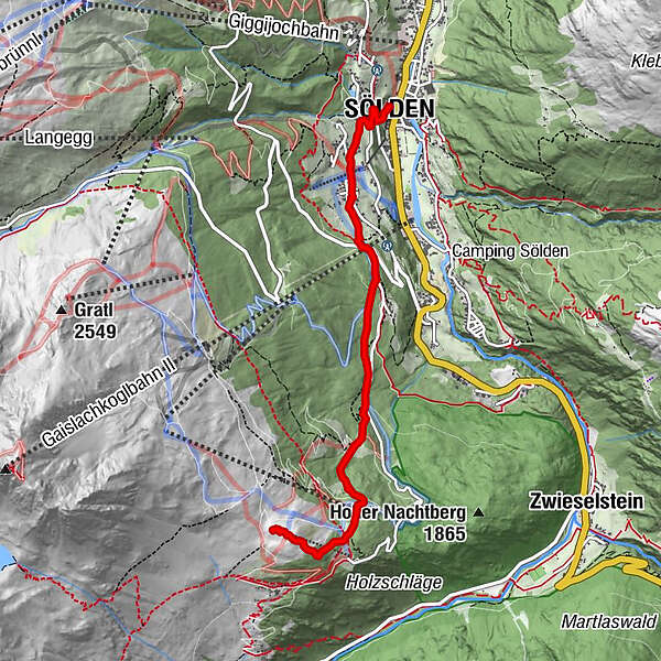
SÖLDEN -> HEIDEALM -> SÖLDEN
- Difficulty
-
medium
- Rating
-
- Starting point
-
Sölden
- Route
-
Mariä Heimsuchung0.0 kmSölden (1,368 m)0.0 kmSee0.2 kmWald1.1 kmGaislachalm4.8 kmHeide Alm5.0 km
- Best season
-
JanFebMarAprMayJunJulAugSepOctNovDec
- Description
-
From Sölden you walk past the church on a narrow paved path steeply up to Innerwald. Through Innerwald you get to the Ötztaler Gletscherstrasse. Follow this street to the Stiegele (crossing Gaislach / Gletscherstraße).
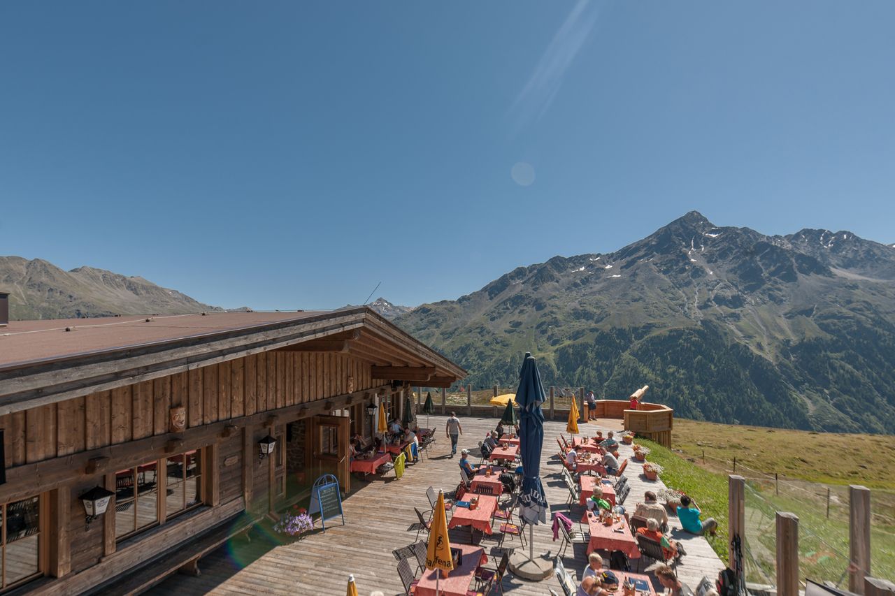
From the Stiegele, a forest road runs relatively flat at first and then a bit steeper up to the first bend. The road often runs parallel to the ski run. After several turns you first reach the Alpengasthof Sonneck, from there you continue to the Gaislachalm and then via the wide path behind the hut to the Heidealm.
- Directions
-
Option 1: From Sölden you walk past the church towards the hamlet of Innerwald. Behind the small chapel in Innerwald you follow the path towards Stiegele. From there you follow the wide forest road towards the Gaislacher Almen.
When you arrive at the Gaislachalm, you can take the wide ascending field path behind the Gaislachalm to the Heidealm.
Option 2: Easily accessible from the middle station of the Gaislachkoglbahn via the wide hiking trail to the Heidealm. Walking time approx. 45 minutes
- Highest point
- 2,124 m
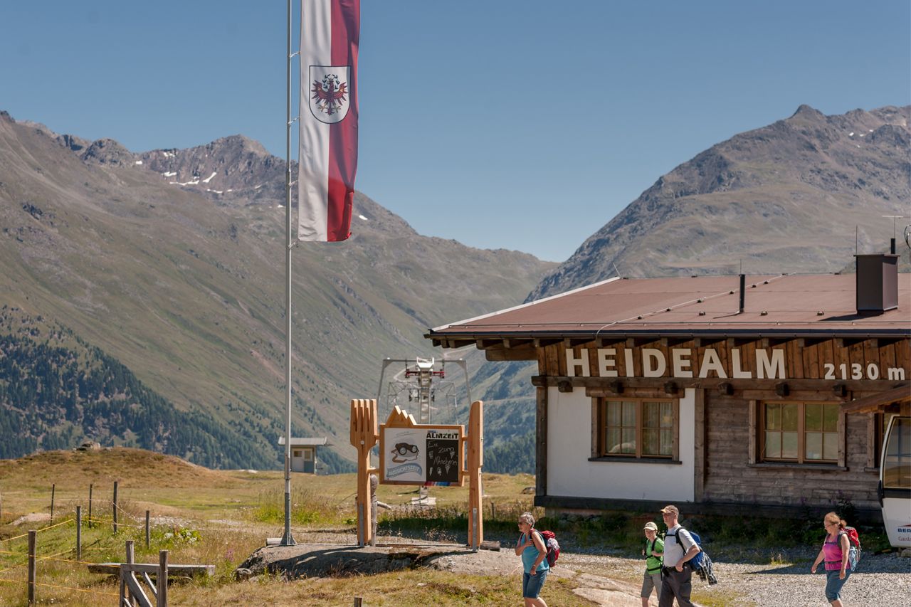
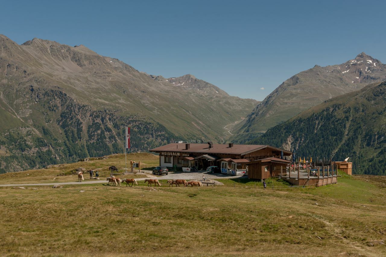
- Endpoint
-
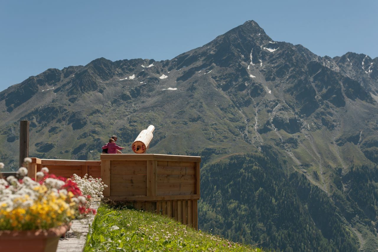
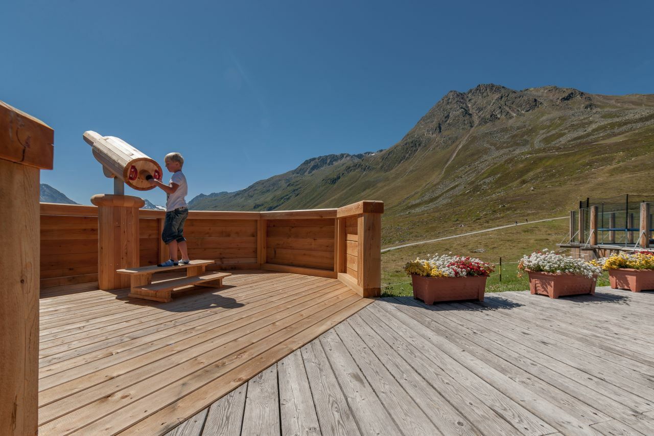
Heidealm
- Height profile
-

- Equipment
-
Appropriate equipment such as breathable suitable outdoor clothes for the weather, ankle-high walking boots, wind-, rain- & sun protection, hat, possibly gloves, is for all hikes and tours necessary. Please bring a first-aidbox, a mobile phone, a walking map and if there is no hut on the way a snack and enough to drink.
- Safety instructions
-
Moderate mountain trail; for sure-footed and experienced hikers. Good physical condition, mountain experience & mountain equipment (see notice equipment) necessary. Please pay attention to the current weather report:
- Additional information
- Directions
-
The car drive to the Ötztal valley. Situated in Tirol, the Ötztal valley set off in southerly direction and is the longest side valley in the Eastern Alps. The journey with the car leads you through the Inntal valley to the entrance of the valley and further on through the valley. Among the toll motorways you can also use the country roads. A route planner will show you the easiest and most convenient way: https://www.google.at/maps
- Public transportation
-
Travel safe and comfortable with the train to the Ötztal Bahnhof train station. Last stop and exit point is the train station Ötztal Bahnhof. Afterwards you can travel smoothly and quick with the public transport or our local taxi companies through the valley to your desired destination. Please find the current bus timetable here:fahrplan.vvt.at
- Parking
-
The following parking facilities are available in Sölden:
- Parking lot
- parking lot Stiegele
- stair parking
- Giggijochbahn + underground garage
- Gaislachkoglbahn + underground garage
- Parking Hochsölden
- parking garage Hochsölden 1. parking lot
All parking is free during the day.
Parking for several days (eg hike tour):
- Parkticket either online or directly at the cash desk of the Gaislachkoglbahn
- Author
-
The tour Heidealm is used by outdooractive.com provided.


General info
-
Meraner Land
1736
-
Ötztal
1111
-
Sölden
329