

- Brief description
-
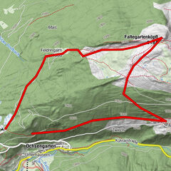
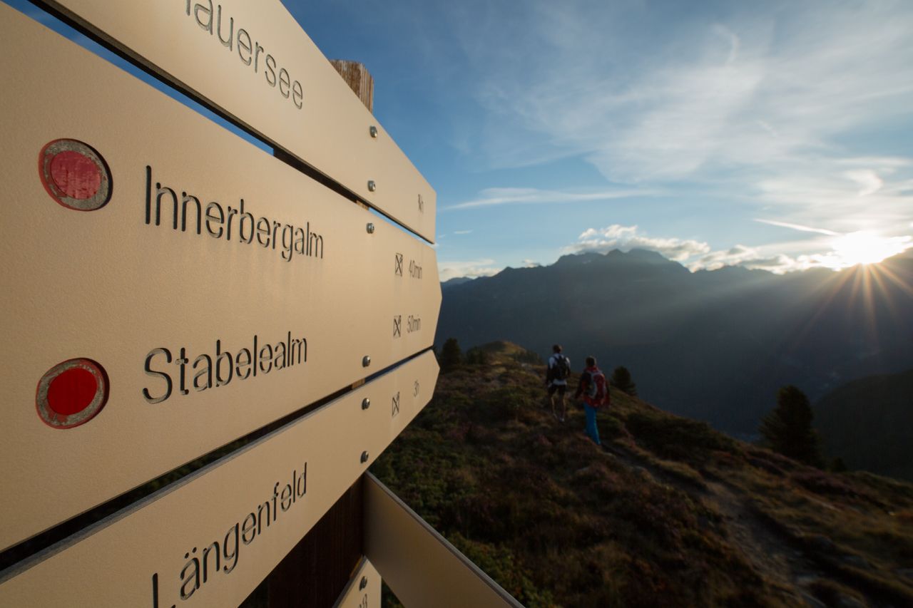
LÄNGENFELD/LEHN -> Steep track direction Stabelealm -> Stabelealm -> INNERBERGALM
- Difficulty
-
medium
- Rating
-
- Route
-
LehnInnerbergalm3.1 km
- Best season
-
JanFebMarAprMayJunJulAugSepOctNovDec
- Description
-
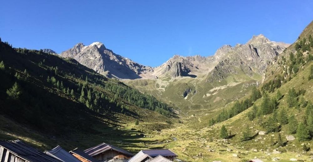
From the parking lot in Lehn (near via ferrata entry point), the mountain path begins to rise steadily in the direction of Stabelealm. Along the path you cross or see the Lehner waterfall. Always steadily uphill over the tree line, the path leads up to the Stabelealm. From there you only have approx. a 30 minutes hike until you reach the Innerbergalm.
There is a second variant via which you reach the Innerbergalm. Through a wide, but longer forest road, which begins in Unterried. First follow the signs in the direction to Wurzbergalm, then follow the path to Leckalm. From there, the forest trail passes Stabelealm and leads you to the Innerbergalm
- Directions
-
You have two possibillities to reach the Stabele-Alm:
Option 1: From Lehn near the via ferrata entry over the steep mountain path towards Innerbergalm. (Duration: approx. 2 hours)
Option 2: Over a wide, but longer forest path starting from Unterried through Wurzbergalm and Leckalm (non managed). (Duration: about 4h)
- Highest point
- 1,946 m
- Endpoint
-
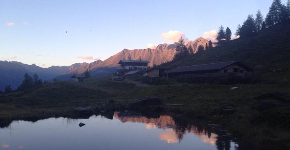
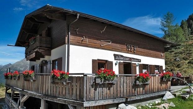
Innerbergalm
- Height profile
-

- Equipment
-
Appropriate equipment such as breathable suitable outdoor clothes for the weather, is for all hikes and tours necessary. Please bring a first-aid box, a mobile phone, a walking map and if there is no hut on the way a snack and enough to drink
- Safety instructions
-
Moderate mountain trail; for sure-footed and experienced hikers. Good physical condition, mountain experience & mountain equipment (see notice equipment) necessary. Please pay attention to the current weather report
- Tips
-
The Innerbergalm can also be reached via the via ferrata Lehner Wasserfall. (After the via ferrata follow the steep track to Innerergalm) Duration: approx. 2 hours
- Additional information
- Directions
-
The car drive to the Ötztal valley. Situated in Tirol, the Ötztal valley set off in southerly direction and is the
longest side valley in the Eastern Alps. The journey with the car leads you through the Inntal valley to the
entrance of the valley and further on through the valley. Among the toll motorways you can also use the country
roads. A route planner will show you the easiest and most convenient way: https://www.google.at/maps
- Public transportation
-
Travel safe and comfortable with the train to the Ötztal Bahnhof train station. Last stop and exit point is the
train station Ötztal Bahnhof. Afterwards you can travel smoothly and quick with the public transport or our local
taxi companies through the valley to your desired destination. Please find the current bus timetable here:
http://fahrplan.vvt.at
- Parking
-
The following parking facilities are available in Längenfeld:
Parking lot in Lehn – near Heimatmuseum – costs €3,00 (Option 1)
Parking lot in Unterried - Start hikeing tour Wurzbergalm - free of charge (Option 2)


- Author
-
The tour Innerbergalm - Längenfeld is used by outdooractive.com provided.


General info
-
Ötztal
1107
-
Längenfeld - Huben - Gries
354