


- Brief description
-
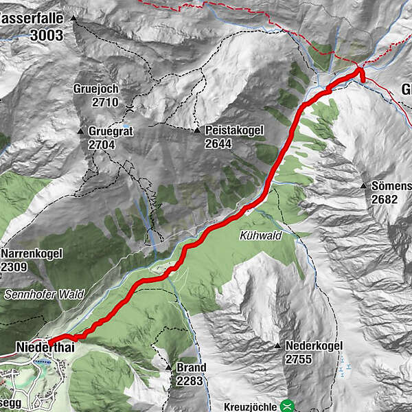
NIEDERTHAI -> car park Sennhof -> Larstigalm -> Klein Horlachalm -> Groß Horlachalm -> SCHWEINFURTER HUT
- Difficulty
-
easy
- Rating
-
- Starting point
-
car park Sennhof
- Route
-
NiederthaiSennhof0.0 kmGrasstallfeld2.0 kmSchweinfurter Hütte5.9 km
- Best season
-
JanFebMarAprMayJunJulAugSepOctNovDec
- Description
-
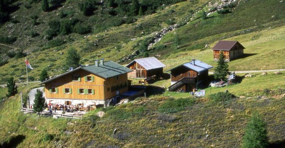
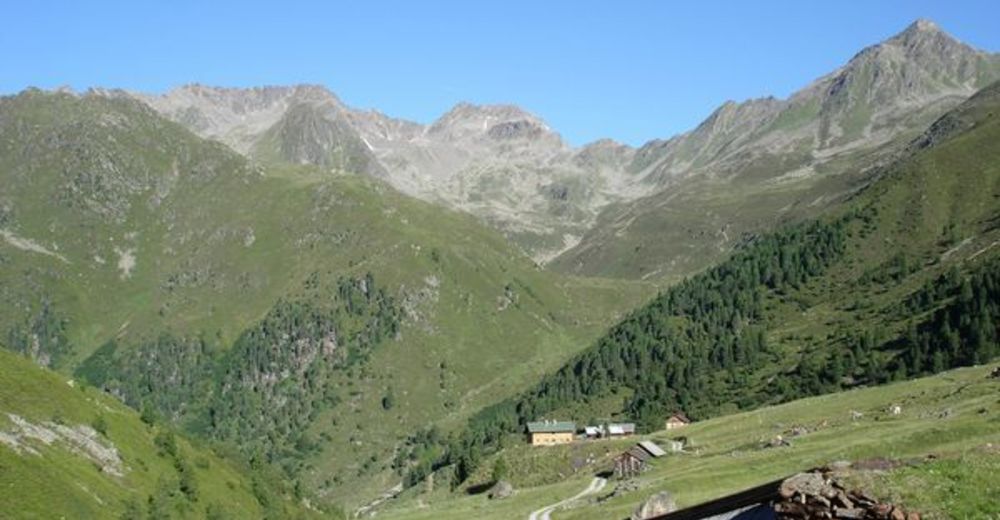
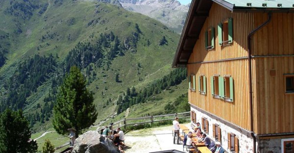
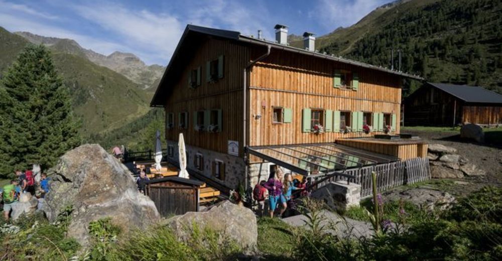
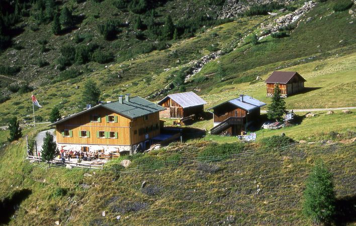
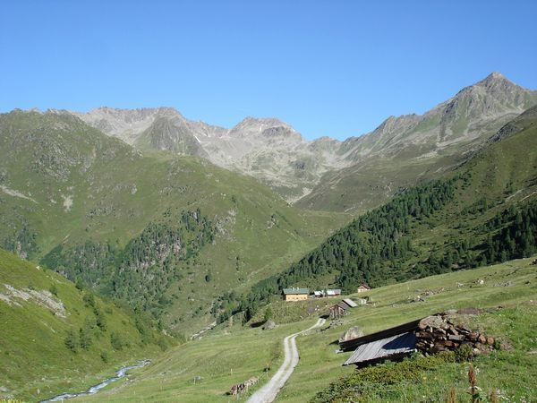
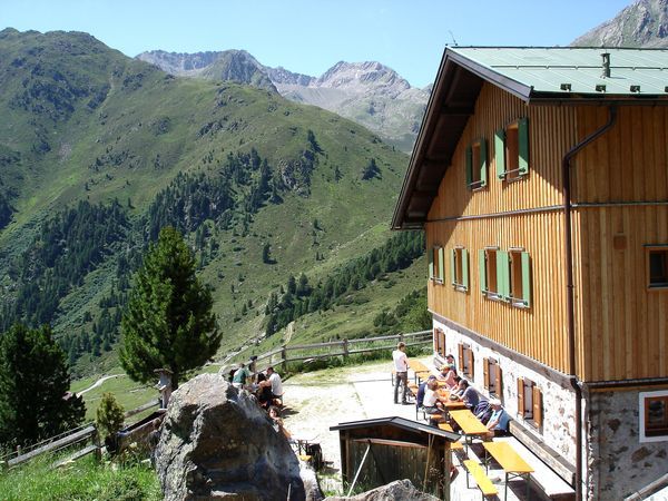
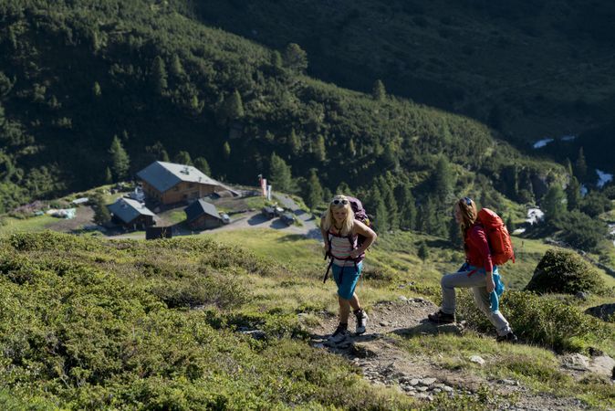
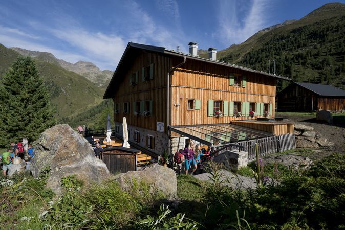
The hike starts in Niederthai at the car park Sennhof (next to the Information office). From there you follow the always slightly rising forest path along the Horlachbach into the Horlachtal. After about an hour you reach the Larstigalm and walk comfortably past it. The path leads up a little steeper and then flat on to a bridge. There you either follow the forest path past the Klein Horlachalm and Groß Horlachalm or the narrow summer hiking trail directly in front of the bridge on the right through open terrain to the Schweinfurter hut. The hut is a very popular day trip destination, accommodation for hut hikers and starting point for easy and demanding hikes and high mountain tours. Even with the mountain bike the hut is very easy to reach. On the way back you can alternatively hike on Bergmaderweg. For this, you have to switch right over the stream shortly after the Larstigalm - beautiful view!
- Directions
-
The hike starts in Niederthai at the car park Sennhof (next to the Information office). From there you follow the always slightly rising forest path along the Horlachbach into the Horlachtal. After about an hour you reach the Larstigalm and walk comfortably past it. The path leads up a little steeper and then flat on to a bridge. There you either follow the forest path past the Klein Horlachalm and Groß Horlachalm or the narrow summer hiking trail directly in front of the bridge on the right through open terrain to the Schweinfurter hut. On the way back you can alternatively hike on Bergmaderweg. For this, you have to switch right over the stream shortly after the Larstigalm - beautiful view!
- Highest point
- 2,026 m
- Endpoint
-
Schweinfurter hut
- Height profile
-

- Equipment
-
Appropriate equipment such as breathable suitable outdoor clothes for the weather, ankle-high walking boots, wind-, rain- & sun protection, hat, possibly gloves, is for all hikes and tours necessary. Please bring a first-aid box, a mobile phone, a walking map and if there is not hut on the way a snack and enough to drink.
- Safety instructions
- Additional information
- Directions
-
The car drive to the Ötztal valley. Situated in Tirol, the Ötztal valley set off in southerly direction and is the longest side valley in the Eastern Alps. The journey with the car leads you through the Inntal valley to the entrance of the valley and further on through the valley. Among the toll motorways you can also use the country roads. A route planner will show you the easiest and most convenient way: https://www.google.at/maps
- Public transportation
-
Travel safe and comfortable with the train to the Ötztal Bahnhof train station. Last stop and exit point is the train station Ötztal Bahnhof. Afterwards you can travel smoothly and quick with the public transport or our local taxi companies through the valley to your desired destination. Please find the current bus timetable here: http://fahrplan.vvt.at
- Parking
-
In Niederthai the following parking facilities are available:
- car park "Sennhof" | one day ticket for cars € 5,00, fee required from 7:00 am till 6:30 pm | the car park for people with handicap is free, please deposit your handicap ID apparent in your car | Buses park for free

- Author
-
The tour Schweinfurter Hütte - Niederthai is used by outdooractive.com provided.
GPS Downloads


General info
Refreshment stop
A lot of view
Other tours in the regions
-
Ötztal
1109
-
Niederthai
385


