- Brief description
-
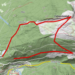
NIEDERTHAI CAR PARK SENNHOF -> Höfle -> BICHL
- Difficulty
-
easy
- Rating
-
- Starting point
-
car park Sennhof
- Route
-
NiederthaiSennhof0.1 kmGasthof Leiter´s Hoamatl1.2 kmHöfle1.3 kmBichl1.7 km
- Best season
-
JanFebMarAprMayJunJulAugSepOctNovDec
- Description
-
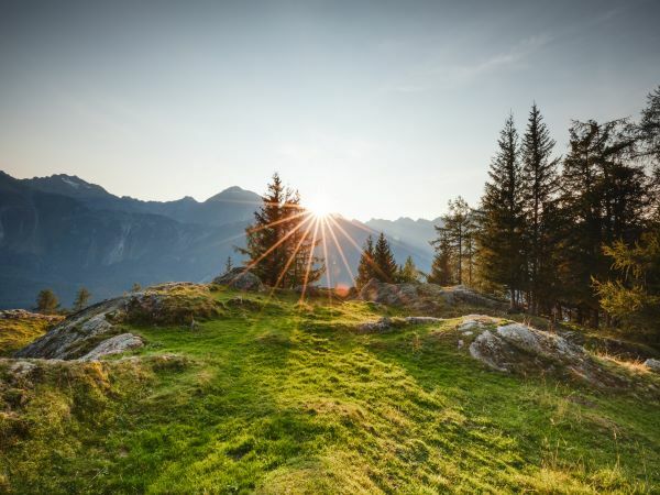
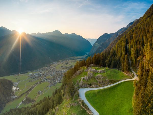
Starting point is the car park "Sennhof", next to the Information Office in Niederthai. From there you go over the wooden bridge and turn left by the fire station in the direction of the hamlets Höfle-Bichl. At the hamlet Höfle, the road continues on the right up to the hamlet Bichl. Once at the top you can enjoy a magnificent view of the Ötztal.
- Directions
-
Starting point is the car park "Sennhof", next to the Information Office in Niederthai. From there you go over the wooden bridge and turn left by the fire station in the direction of the hamlets Höfle-Bichl. At the hamlet Höfle, the road continues on the right up to the hamlet Bichl. Once at the top you can enjoy a magnificent view of the Ötztal.
- Highest point
- 1,598 m
- Endpoint
-
District Bichl Niederthai
- Height profile
-

- Equipment
-
Appropriate equipment such as breathable suitable outdoor clothes for the weather, ankle-high walking boots, wind-, rain- & sun protection, hat, possibly gloves, is for all hikes and tours necessary. Please bring a first-aid box, a mobile phone, a walking map and if there is not hut on the way a snack and enough to drink.
- Safety instructions
- Tips
-
Since the path is mostly flat, it is also suitable for wheelchair user and children's push chair. (forest track & gravel path)
- Additional information
- Directions
-
The car drive to the Ötztal valley. Situated in Tirol, the Ötztal valley set off in southerly direction and is the longest side valley in the Eastern Alps. The journey with the car leads you through the Inntal valley to the entrance of the valley and further on through the valley. Among the toll motorways you can also use the country roads. A route planner will show you the easiest and most convenient way: https://www.google.at/maps
- Public transportation
-
Travel safe and comfortable with the train to the Ötztal Bahnhof train station. Last stop and exit point is the train station Ötztal Bahnhof. Afterwards you can travel smoothly and quick with the public transport or our local taxi companies through the valley to your desired destination. Please find the current bus timetable here: http://fahrplan.vvt.at
- Parking
-
In Niederthai the following parking facilities are available:
- car park "Sennhof" | one day ticket for cars € 5,00, fee required from 7:00 am till 6:30 pm | the car park for people with handicap is free, please deposit your handicap ID apparent in your car | Buses park for free
- Author
-
The tour Höfle - Bichl - Niederthai is used by outdooractive.com provided.


General info
-
Ötztal
1107
-
Niederthai
385