- Difficulty
-
medium
- Rating
-
- Route
-
Ötztal-Bahnhof0.3 kmAntoniuskapelle2.8 kmLöckpuit4.4 kmMairhof4.4 kmRoppen (724 m)4.6 kmLourdeskapelle4.7 kmPfarrkirche hl. Leonard4.7 kmOberängern5.3 kmMaisalm11.9 km
- Best season
-
JanFebMarAprMayJunJulAugSepOctNovDec
- Description
-
Variant 1: from Roppen (forest road - approx. 2,5 - 3h) - this is also the way of the tenants.
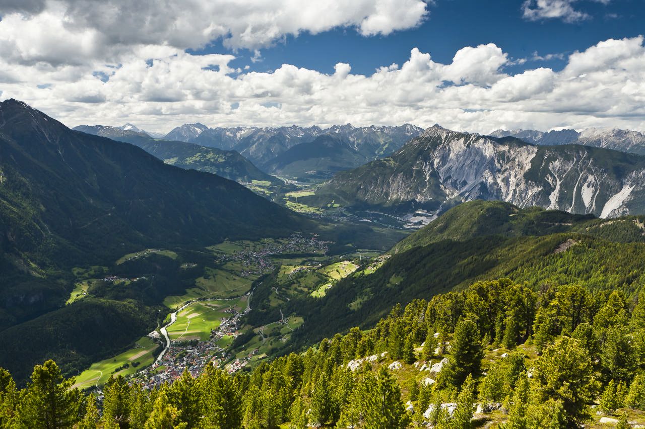
Variant 2 from Sautens: The starting point is the car park at the sports field at the end of Sautens. The trail will take a broad forest trail in the direction of Bärentalhütte. Afterwards, you take a fork over a hiking trail about 1.5 - 2 hours towards Maisalm. The trail is slightly ascending at first, then steeper before you come back on a wide forest path and follow it for about 30 minutes. After approx. 3 - 3,5 h total time you reach the Maisalm, where you can enjoy a fantastic view of the Inn valley!
- Directions
-
Variant 1: from Roppen (forest road - approx. 2,5 - 3h) - this is also the way of the tenants.
Variant 2 from Sautens: The starting point is the car park at the sports field at the end of Sautens. The trail will take a broad forest trail in the direction of Bärentalhütte. Afterwards, you take a fork over a hiking trail about 1.5 - 2 hours towards Maisalm. The trail is slightly ascending at first, then steeper before you come back on a wide forest path and follow it for about 30 minutes. After approx. 3 - 3,5 h total time you reach the Maisalm, where you can enjoy a fantastic view of the Inn valley!
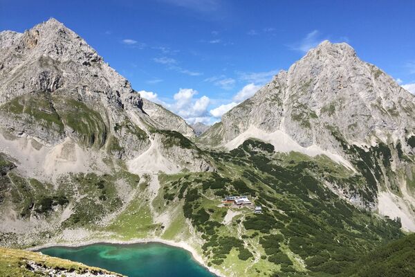
- Highest point
- 1,658 m
- Endpoint
-
Maisalm
- Height profile
-

- Equipment
-
It is recommended to wear hiking equipment such as breathable and weather-adapted outdoor clothing, ankle-high mountain boots, wind, rain and sun protection, cap and possibly gloves. It is also important to have enough food, as well as a first-aid package, a cell phone and a hiking map.
- Additional information
- Directions
- Public transportation
- Parking
-
The following parking facilities are available in Ötztal Bahnhof:
- Parking Train station - subject to charges
- Ötztaler Höhe - free of charge
- Author
-
The tour Maisalm is used by outdooractive.com provided.


General info
-
Outdoorregion Imst
1227
-
Roppen
319