- Brief description
-
HINTERE FUNDUSALM -> Frischmannhut -> Köfler waal path -> Köfler Scharte -> HINTERE FUNDUSALM
- Difficulty
-
medium
- Rating
-
- Starting point
-
Hintere Fundusalm
- Route
-
Hintere Fundusalm0.0 kmFrischmannhütte1.8 kmHintere Fundusalm5.9 km
- Best season
-
JanFebMarAprMayJunJulAugSepOctNovDec
- Description
-
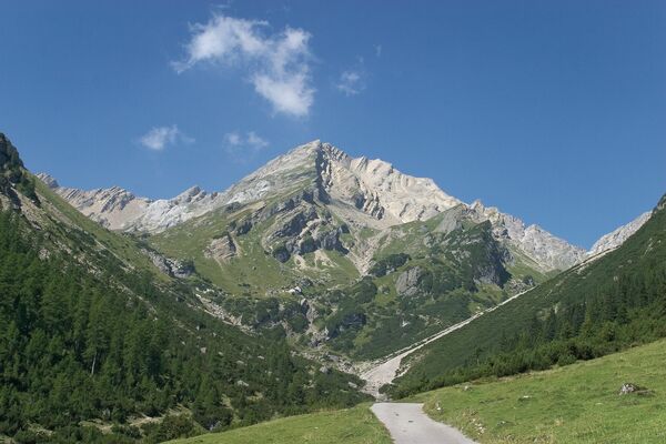
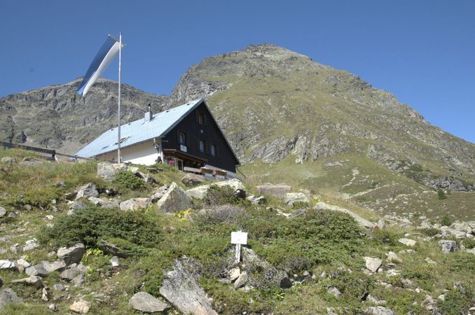
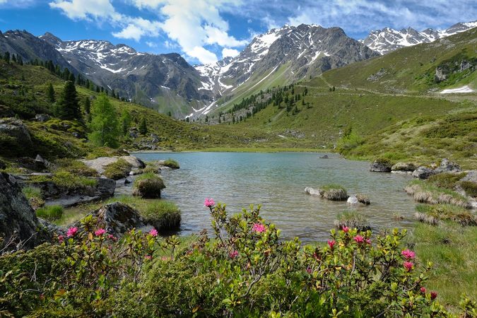
The hut-taxi takes you from Umhausen to the Hintere Fundusalm. The loneliness and the beauty of nature can be wonderfully enjoyed here. Green meadows and the crystal-clear Fundussee invite you to linger on a hot summer's day. There begins the trail to the Frischmannhut. Then the circular trail leads in the direction of Schwarze Wand and over the Köfler waal path, which is probably unique because of its exposed position above the tree line and the terrain (more than 50% consists of primary rocks) up to the Köfler Scharte at 2,084 m above sea level. From the saddle, a short path leads down to the Hintere Fundusalm, where you can again take the return trip to Umhausen by taxi. If you are still fit and you want to, you can walk down the wide forest path to Umhausen - walking time about two hours.
- Directions
-
The hut-taxi takes you from Umhausen to the Hintere Fundusalm. There begins the trail to the Frischmannhut. Then the circular trail leads in the direction of Schwarze Wand and over the Köfler waal path, which is probably unique because of its exposed position above the tree line and the terrain (more than 50% consists of primary rocks) up to the Köfler Scharte at 2,084 m above sea level. From the saddle, a short path leads down to the Hintere Fundusalm, where you can again take the return trip to Umhausen by taxi.
- Highest point
- 2,205 m
- Endpoint
-
Hintere Fundusalm
- Height profile
-

- Equipment
-
Appropriate equipment such as breathable suitable outdoor clothes for the weather, ankle-high walking boots, wind-, rain- & sun protection, hat, possibly gloves, is for all hikes and tours necessary. Please bring a first-aid box, a mobile phone, a walking map and if there is not hut on the way a snack and enough to drink.
- Safety instructions
- Tips
-
Köfler Jochwaal - This irrigation system was built in the middle of the 15th century to make better use of the fields and meadows.
- Additional information
- Directions
-
The car drive to the Ötztal valley. Situated in Tirol, the Ötztal valley set off in southerly direction and is the longest side valley in the Eastern Alps. The journey with the car leads you through the Inntal valley to the entrance of the valley and further on through the valley. Among the toll motorways you can also use the country roads. A route planner will show you the easiest and most convenient way: https://www.google.at/maps
- Public transportation
-
Travel safe and comfortable with the train to the Ötztal Bahnhof train station. Last stop and exit point is the train station Ötztal Bahnhof. Afterwards you can travel smoothly and quick with the public transport or our local taxi companies through the valley to your desired destination. Please find the current bus timetable here: http://fahrplan.vvt.at
- Parking
-
In Umhausen the following parking facilities are available:
- car park "Mure" | free of charge


- Author
-
The tour waal path Fundus valley - Umhausen is used by outdooractive.com provided.


General info
-
Pitztal
1068
-
Umhausen im Ötztal
401