© Tourismusbüro Obertilliach
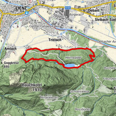
Tour data
6.36km
1,430
- 2,057m
624hm
01:30h

- Brief description
-
Über den Forstweg einfache, sonst mittelschwere Wanderung
- Rating
-
- Starting point
-
Obertilliach/Dorf bzw. Sesselbahn
- Route
-
ObertilliachConny-Alm6.3 km
- Highest point
- 2,057 m
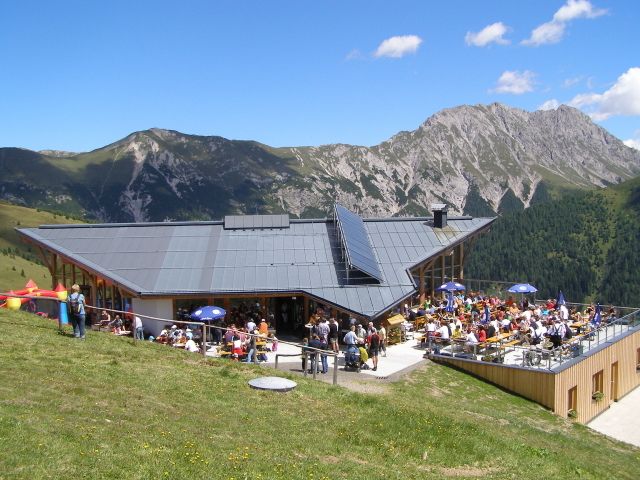
- Rest/Retreat
-
Panorama-Bergrestaurant "Connyalm"
- Ticket material
-
Wanderkarte Hochpustertal/Verlag Mayr, Kompass-WK Lienzer Dolomiten/Lesachtal
GPS Downloads


Trail conditions
Asphalt
Gravel
(7 km)
Meadow
Forest
Rock
Exposed
Other tours in the regions