© Tourismusverband Region Hall-Wattens - Anne W.

© Tirol Werbung - Hall Wattens

© Tourismusverband Region Hall-Wattens - Anne W.

© Tourismusverband Region Hall-Wattens - Anne W.

© Tourismusverband Region Hall-Wattens - Anne W.

© Tourismusverband Region Hall-Wattens - Anne W.

© Tourismusverband Region Hall-Wattens - Anne W.
© Tourismusverband Region Hall-Wattens - Anne W.

© Alpenverein Hall in Tirol - Gerald Aichner
- Brief description
-
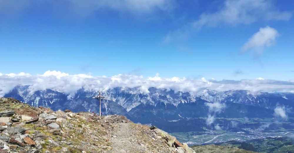
360° panoramic view
- Difficulty
-
medium
- Rating
-
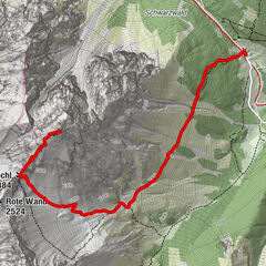
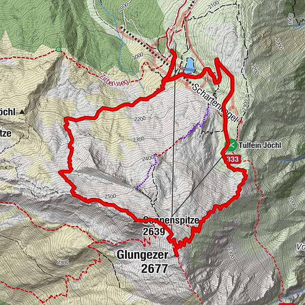
- Route
-
Tulfein AlmSpielplatz Zirbensee0.4 kmGlungezer (2,677 m)3.8 kmGlungezerhütte4.2 kmSonnenspitze (2,639 m)4.5 kmHirschvogel5.8 kmSpielplatz Zirbensee7.2 kmTulfein Alm8.6 km
- Best season
-
JanFebMarAprMayJunJulAugSepOctNovDec
- Description
-
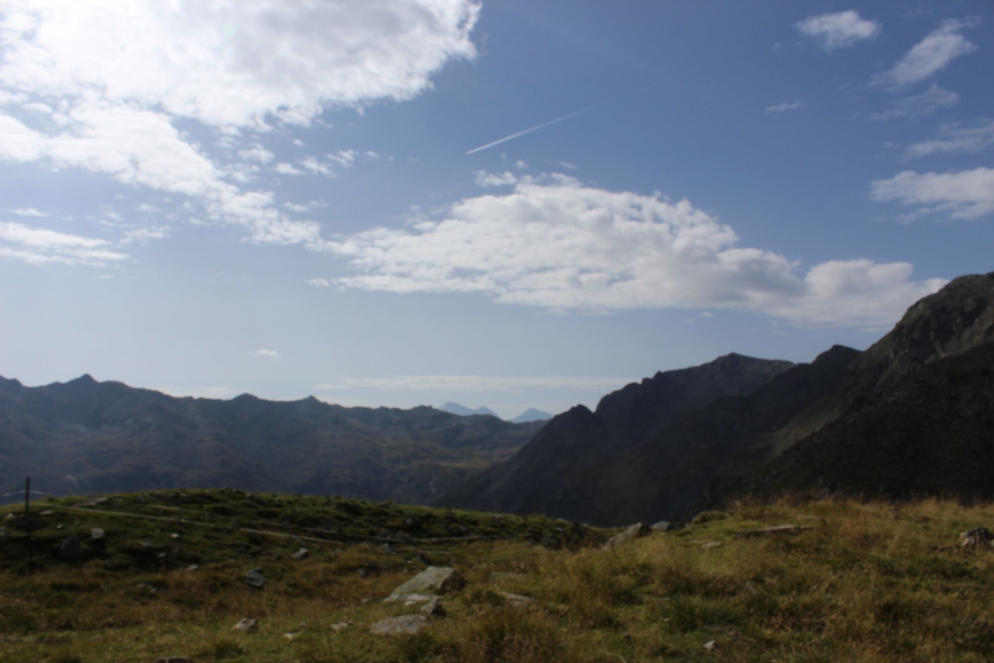
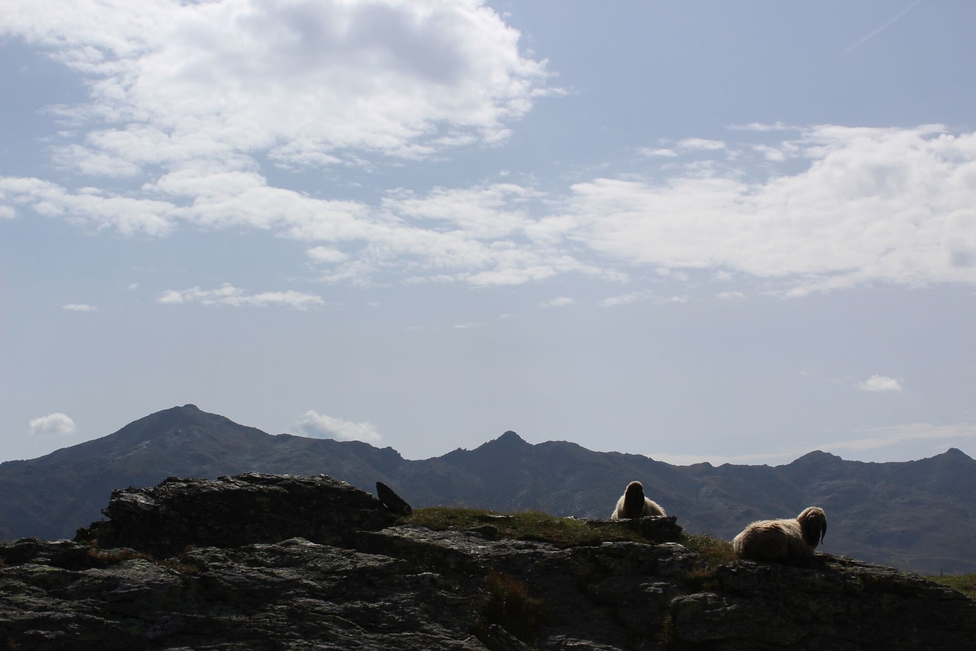
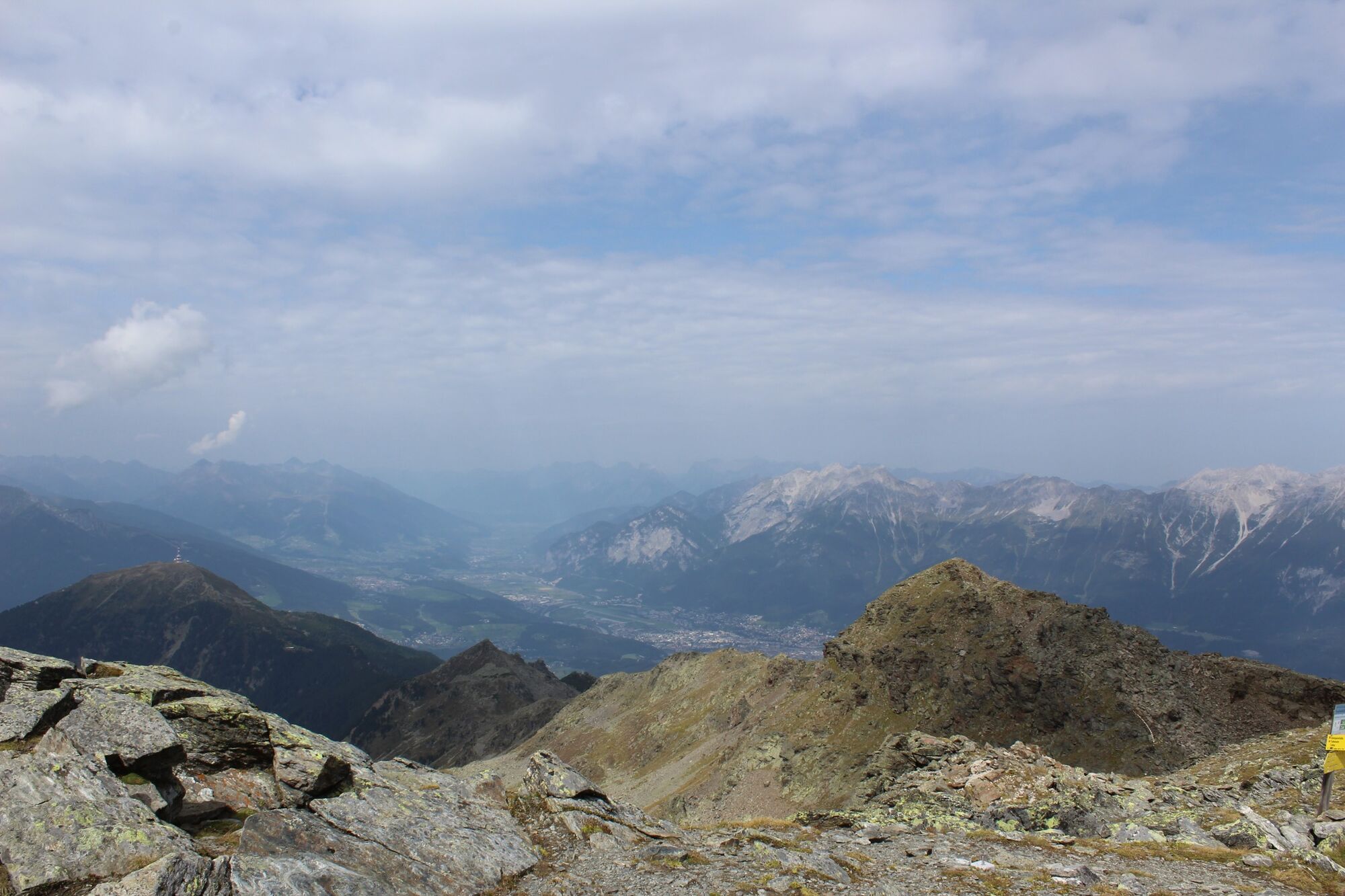
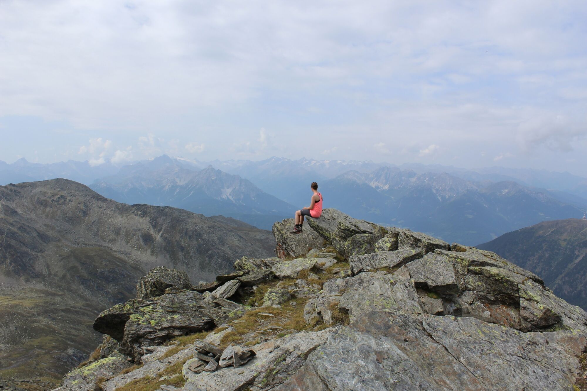
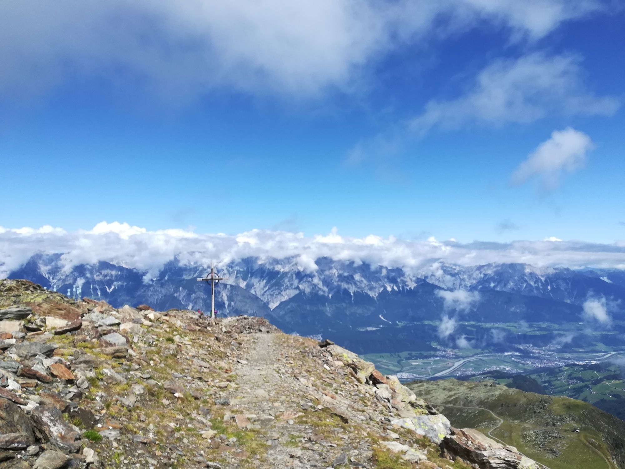
You can comfortably take the Glungezerbahn to the Tulfein mountain station. From here the hiking shoes are laced closer and you can reach the summit of the Glungezer with its impressive 360° view in 1.5h to 2h.
- Directions
-
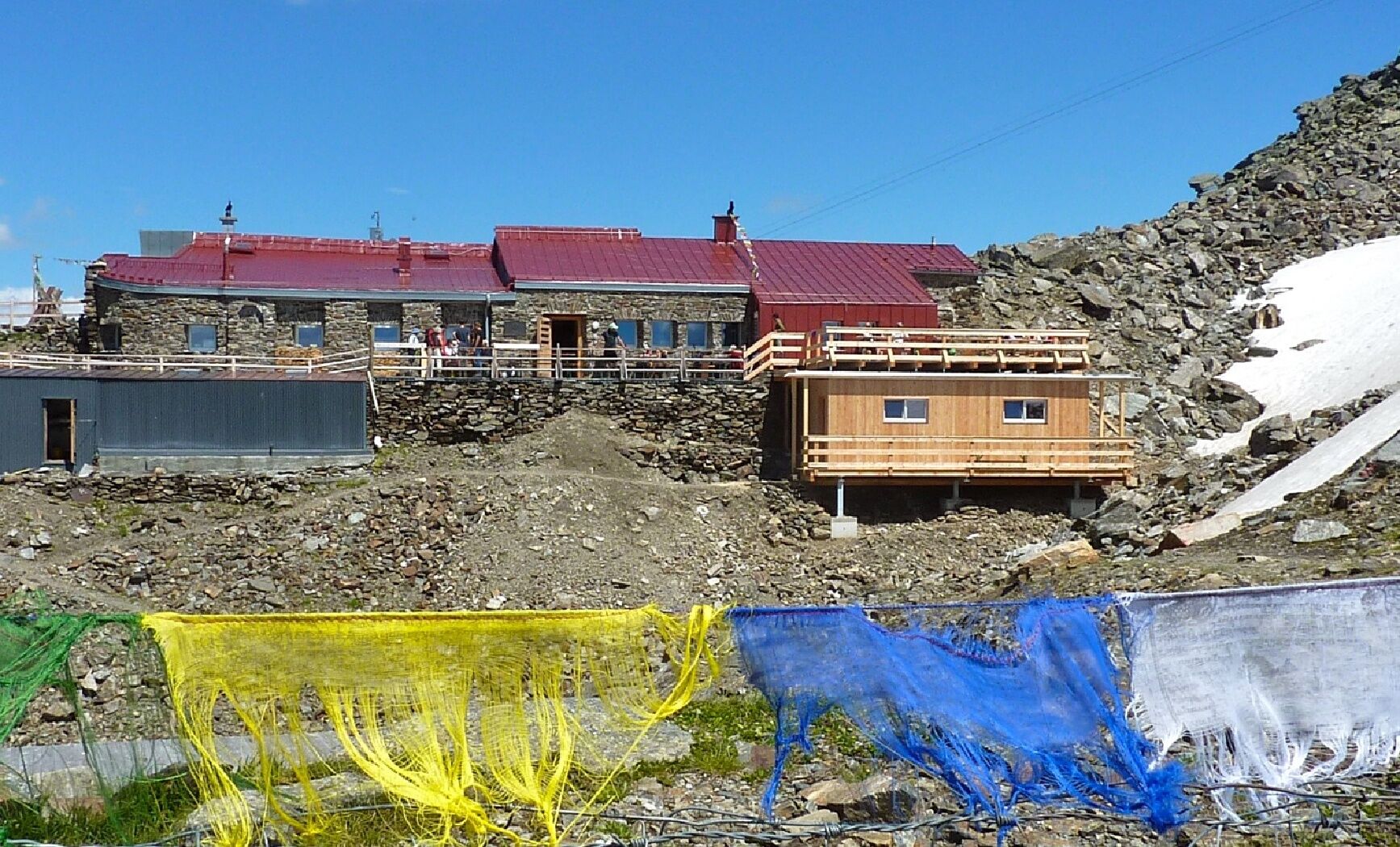
The Glungezerbahn takes you first to the Tulfein mountain station. Along the Kurt-Recheis path you get to the Tulfeinjöchl (pass). Pass the Schaferhütte and continue up with magnificent views along the panoramic trail along the ridge. The path divides just below the summit. Here you can either hike to the hut first, or stop directly at the Glungezer summit and then stop for refreshment at the Glungezer hut.
- Highest point
- 2,666 m
- Endpoint
-
Tulfeinalm
- Height profile
-

- Public transportation
-
Bus 4134


-

-
AuthorThe tour From the Tulfeinalm to the peak of the Glungezer is used by outdooractive.com provided.
GPS Downloads


General info
Refreshment stop
A lot of view
Other tours in the regions