
- Brief description
-
Varied hike in the Brandenberg Alps with several nature highlights
- Difficulty
-
medium
- Rating
-
- Starting point
-
Brandenberg/Winkel Pumphaus car park
- Route
-
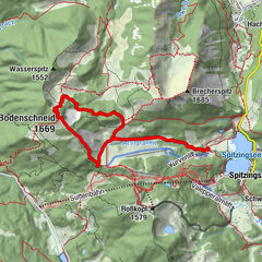
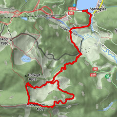
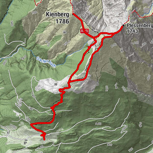
Jocheralm2.1 kmKienberg (1,786 m)3.6 kmPlessenberg (1,743 m)4.9 kmHeuberg5.2 kmJocheralm6.2 km
- Best season
-
JanFebMarAprMayJunJulAugSepOctNovDec
- Description
-
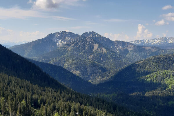
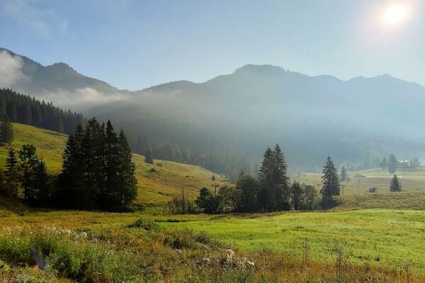
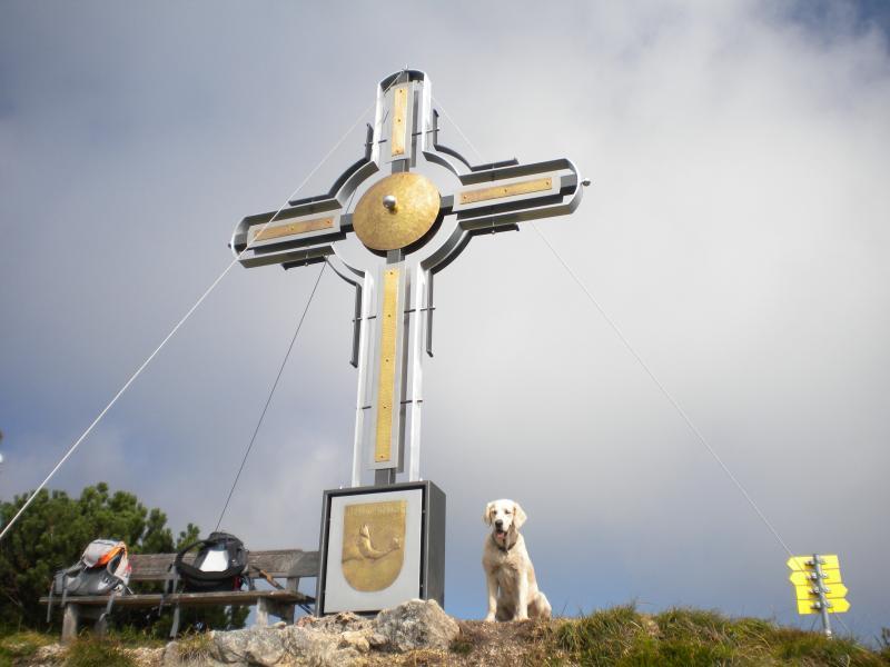
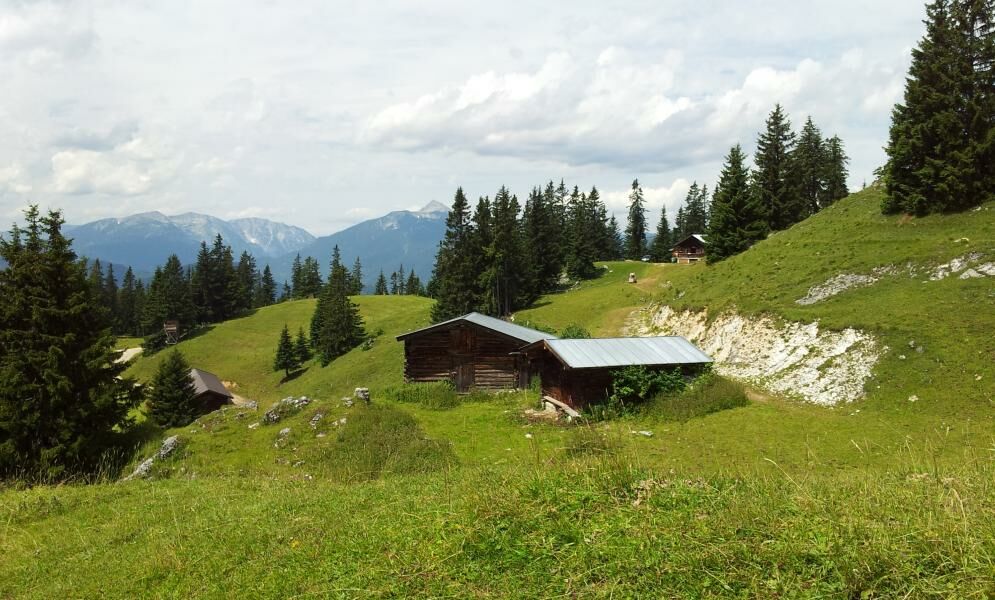
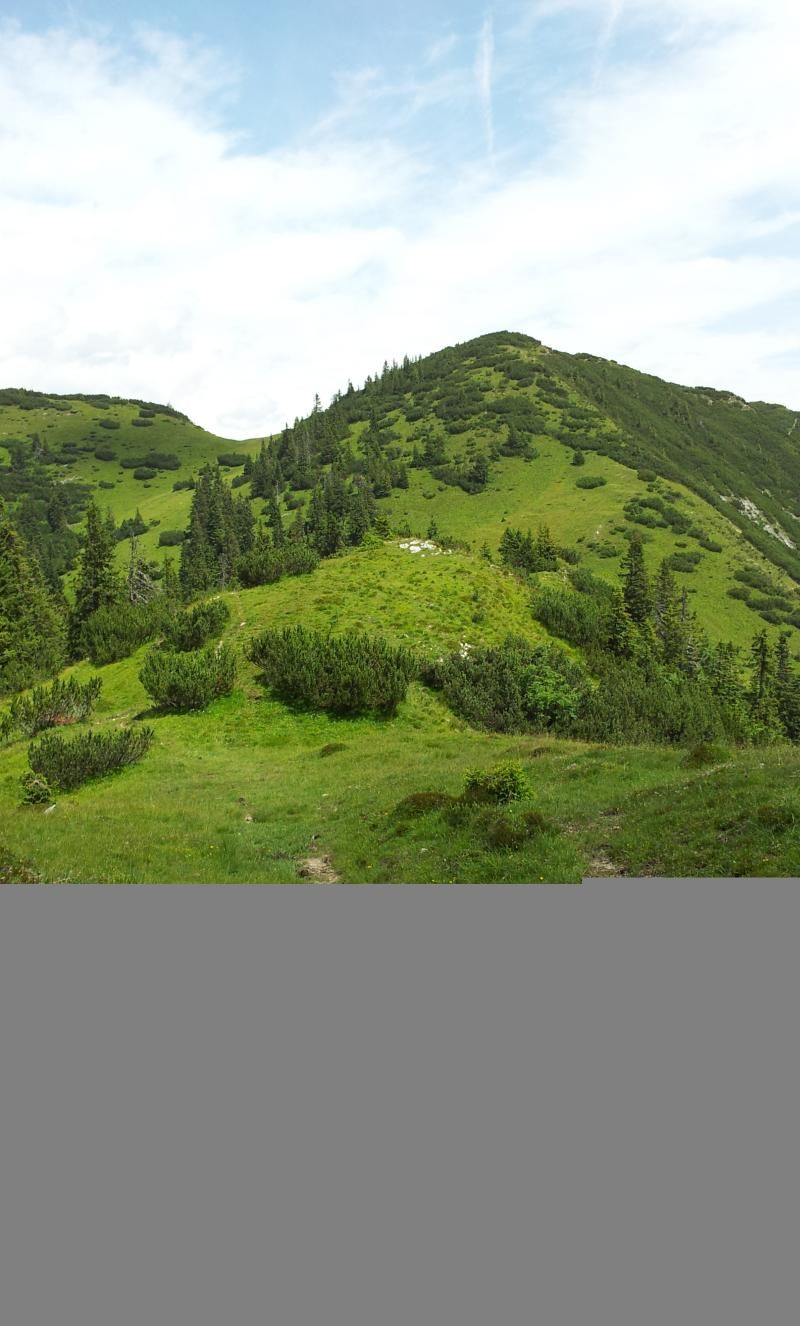
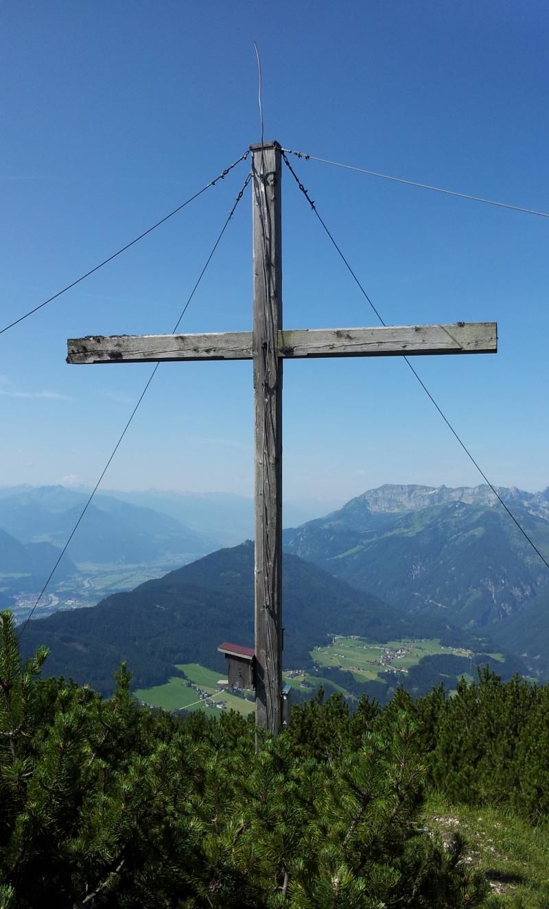
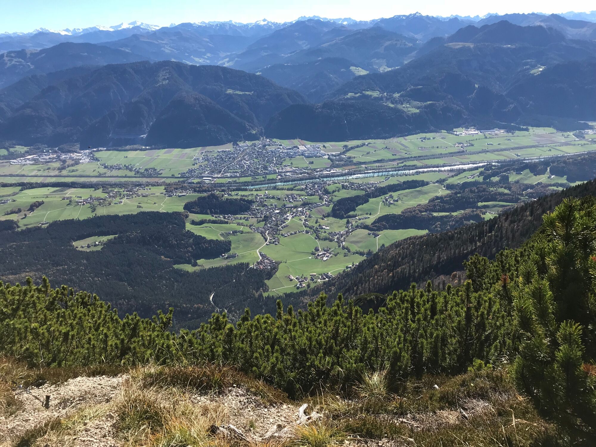
From the Pumphaus car park (parking free of charge) follow the signs for „Alter Steig“ and the waymarks uphill through the woods direction Jocheralm. After approx. 40 min. one reaches the forest track and 3 min. later the Jocheralm. Follow the trail direction Kienberg. The path to the Kienberg peak is easy and the peak is reached within approx. 50 min. The views from the bench towards the Rofan Range and Karwendel mountains, Guffert, Kitzbühel and Ziller Valley Alps are most rewarding. Take the same path for the hike back up to the first junction below the peak. Turn left walking along the "Grat" path direction Plessenberg (little elevation difference). Once again the peak offers an ideal vantage point to enjoy views over the Inn Valley, the Kitzbühel and Ziller Valley Alps and the Hohe Tauern with Großglockener and Großvenediger. Walk back the way you came, at the saddle bear left along a short uphill (surefootedness required) towards Heuberg. Continue straight along the ridge downhill towards the Jocheralm. At the Jocheralm either walk back the way you came or follow the forest track to the starting point.
- Directions
-
From the Pumphaus car park (parking free of charge) follow the signs for „Alter Steig“ and the waymarks uphill through the woods direction Jocheralm. After approx. 40 min. one reaches the forest track and 3 min. later the Jocheralm. Follow the trail direction Kienberg. The path to the Kienberg peak is easy and the peak is reached within approx. 50 min. Take the same path for the hike back up to the first junction below the peak. Turn left walking along the "Grat" path direction Plessenberg (little elevation difference). Walk back the way you came, at the saddle bear left along a short uphill (surefootedness required) towards Heuberg. Continue straight along the ridge downhill towards the Jocheralm. At the Jocheralm either walk back the way you came or follow the forest track to the starting point.
- Highest point
- 1,784 m
- Endpoint
-
Brandenberg/Winkel Pumphaus car park
- Height profile
-

- Equipment
-
Sturdy shoes and surefootedness required.
- Safety instructions
-
Please note; the path leading to Heuberg demands surefootedness and a head for heights!
The Heuberg can be easily bypassed by staying on the path up to the Kienberg cross section. Instead of walking through the meadow turn left and walk along the ridge to the Jocheralm.
- Tips
-
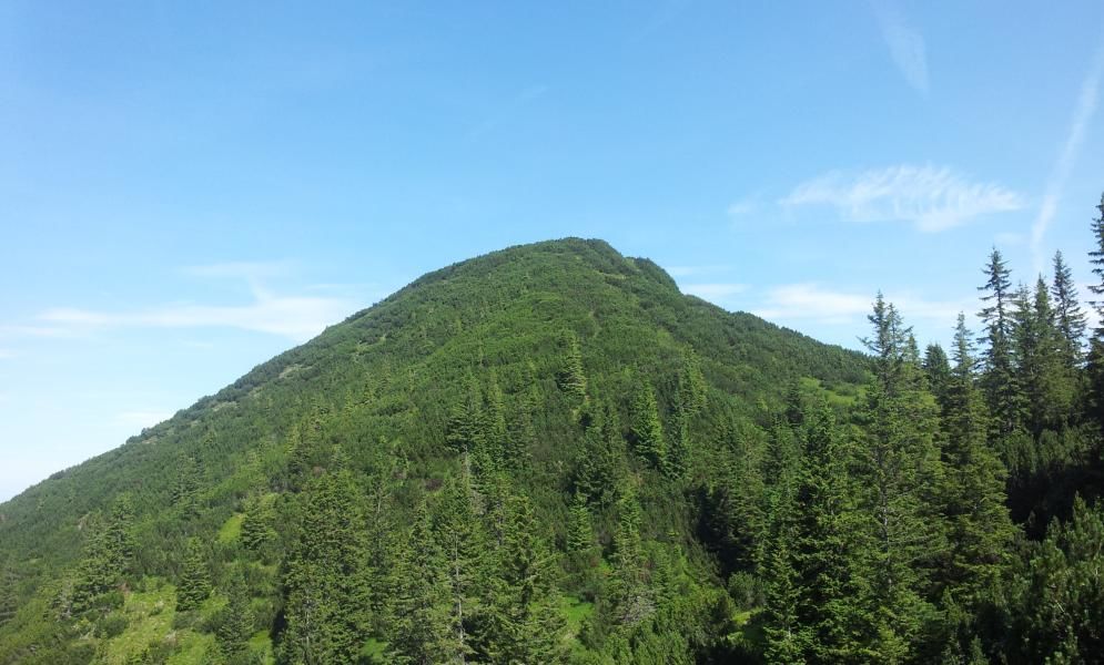
All 3 peaks are characterised by their dense mountain pine vegetation and unspoilt nature. Due their immediate vicinity to each other they can easily be hiked together. All 3 peaks are over 1.700 m, resulting in very little elevation gain.
- Directions
-
A12, motorway exit Kramsach, towards Kramsach, lakes (sign: Zu den Seen), towards Brandenberg, through the village to the Winkel hamlet. At the former Gasthof Kink uphill to the Pumphaus / Joch car park.
- Public transportation
-
not accessible by public transport
- Parking
-
Pumphaus/Joch car park in Brandenberg Winkel hamlet
- Author
-
The tour 3-peak-tour Kienberg-Plessenberg-Heuberg is used by outdooractive.com provided.


General info
-
Alpbachtal
1502
-
Breitenbach am Inn
451