
- Brief description
-
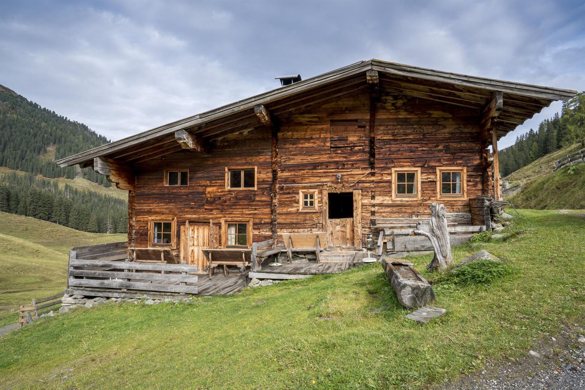
Easy hike through the Lueger Valley to the rustic Faulbaumgartenalm
- Difficulty
-
easy
- Rating
-
- Starting point
-
Hochberg car park, Inneralpbach
- Route
-
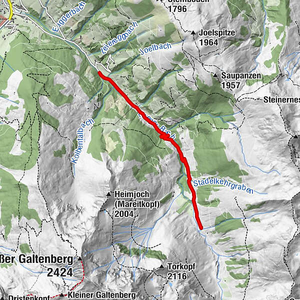
Kühtalalm0.9 kmFaulbaumgarten Alm3.6 kmFaulbaumgartenalm (1,507 m)3.6 kmKühtalalm6.5 km
- Best season
-
JanFebMarAprMayJunJulAugSepOctNovDec
- Description
-
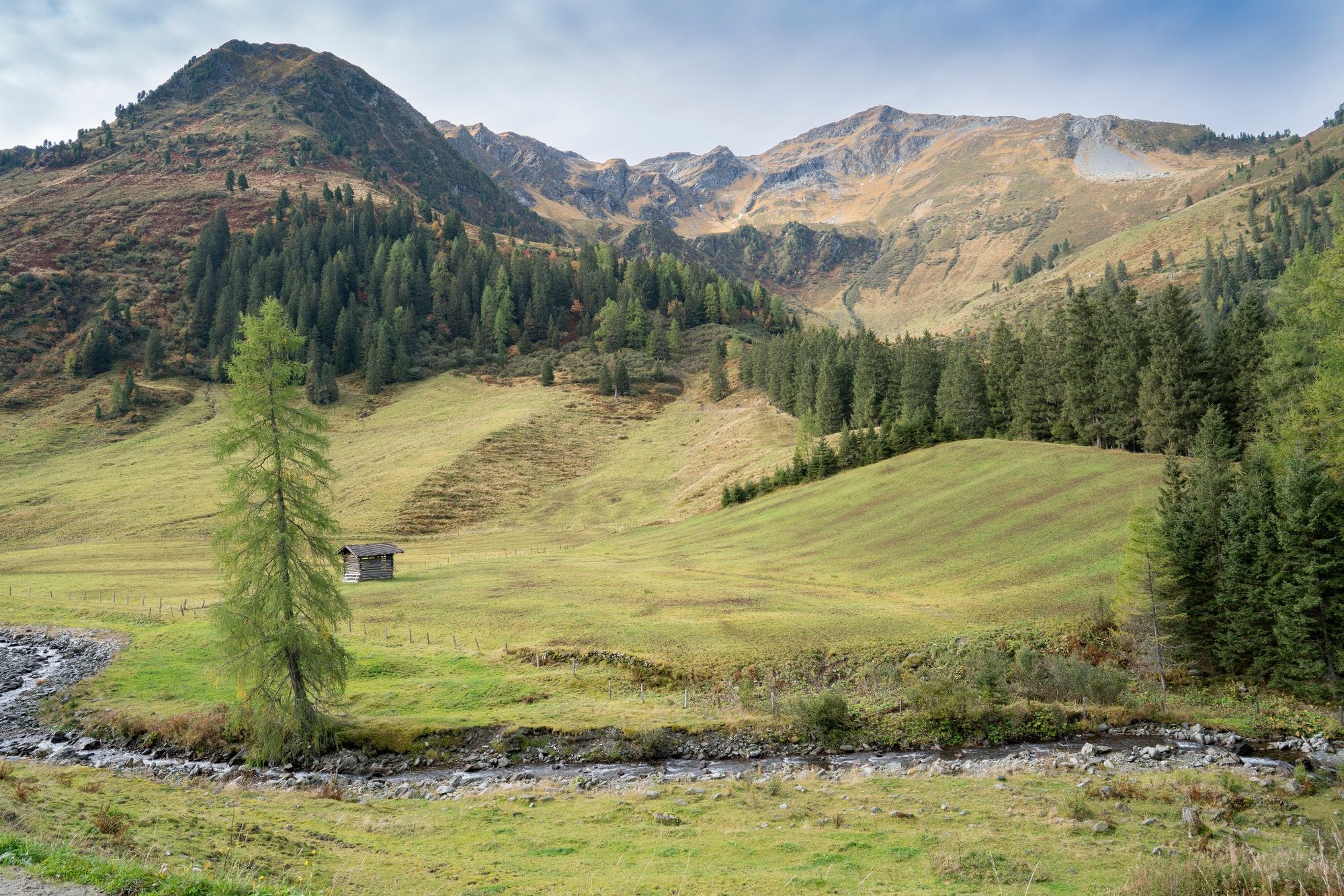
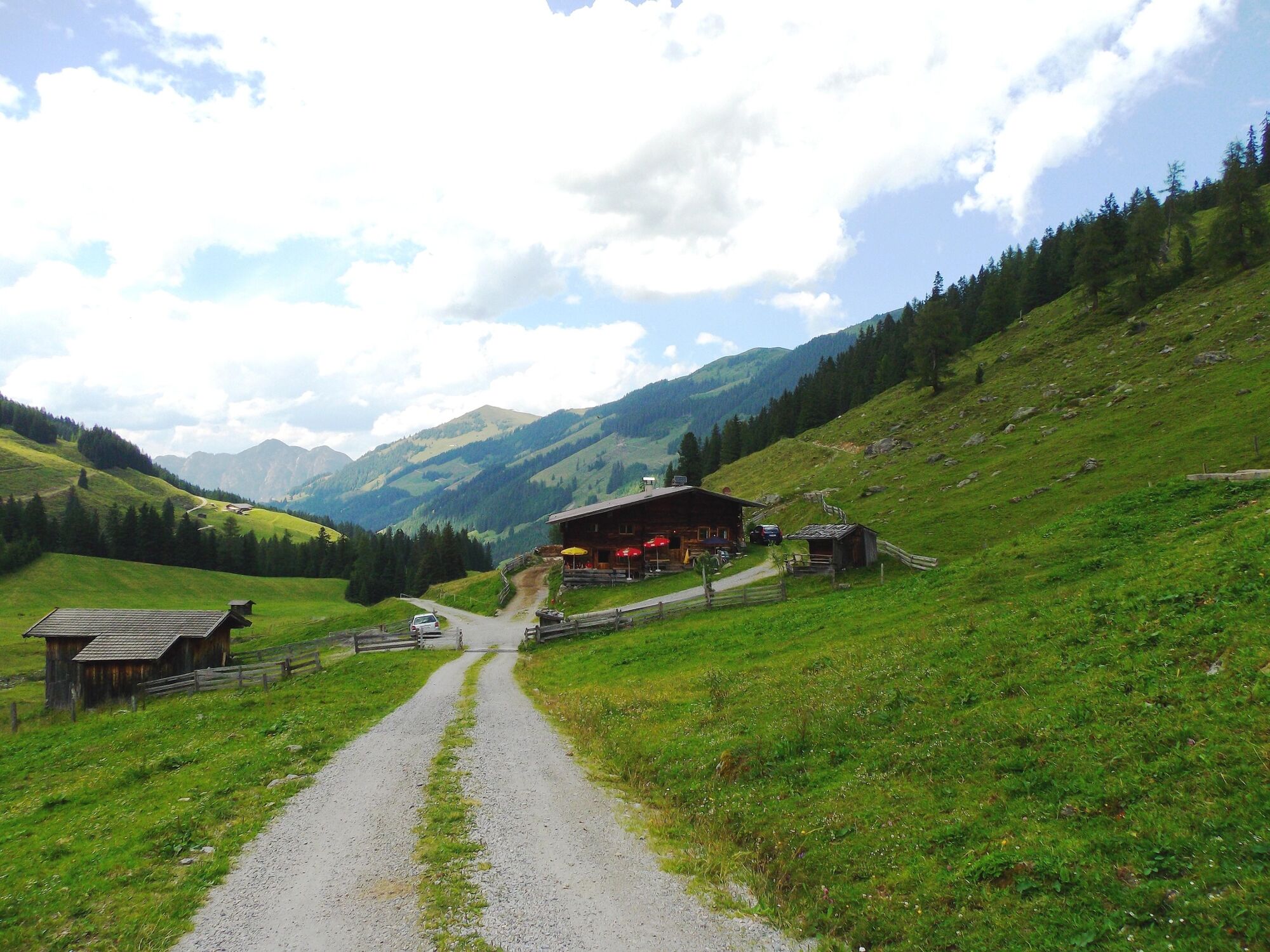
Starting from theHochberg car park (parking fee!) follow the dirt track up the valley walking along side the stream andthen in serpentines through Alpine pasture terrain to the Faulbaumgartenalm. The hut faces the mighty Galtenberg and further hikes - such as a walk to the the Steinbergalm (approx. 1 hour) - can be undertaken from this point. Walk back the same route.
- Directions
-
Inneralpbach, left hand valley - Lueger Valley - turn left at Connys - Original Tiroler Wirtshaus - cross a small bridge - keep to the right and follow the course of the road to the Hochberg car park (parking fees apply) - walk to the Faulbaumgartenalm, a hut serving food and drinks.
Please note: motorised traffic is not authorised after Hochberg
- Highest point
- 1,490 m
- Endpoint
-
Hochberg car park, Inneralpbach
- Height profile
-

- Equipment
-
Suitable clothing, sturdy shoes, something to drink
- Safety instructions
-
Beware of possible traffic!
- Tips
-
Popular Bike & Hike route to the Steinbergalm and up the Sonnjoch
- Additional information
- Directions
-
A12 motorway, exit Kramsach/Brixlegg, towards Brixlegg, Alpbachtal to Inneralpbach - turn left at Connys - Original Tiroler Wirtshaus - walk up the Lueger Valley - approx. 2,5 km to the Hochberg car park
- Public transportation
-
Bus no. 4074, bus stop: Inneralpbach --> approx. 1/2 hour wlak to the Hochberg car park
- Parking
-
Hochberg/Inneralpbach car park


- Author
-
The tour Faulbaumgartenalm is used by outdooractive.com provided.


-
Alpbachtal
1502
-
Alpbach
494