


- Brief description
-
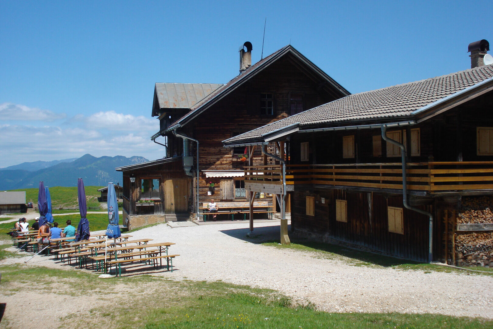
Pleasant hike along shady paths to the Berggasthof Holzalm
- Difficulty
-
medium
- Rating
-
- Starting point
-
Saulueg/Distelberg, Kundl
- Route
-
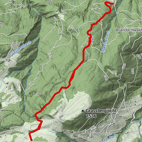
Holzalm3.6 km
- Best season
-
JanFebMarAprMayJunJulAugSepOctNovDec
- Description
-
Walk along the dirt track past the large fountain and after approx. 300 m turn left onto a small path – signposted!! The path leads uphill crossing the forest road on 5 occasions. Continue along the uphill path and walk through the Alpine pasture scenery. Find a suitable spot to cross through the marshy ground and walk through the meadows to an Alpine hut and – visible from this point – the Berggasthof Holzalm. Calculate approx. 1 h 45 min. for the ascent.
Behind the Berggasthof Holzalm a trail leads up to Gratlspitze. Calculate approx. 2h 45 min for the hike up to the cross and back.
Walk back to the parking the way you came.
- Directions
-
Kundl - Klammstraße to Saulueg/Distelberg - after the large fountain approx. 300 m along the forest track - turn left onto a small path – the path leads uphill crossing the forest road on 5 occasions - continue along the uphill path and walk through the Alpine pasture scenery - find a suitable spot to cross through the marshy ground - walk through the meadows to the Berggasthof Holzalm - walk back to the parking the way you came.
- Highest point
- 1,449 m
- Endpoint
-
Saulueg/Distelberg, Kundl
- Height profile
-

- Equipment
-
Sturdy shoes, protective clothing.
- Tips
-
This tour is ideal on a hot summer's day as the majority of the route to the Berggasthof Holzalm leads through dense woods.
- Directions
-
Kundl, Kundl Gorge. Towards Saulueg, turn right at the end of the plateau and walk drive uphill to the former Gasthof Distelberg
- Public transportation
-
Not applicable
- Parking
-
Curve after the former Gasthof Distelberg
- Author
-
The tour Holzalm from Kundl Saulueg/Distelberg is used by outdooractive.com provided.


General info
-
Alpbachtal
1502
-
Alpbach
494


