- Brief description
-
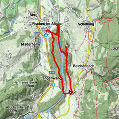
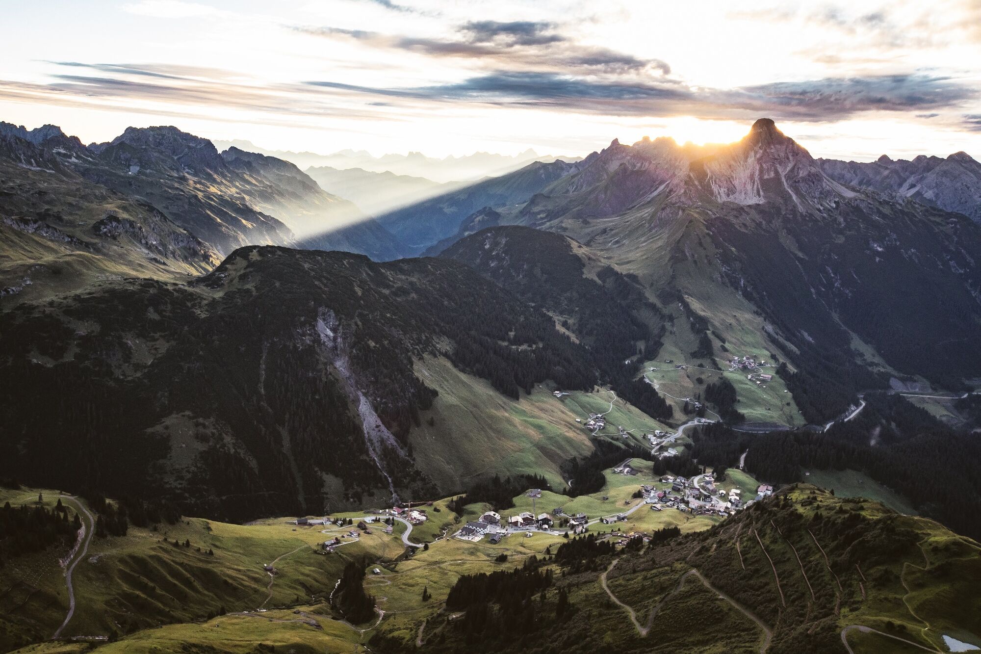
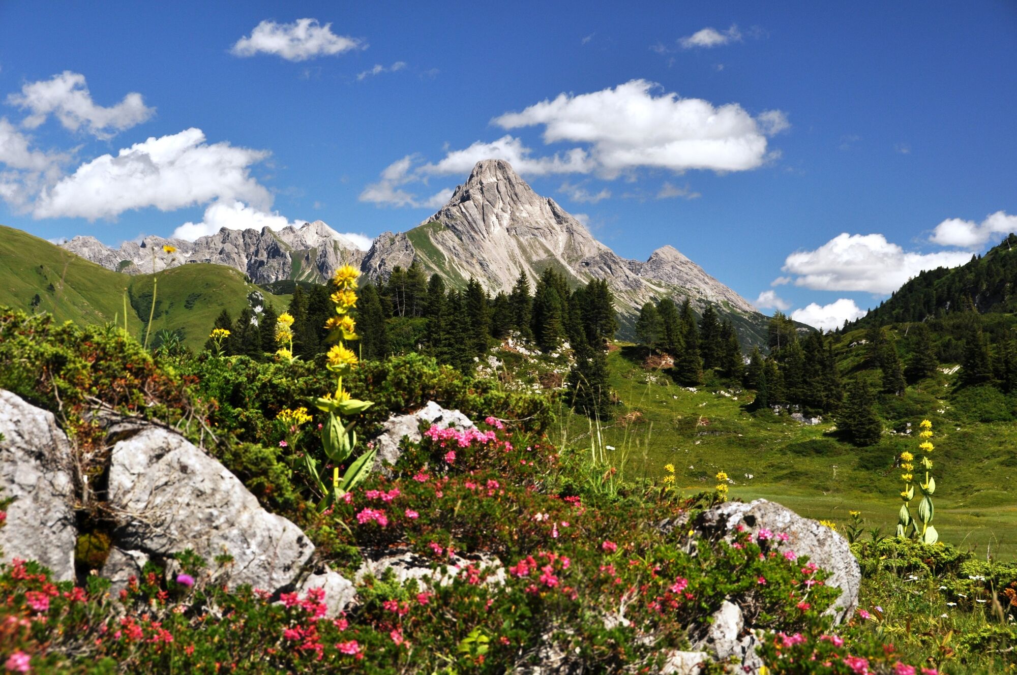
Follow the loamy path up to the Lechleitner Alpe. Arriving here, a wonderful view of Warth awaits you and is perfect for a little break. Through blooming alpine meadows, partly already decayed huts and small lakes you hike further to the border crossing Bavaria-Tyrol. And don’t forget, you are now under the giant Biberkopf, which stretches 2.599 m up in front of you. A nice footpath takes you to the Mutzentobel, where you should be be free from giddiness and safe. Only slightly ascending to the lookout point towards Oberstdorf and a final ascent to the Rappenseehütte awaits you. The Rappenseehütte is located at 2.091 m and is one of the largest alpine club huts in the German-speaking area and can accommodate up to 400 people. Not to be forgotten is the turquoise mountain lake – the Rappensee. Go back on the same path again to Lechleiten to the entrance.
- Difficulty
-
medium
- Rating
-
- Starting point
-
Lechleiten
- Route
-
Rappenseehütte6.6 km
- Best season
-
JanFebMarAprMayJunJulAugSepOctNovDec
- Description
-
Touring.
Lechleiten - Lechleitner Alpe - Border Bayern-Tirol - Mutzentobel - Rappenseehütte - Mutzentobel - Border Bayern-Tirol - Lechleitner Alpe - Lechleiten
- Directions
-
Touring.
Lechleiten - Lechleitner Alpe - Border Bayern-Tirol - Mutzentobel - Rappenseehütte - Mutzentobel - Border Bayern-Tirol - Lechleitner Alpe - Lechleiten
- Highest point
- 2,085 m
- Endpoint
-
Lechleiten
- Height profile
-

- Equipment
-
This should never be missing on the mountain.
Backpack, First-Aid Set incl. Bladder plaster, telephone with emergency number, cash, drinking bottle, pocket knife, provisions, sun protection in good weather.
- Safety instructions
-
Emergency numbers.
140 - Alpine emergencies throughout Austria
144 - Alpine emergencies in Vorarlberg
112 - Euro emergency call
- Additional information
- Directions
- Public transportation
- Parking
- Author
-
The tour Rappensee hut is used by outdooractive.com provided.


General info
-
Kleinwalsertal
2055
-
Steeg im Lechtal
364