Tour data
11.5km
840
- 1,346m
514hm
508hm
04:00h
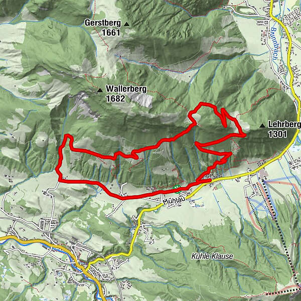
- Difficulty
-
medium
- Rating
-
- Route
-
Pfarrkirche Sankt Jakob in HausZur Post0.0 kmSt. Jakob in Haus0.7 kmTorfmoos1.4 kmGerstberg5.1 kmHohe Scharte6.7 kmLehrbergalm8.3 kmZur Post11.3 kmPfarrkirche Sankt Jakob in Haus11.3 km
- Description
-
From the Gasthof Post walk in a westerly direction along
the „Path of senses“ to the hamlet Filzen and further on
to Obwall. Pass the farm houses until the crossing Fieberbrunn-
Tennäusl. Turn right and follow the way until
Tennhäusl and the 700 year old farm Gerstberg. Walk
along the St. Jakob high-level-trail until the Hauserberg
(here you can decend via Eiblberg to the hamlet Filzen
or to the village center) and further on to Schartenalm- Lehrbergalm. From the Lehrbergalm return to the
center of St. Jakob i.H. (Alternative descent: directly to
the farm house Lehrberghof and the bus stop St. Jakob
in Haus Buchenstein). - Highest point
- 1,346 m
GPS Downloads


Other tours in the regions
-
Pillerseetal
1762
-
St. Jakob in Haus
405