


- Brief description
-
A must for hikers in Söll - local history and culinary delights on the sunny side.
- Difficulty
-
medium
- Rating
-
- Starting point
-
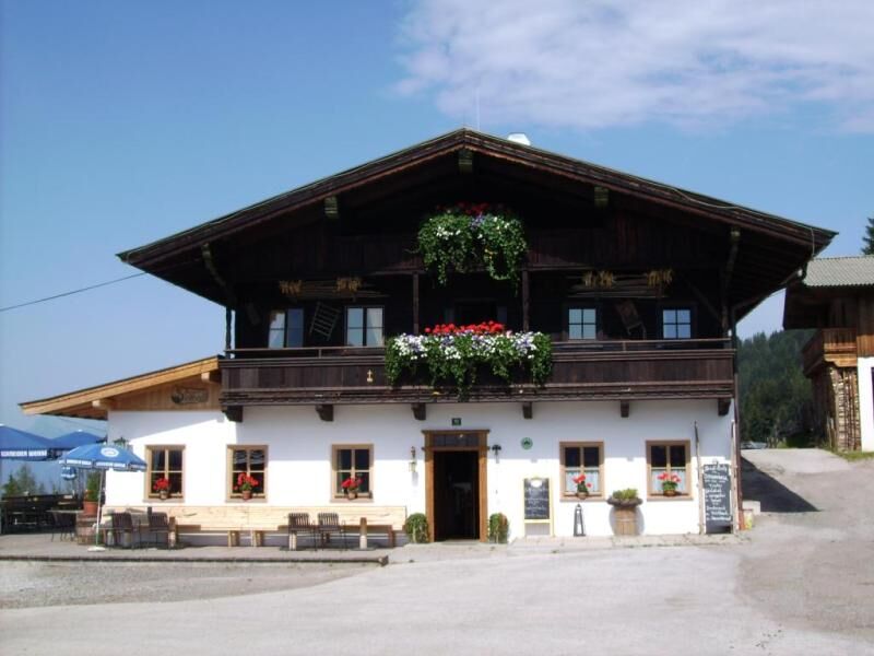
Hiking starting point Franzlhof, Söll (703 m)
- Route
-
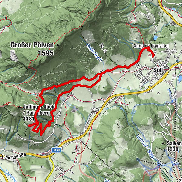
SöllDorfbichl0.0 kmReit1.9 kmLengaukapelle3.6 kmStallhäusl5.4 kmPaisslberg6.9 kmAgerhof9.2 kmReit10.0 kmDorfbichl12.0 kmSöll12.0 km
- Best season
-
JanFebMarAprMayJunJulAugSepOctNovDec
- Description
-
The starting point for your tour is at the Franzlhof leisure centre and get ready to be rewarded with many local secrets and sun-soaked inns. Follow the main trail to the Reiter Dörfl before heading up right to the Schwazerbauer. After a short but steep section that takes you past the Marienbründl, go to the Lengauer chapel and Stallhäusl. Head back down the road as the Sunnseit path on the left takes you on a journey back to the village.
- Highest point
- 1,009 m
- Endpoint
-
Hiking starting point Franzlhof, Söll (703 m)
- Height profile
-

- Equipment
-
Rucksack, sturdy hiking/mountaineering boots with anti-slip treaded soles, weather-appropriate hiking gear (breathable), a change of clothes, sun protection (sunglasses, sun cream, lip protection, headgear), waterproofs (rain jacket/poncho, pocket umbrella, rucksack protector), cold protection (hat, gloves), sufficient food and drink, hiking poles (height adjustable) if required, first aid kit incl. rescue blanket and bivouac sack, mobile phone with fully charged battery, headlamp, plastic bag for waste, hiking map, route description and information materials (GPX track), ID, insurance card, cash
- Directions
-
Heading from Wörgl, Kufstein or St. Johann on the B178 road, take the exit to Söll and then take the exit to Söll centre (“Söll, Zentrum”) at the roundabout. Drive straight through the village and bear right before the “Giovanni” pizzeria. Follow the road until you reach the hiking starting point at the Franzlhof leisure centre.
- Public transportation
-
KaiserJet/Postbus stop “Söll Dorf” – followed by approx. 10-minute hike to the hiking starting point
More information at: www.wilderkaiser.info - Parking
-
Franzlhof leisure centre car park, Söll (703 m) – free

- Author
-
The tour Sunnseitweg trail circular route is used by outdooractive.com provided.


General info
-
Region Hohe Salve
1812
-
Söll
608


