© Österreichs Wanderdörfer - Bernhard Pichler
Tour data
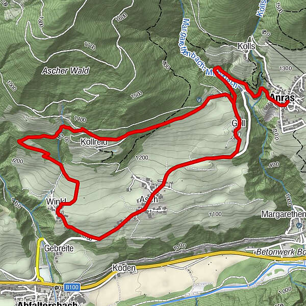
6.81km
1,110
- 1,357m
276hm
271hm
02:14h

Österreichs Wanderdörfer
- Difficulty
-
easy
- Rating
-
- Route
-
Pfarrkirche AnrasAnras0.1 kmGoll1.4 kmBildstock Bartler1.7 kmMaria Himmelfahrt2.4 kmAsch2.6 kmWinkl3.5 kmKollreid5.5 kmAnras6.8 km
- Best season
-
JanFebMarAprMayJunJulAugSepOctNovDec
- Highest point
- 1,357 m
- Endpoint
-
Dorfzentrum Anras
- Height profile
-


-

-
AuthorÖsterreichs WanderdörferThe tour Mühlenweg - Kollreid is used by outdooractive.com provided.
GPS Downloads


General info
A lot of view
Other tours in the regions