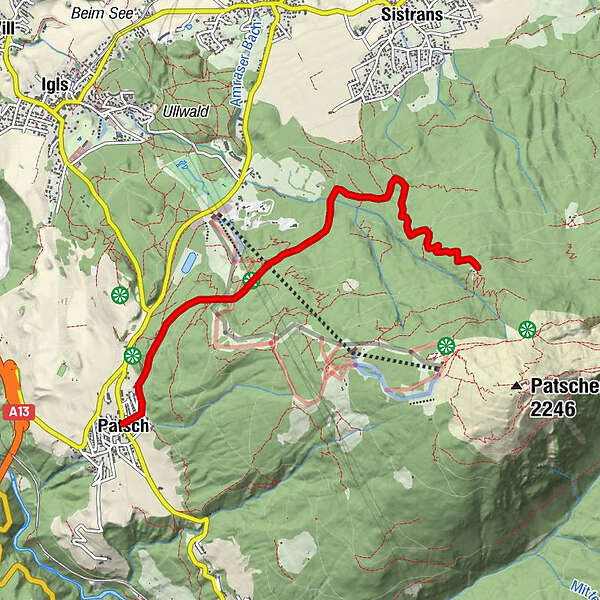
Patsch - Lanser Alm

Logo Patsch - Lanser Alm
Tour data
10.5km
1,046 - 1,699m
Distance
933hm
933hm
Ascent
03:10h
 
Duration
Brief description

Von der Römerstraße zur Lanser Alm

Difficulty
easy
Rating
Technique
Fitness
Landscape
Experience
Best season
Jan
Feb
Mar
Apr
May
Jun
Jul
Aug
Sep
Oct
Nov
Dec
Highest point
Patscherkofel (1,699 m)

Overall rating

5

0

%

4

0

%

3

0

%

2

0

%

1

0

%

Error
An error has occurred. Please try again.
Thank you for your review

Rating has been deleted

GPS Downloads
  • GPX GPS Exchange Format (XML)
  • KML Google Earth, Google Maps
QR Download Codes for Mobile Phones

Trail conditions

Asphalt
Gravel
Meadow
Forest
Rock
Exposed
Other tours in the regions

Popular tours in the area

Gramaialm - Lamsenjochhütte

medium Hiking
4.08km | 679hm | 01:01h

Vordere Brandjochspitze, Tirol/Österreich

medium Hiking
15.2km | 1705hm | 04:57h

Neustift im Stubaital - Habicht

Hiking
19.2km | 1841hm | 09:00h

"Königstour" über die Gipfel

Hiking
4.52km | 322hm | 04:00h