- Brief description
-
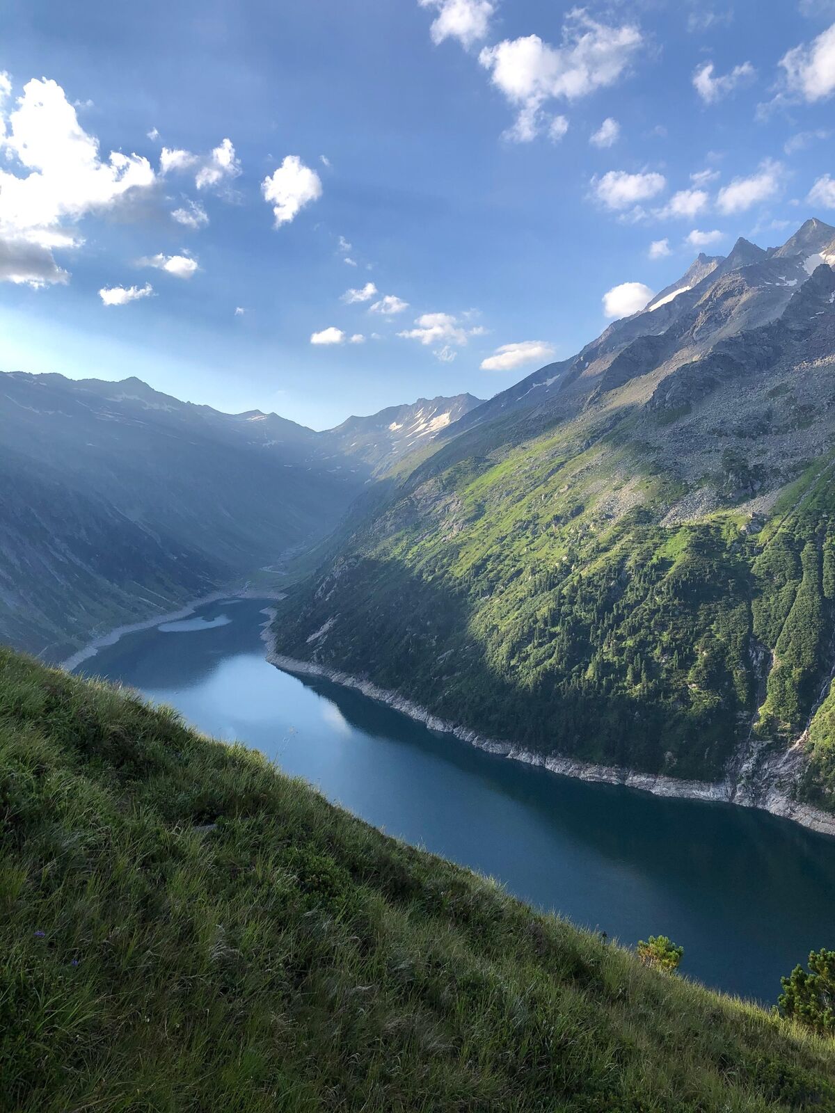
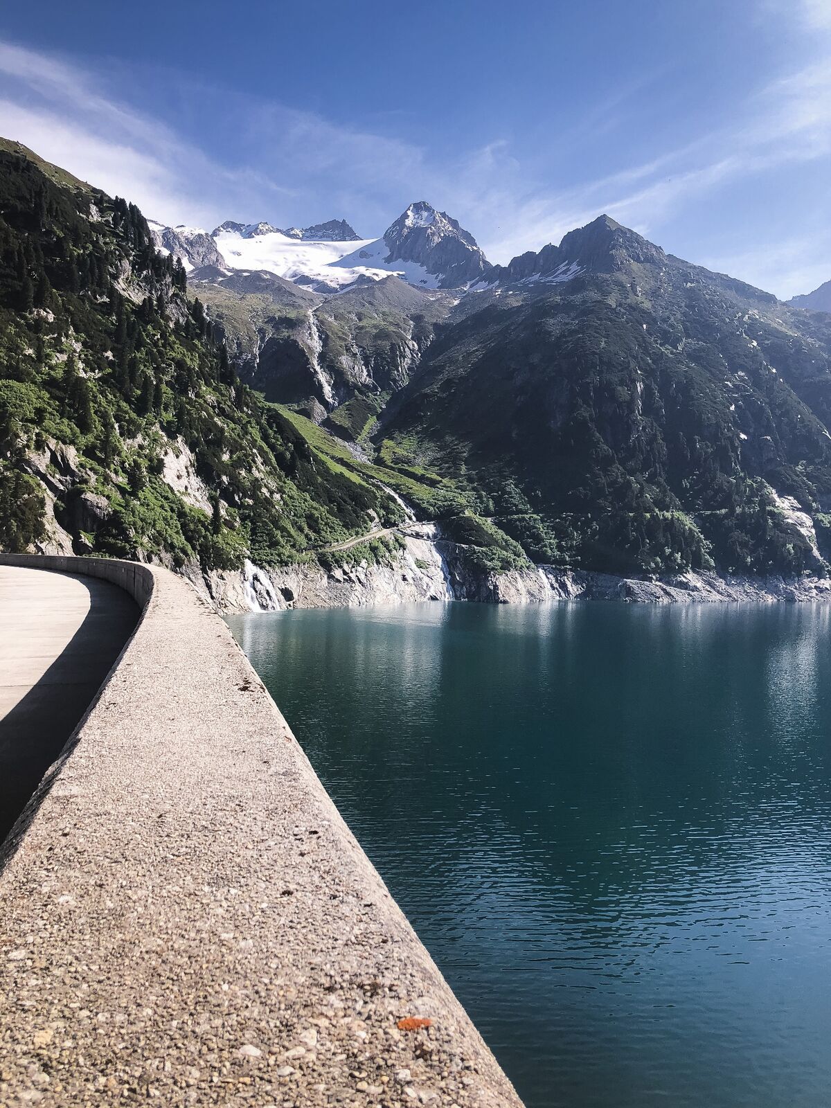
Impressive landscape in the middle of the Zillertal Alps
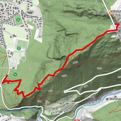
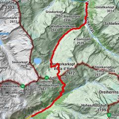
- Route
-
AdlerblickKlein Tibet “Hohenaualm”3.8 kmHohenau-Alm3.9 km
- Best season
-
JanFebMarAprMayJunJulAugSepOctNovDec
- Description
-
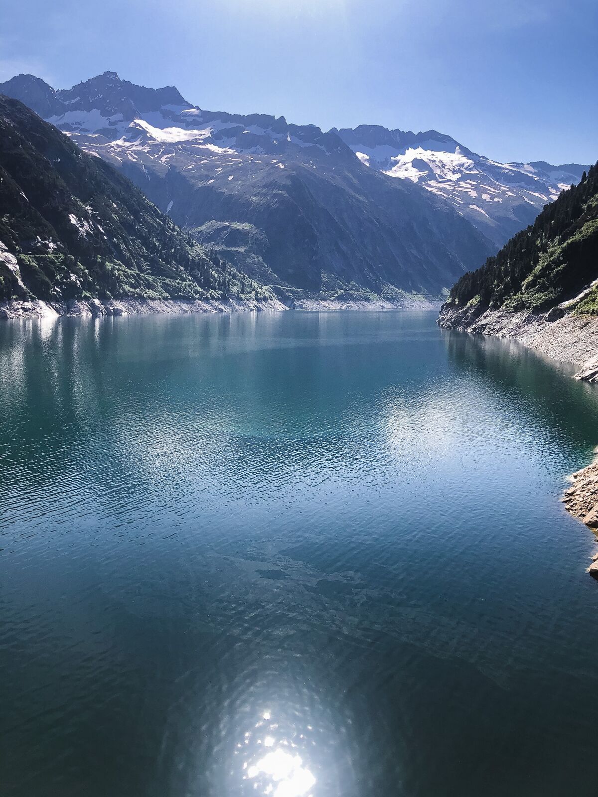
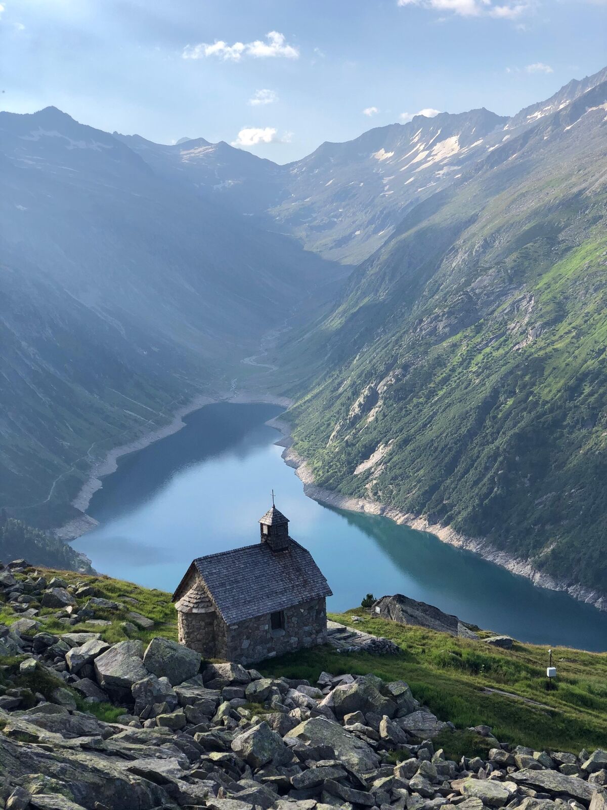
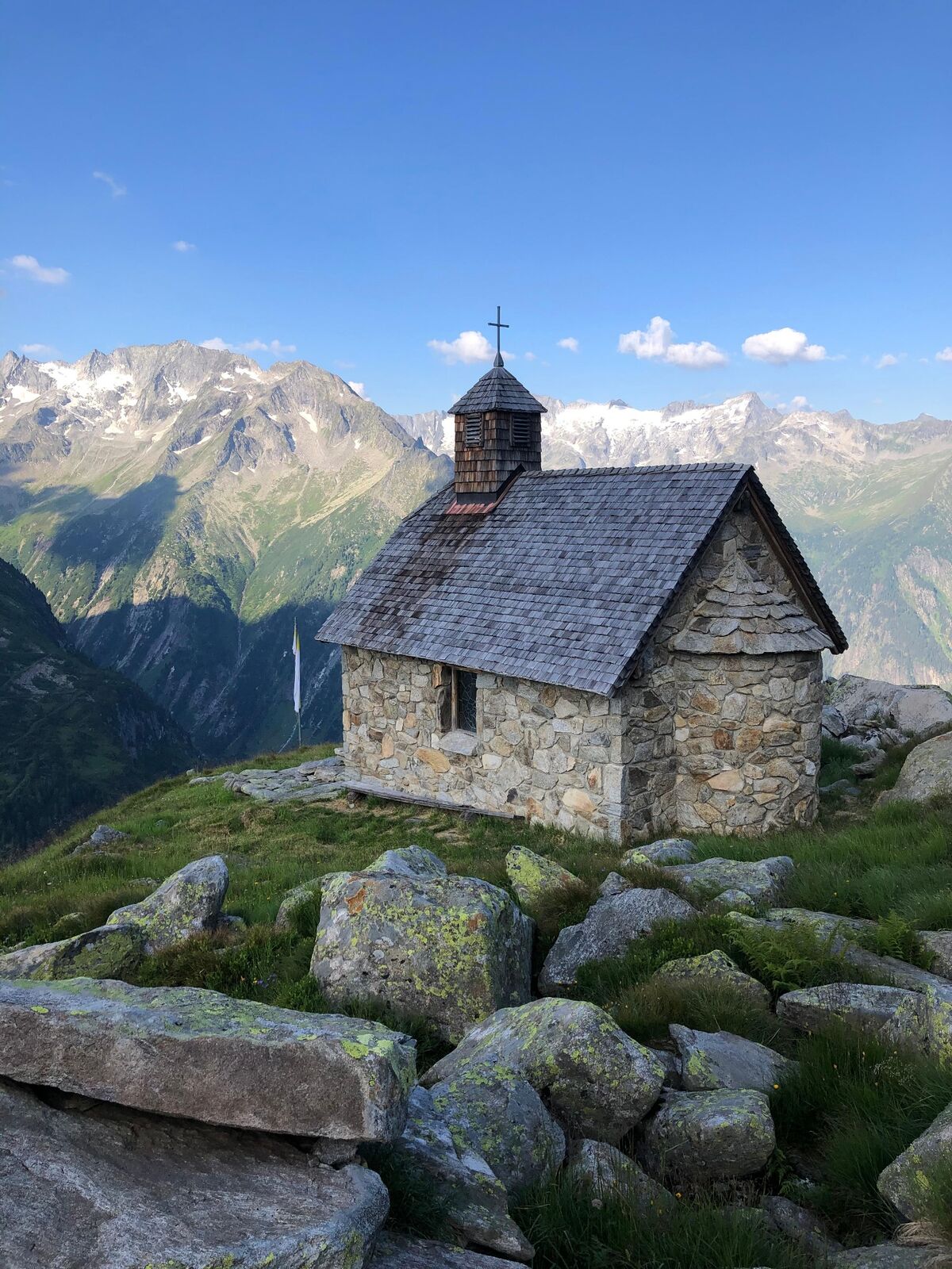
With its fjord-like landscape, the Zillergrund offers the perfect starting point for a hike. On the left bank at a few meters above sea level, the path leads along the reservoir further into the Zillergrund. Here is also the source of the Ziller, which gives the Ziller Valley its name. The destination is the Hohenaualm, which is reminiscent of Tibet in the Himalayan mountains, and is therefore also called "Little Tibet".
- Directions
-
Your journey begins in Mayrhofen, from where you take one of the regular buses to the Zillergrund reservoir. After enjoying the view of the reservoir, you start your hike on the trail towards "Little Tibet". The path leads past the turquoise-green water of the reservoir, surrounded by mighty mountains with steep cliffs. The closer you get to the Hohenaualm, the more the landscape reminds you of Tibet. From a distance you can already see the red, blue and yellow fabrics of the Tibetan flags waving in the wind. A last stretch past small wooden huts and several prayer wheels will finally take you to the Hohenaualm, which is decorated with historical paintings, antlers and milk churns.
- Highest point
- 1,909 m
- Endpoint
-
Hohenaualm
- Height profile
-

- Equipment
-
For an easy tour that lasts a day or several hours, the basic equipment of a hike is enough for you. This includes:
Good and reasonable footwear
Backpack (approx. 15-20l)
Enough provisions: drinks, preferably water in refillable drinking bottles, at least one meal and snacks like energy bars for in between, think also of a small plastic bag for waste!
Proper hiking clothing: avoid sweating too much and hypothermia, pack a light change of clothes if necessary, a jacket should never be missing and possibly rain gear (pay attention to the weather forecast!)
Sun protection: sunscreen, sunglasses and headgear.
Cell phone (charged!) with emergency app, ID card, possibly alpine club ID and cash for the huts
First aid kit, blister plasters and tissues
Hiking poles
Especially as a beginner, your backpack should end up weighing no more than 9kg. The motto is: as much as necessary, as little as possible.
- Safety instructions
-
Information on the current trail conditions can be obtained from the responsible tourism associations by telephone during the respective opening hours. Zillertal Tourism assumes no liability.
- Tips
-
The "Little Tibet" does not exist anywhere else and gives everyone a small glimpse of the Himalayan mountains.
- Additional information
-
The entire range of hikes, as well as information on all the places to stop for refreshments, the Zillertal Alps High Mountain Nature Park and the summer mountain railroads can be found at www.zillertal.at/hike.
- Directions
-
Unlimited mobility during your vacation is ensured by the comprehensive transport offer consisting of buses, hiking cabs, summer mountain railroads (depending on the route) and the Zillertalbahn.
The Zillertal Activcard allows you free use of most means of public transport as well as one ascent and descent with a mountain railroad every day. You can find more information on www.zillertal.at/en/activcard
Detailed timetable information can be found at www.zillertal.at/timetables.
- Public transportation
-
Unlimited mobility during your vacation is ensured by the comprehensive transport offer consisting of buses, hiking cabs, summer mountain railroads (depending on the route) and the Zillertalbahn.
The Zillertal Activcard allows you free use of most means of public transport as well as one ascent and descent with a mountain railroad every day. You can find more information on www.zillertal.at/en/activcard
Detailed timetable information can be found at www.zillertal.at/timetables.
- Parking
-
Bärenbadalm, Zillergrund 78, 6290 Brandberg

-

-
AuthorThe tour Zillergrund - Hohenaualm "Klein Tibet" is used by outdooractive.com provided.


General info
-
Bruneck und Umgebung / Kronplatz
1813
-
Zillertal Arena
1322
-
Prettau
80