
- Brief description
-
Beautiful round tour with several stops.
- Difficulty
-
easy
- Rating
-
- Starting point
-
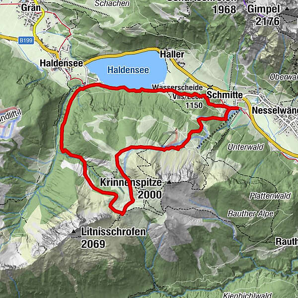
Nesselwängle parking
- Route
-
Schmitte0.1 kmKrinnenalpe1.5 kmEdenalpe Nesselwängle3.1 kmSchmitte10.1 km
- Best season
-
JanFebMarAprMayJunJulAugSepOctNovDec
- Description
-
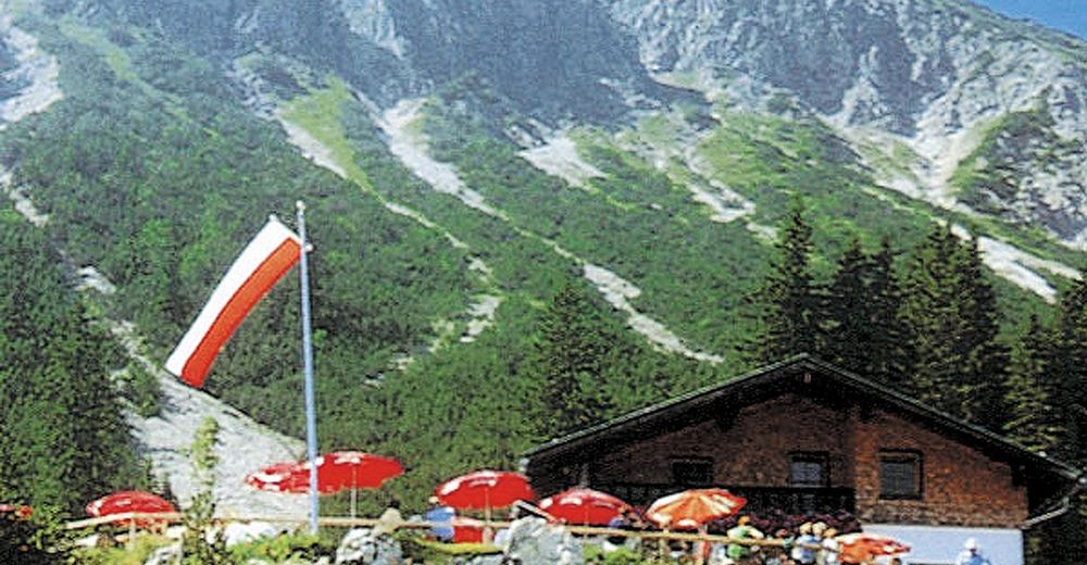
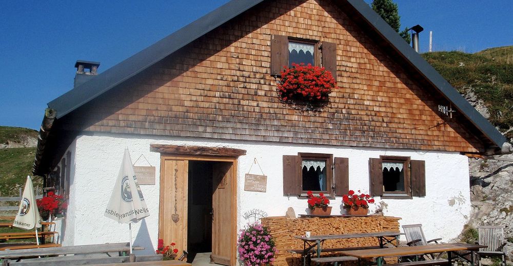
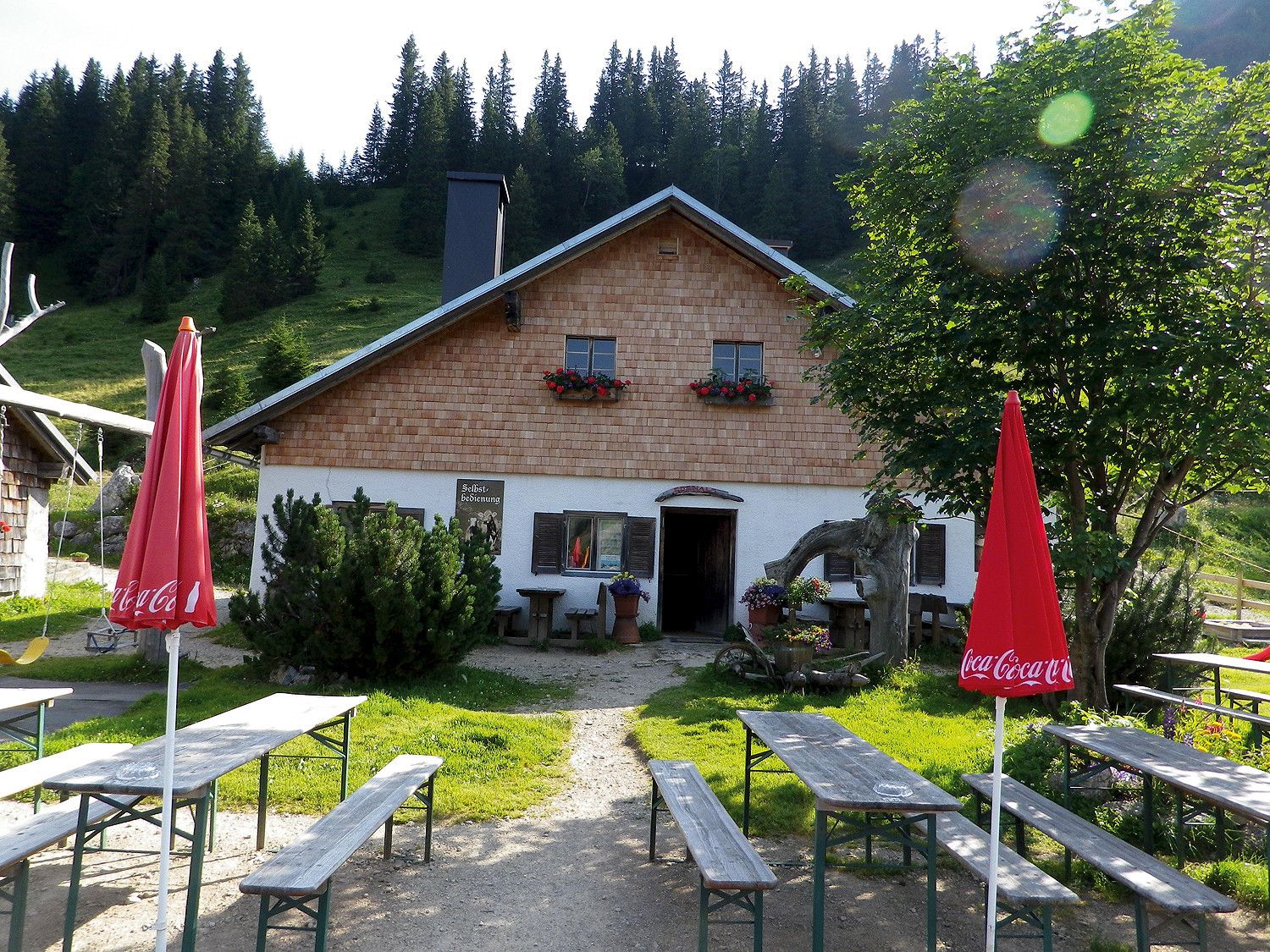
On the way there are three different huts - the Krinnenalpe, the Nesselwängler Edenalpe and the Gräner Ödenalpe, which invite you not only to stop in but also to stay overnight.
- Directions
-
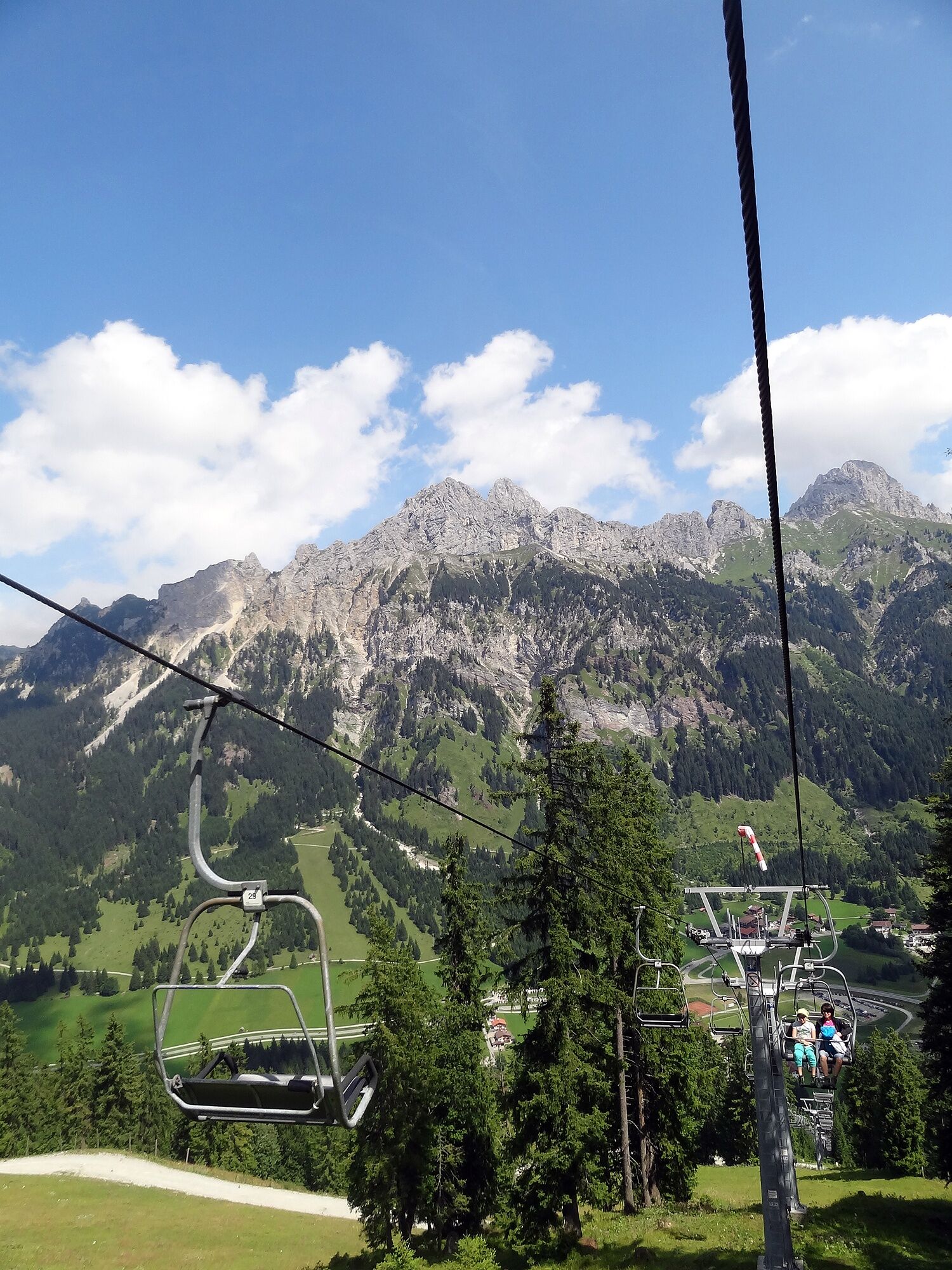
From the starting point you can either take the 2-seater chairlift or walk up the forest path to the Krinnenalpe. If you choose the ascent with the chairlift, you shorten the ascent by about 1 hour. From there you follow the Alpenrosenweg to the Nesselwängler Edenalpe and then on to the third hut, the Gräner Ödenalpe. The descent towards Haldensee runs through Strindenbachtal first on your mountain hiking trail and finally turns into a forest path, which leads along the southern shore of Haldensee back to Nesselwängle to the lift car park.
- Highest point
- 1,721 m
- Endpoint
-
Nesselwängle parking
- Height profile
-

- Equipment
-
The personal mountaineering equipment must be safe and serviceable and meet the relevant technical standards. Every hiker is recommended to obtain information about the planned tours from specialist alpine literature or on site.
- Safety instructions
-
General valid and customary rules of conduct
It should be noted that in mountaineering there is an increased risk of accidents and injuries. Despite careful route planning, a basic risk always remains. Tour preparation through endurance sports, appropriate technical training and further education as well as personal prudence reduces the danger of accidents and risks. However, please never forget that the weather in the mountains can change very quickly. Stay on the marked hiking trails.
- Tips
-
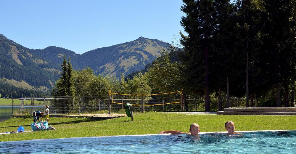
After the descent enjoy a cool refreshment in the Haldensee or in the outdoor pool, surrounded by a unique mountain scenery.
- Directions
-
On the motorway A7 at the exit "Oy-Mittelberg" on the B310 towards Wertach and to Oberjoch. There follow the signposting "Tannheimer Tal" B199, exit Nesselwängle.From the Tyrolean side via Reutte on the B198 towards Lechtal until Weißenbach, over the Gaichtpass along the B199 until exit Nesselwängle.
- Public transportation
-
By train to Sonthofen, Pfronten/Ried or Reutte, then by bus to Nesselwängle.
- Parking
-
Lift parking lot in Nesselwängle - parking fee


- Author
-
The tour Nesselwängler Edenalpe - Gräner Ödenalpe - Haldensee is used by outdooractive.com provided.


General info
-
Allgäu
2367
-
Tannheimer Tal
1458
-
Nesselwängle
594