


- Brief description
-
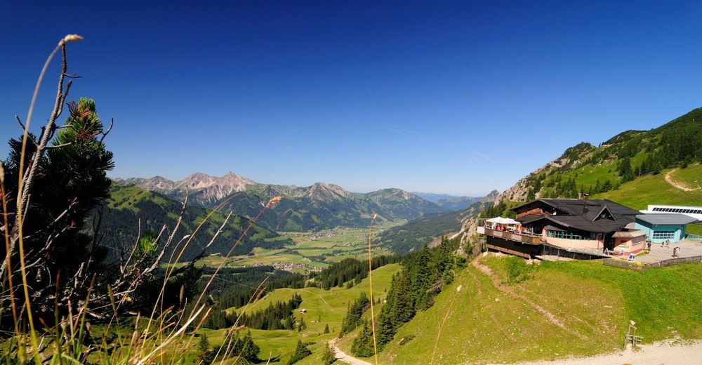
Round tour with great views and impressive views of the surrounding Tannheim mountain group - Rot Flüh, Gimpel and Köllenspitze.
- Difficulty
-
medium
- Rating
-
- Starting point
-
Lift parking summer moutain railways, Grän
- Route
-
Sonnenalm2.7 kmFüssener Jöchle2.7 kmReintaljoch3.1 kmFüssener Hütte4.7 kmOtto-Mayr-Hütte4.9 kmFüssener Jöchle Talstation11.1 km
- Best season
-
JanFebMarAprMayJunJulAugSepOctNovDec
- Description
-
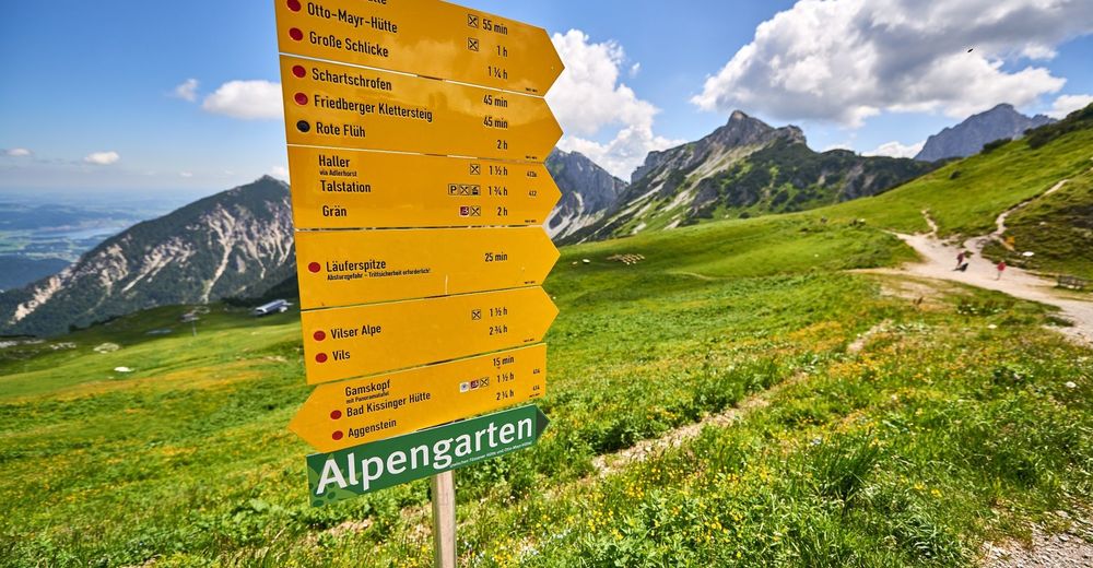
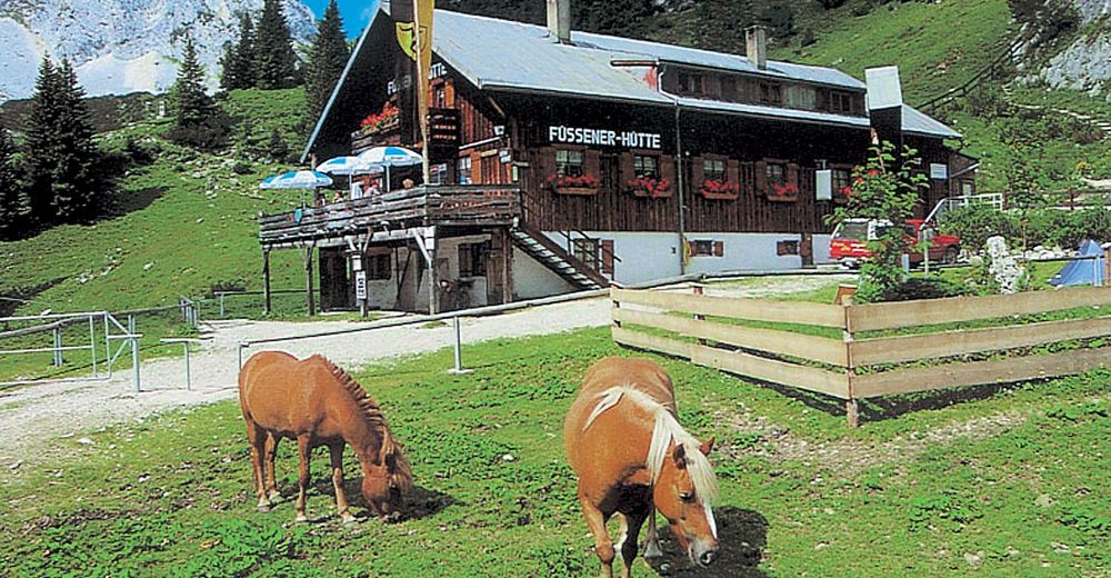
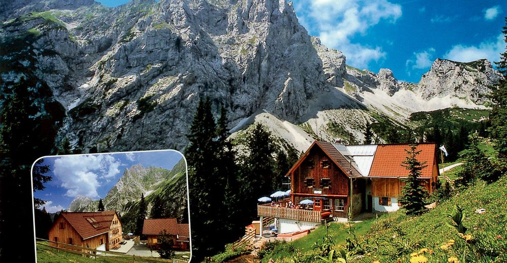
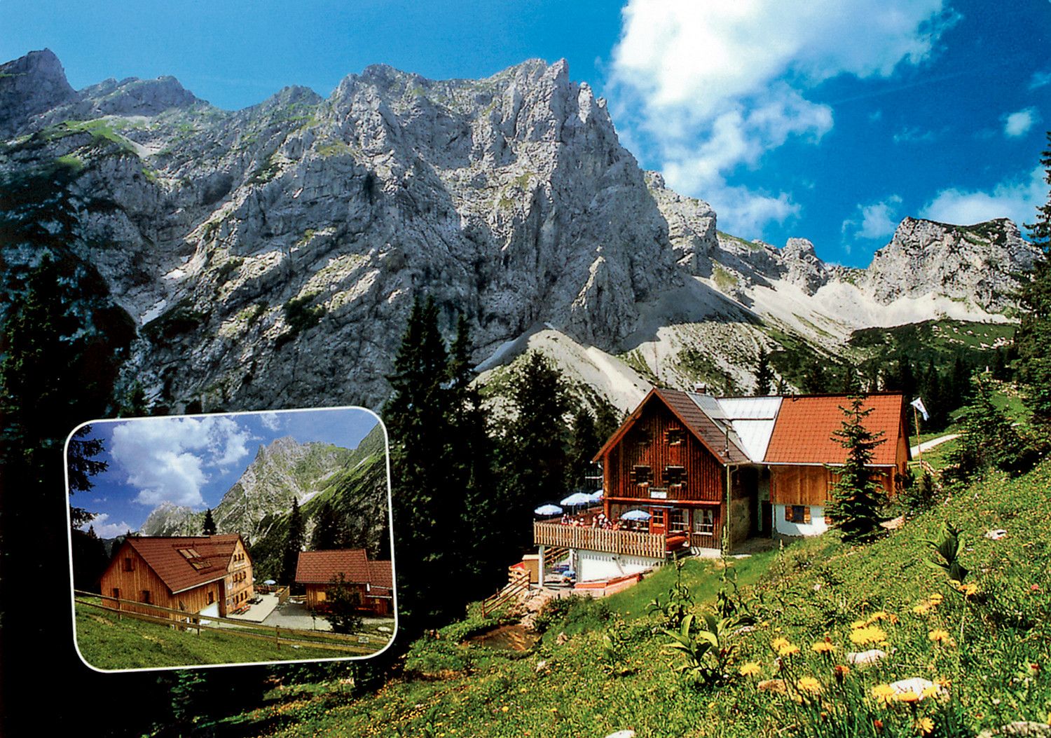
The hike to the Füssener Hut or Otto Mayr Hut with descent via the Gessenwangalm (not managed) follows easy mountain paths.
- Directions
-
Starting from Grän, take the 8-seater gondola lift to the Füssener Jöchle. The starting point of the hike is the mountain station/Sonnenalm, from where the hike continues to the Raintaler Joch. The descent is through slopes to the Füssener Hut and/or Otto Mayr Hut. Here you will find a rich animal world and alpine flora, ideal places to relax. From the Otto Mayr Hut, you return a short distance on the same route, then on the way west, the ascent to the Hallergehrenjoch begins, from here the descent passes the Gessenwangalm (not managed). The last stretch is on the forest path back to Grän to the valley station/lift car park of the 8-seater gondola lift.
- Highest point
- 1,845 m
- Endpoint
-
Lift parking summer moutain railways, Grän
- Height profile
-

- Equipment
-
The personal mountaineering equipment must be safe and serviceable and meet the relevant technical standards. Every hiker is recommended to obtain information about the planned tours from specialist alpine literature or on site.
- Safety instructions
-
It should be noted that in mountaineering there is an increased risk of accidents and injuries. Despite careful route planning, a basic risk always remains. Tour preparation through endurance sports, appropriate technical training and further education as well as personal prudence reduces the danger of accidents and risks. However, please never forget that the weather in the mountains can change very quickly. Stay on the marked hiking trails.
- Tips
-
Refreshments and overnight stays are available both at the Füssener and the Otto Mayr Hut. From both huts you will find an extensive network of paths, with hiking, climbing and summit routes.
- Directions
-
on the motorway A7 at the exit "Oy-Mittelberg" on the B310 towards Wertach and to Oberjoch. There follow the signposting "Tannheimer Tal" B199 until you reach Grän. From the Tyrolean side via Reutte on the B198 towards Lechtal until Weißenbach, over the Gaichtpass along the B199 until Grän.
- Public transportation
-
By train to Sonthofen, Pfronten/Ried or Reutte, then by bus to Grän.
- Parking
-
Grän, lift parking summer mountain railway


- Author
-
The tour Füssener Hütte - Otto Mayr Hütte is used by outdooractive.com provided.


General info
-
Allgäu
2367
-
Tannheimer Tal
1458
-
Nesselwängle
594


