- Brief description
-
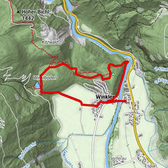
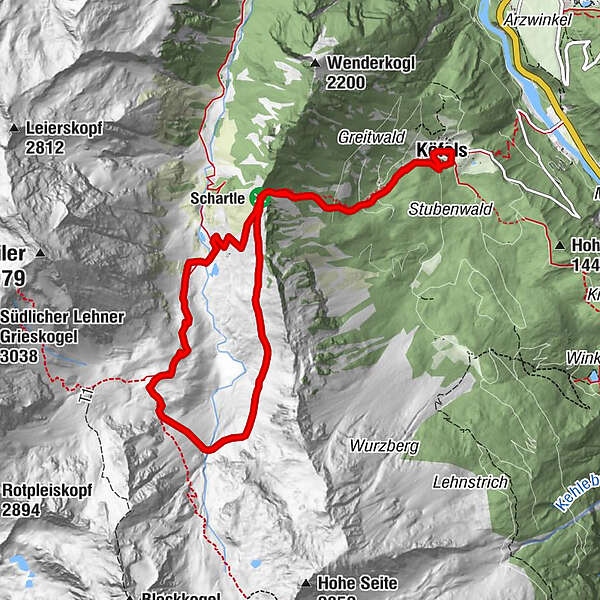
Köfels -> Köfler Scharte -> Waalweg -> Frischmann Hütte -> hintere Fundusalm -> Köfels
- Difficulty
-
medium
- Rating
-
- Starting point
-
car park Köfels
- Route
-
Expositurkirche Köfels Hl. Maria0.1 kmKöfels0.2 kmFrischmannhütte6.0 kmHintere Fundusalm7.9 kmExpositurkirche Köfels Hl. Maria10.8 kmKöfels10.8 km
- Best season
-
JanFebMarAprMayJunJulAugSepOctNovDec
- Description
-
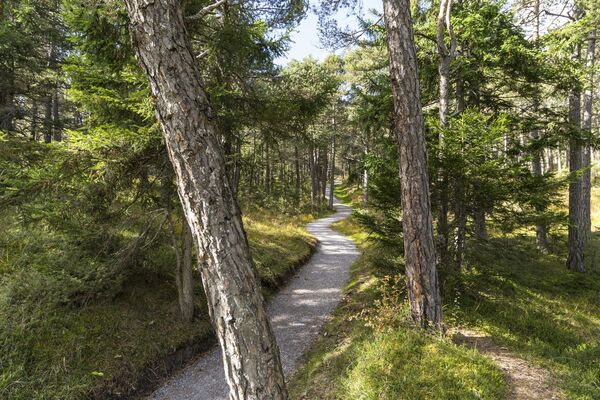
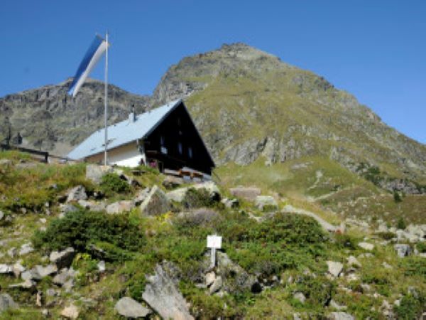
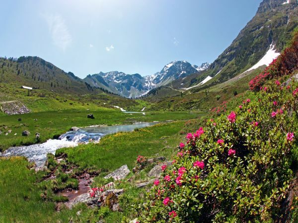
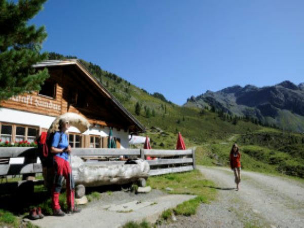
Start in the parking area of Köfels, proceed on the ascending hiking trail to "Köfler Schartle". On top you enjoy marvelous panoramic views of Fundustal valley and Ötztal. Continue along Waalweg (Europe's highest Waalweg Trail) towards Frischmannhütte. After a nice rest stop you walk back to the starting point past quaint Fundusalm.
- Directions
-
Start in the parking area of Köfels, proceed on the ascending hiking trail to "Köfler Schartle". On top you enjoy marvelous panoramic views of Fundustal valley and Ötztal. Continue along Waalweg (Europe's highest Waalweg Trail) towards Frischmannhütte. After a nice rest stop you walk back to the starting point past quaint Fundusalm.
- Highest point
- 2,205 m
- Endpoint
-
car park Köfels
- Height profile
-

- Equipment
-
Appropriate equipment such as breathable suitable outdoor clothes for the weather, ankle-high walking boots, wind-, rain- & sun protection, hat, possibly gloves, is for all hikes and tours necessary. Please bring a first-aid box, a mobile phone, a walking map and if there is no hut on the way a snack and enough to drink.
- Safety instructions
-
Moderate mountain trail; for sure-footed and experienced hikers. Good physical condition, mountain experience & mountain equipment (see notice equipment) necessary.
Please pay attention to the current
- Additional information
- Directions
-
The car drive to the Ötztal valley. Situated in Tirol, the Ötztal valley set off in southerly direction and is the longest side valley in the Eastern Alps. The journey with the car leads you through the Inntal valley to the entrance of the valley and further on through the valley. Among the toll motorways you can also use the country roads.
A route planner will show you the easiest and most convenient way: https://www.google.at/maps
- Public transportation
-
Travel safe and comfortable with the train to the Ötztal Bahnhof train station. Last stop and exit point is the train station Ötztal Bahnhof. Afterwards you can travel smoothly and quick with the public transport or our local taxi companies through the valley to your desired destination. Please find the current bus timetable here: fahrplan.vvt.at
- Parking
-
The following parking facilities are available in Umhausen:
- car park Köfels (payable)
- Author
-
The tour Köfler Waalweg - Frischmann Hütte is used by outdooractive.com provided.
GPS Downloads


General info
Refreshment stop
Cultural/Historical
Flora
A lot of view
Other tours in the regions
-
Pitztal
1068
-
Umhausen im Ötztal
401