© TVB Kufsteinerland - Sportalpen Marketing

- Brief description
-
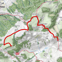
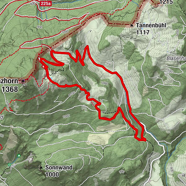
Hike the Erler legends at 2 stations.
- Difficulty
-
easy
- Rating
-
- Starting point
-
Parking Kranzhorn
- Route
-
Hintermoar-Alm0.3 kmKranzhorn Alm3.3 km
- Best season
-
JanFebMarAprMayJunJulAugSepOctNovDec
- Description
-
From the hiking parking Kranzhorn we hike along the forest path to the Kranzhorn Alm. A detour to the Kranzhorn summit is very recommendable, it offers a wonderful view over the Bavarian-Tyrolean border area. From the Alm down we march over the Bubenaualm again to the parking lot.
- Highest point
- 1,222 m
- Endpoint
-
Parking Kranzhorn
- Height profile
-

- Equipment
-
Outdoor clothing appropriate to the weather (good footwear, rain protection, breathable clothing...)
Snacks (e.g. fruit, muesli bars, wholemeal breads) and drinks (allow for sufficient liquid)
First aid equipment
Mobile phone with full battery
Hiking map and guide literature
Sun protection (sunscreen and glasses, cap)
Bivouac bag - Directions
-
Arrival is possible by car to the Kranzhorn hiking car park.
- Parking
-
Hiking car park Kranzhorn.

- Author
-
The tour Legend trail - Kranzhorn Erl is used by outdooractive.com provided.
GPS Downloads


Other tours in the regions
-
Kufsteinerland
2116
-
Erl
662