© TVB Kufsteinerland - Sven Roscher

© TVB Kufsteinerland - Sven Roscher

© TVB Kufsteinerland - SvenFotografiert

- Brief description
-
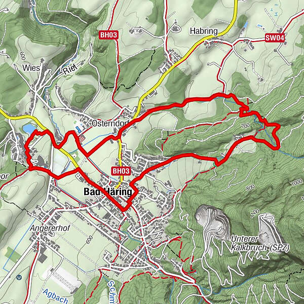
Five stations invite you to walk through the Bad Häringer legends.
- Difficulty
-
easy
- Rating
-
- Starting point
-
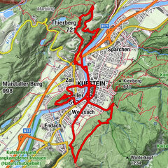
Village centre Bad Häring
- Route
-
Bad HäringHäringer Wasserfall2.7 kmLourdeskapelle3.9 kmOsterndorf4.0 kmAntoniuskapelle4.3 kmPölvenblick4.5 kmHildegardkapelle5.2 kmBad Häring6.3 km
- Best season
-
JanFebMarAprMayJunJulAugSepOctNovDec
- Description
-
From the centre of the idyllically situated village of Bad Häring we hike slightly uphill to the thunderous waterfall with its natural Kneipp basin, then along the Rück Dich Gesund path towards the village and on to a small chapel. Once there, we walk along the spa gardens, which lure you with a raised bed to Hildegard von Bingen, to Lindenbühel and back to the starting point in the village centre.
- Highest point
- 750 m
- Endpoint
-
Village centre Bad Häring
- Height profile
-

- Equipment
-
Outdoor clothing appropriate to the weather (good footwear, rain protection, breathable clothing...)
Snacks (e.g. fruit, muesli bars, wholemeal breads) and drinks (allow for sufficient liquid)
Mobile phone with full battery
Hiking map and guide literature
Sun protection (sunscreen and glasses, cap) - Directions
-
Via the Inntal motorway A12 exit Kirchbichl and continue to Bad Häring.
- Public transportation
-
Take line 4026 in the direction of Wörgl and get off at "Bad Häring Dorf".
- Parking
-
Community office or at the primary schools


- Author
-
The tour Legend trail - Bad Häring tour is used by outdooractive.com provided.
GPS Downloads


Other tours in the regions
-
Region Hohe Salve
1812
-
Bad Häring
521