- Brief description
-
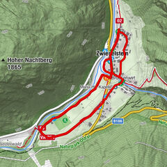
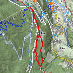
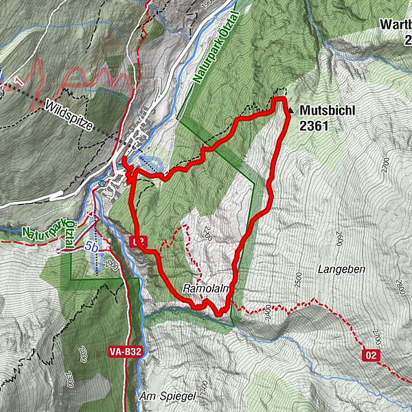
Vent - Mutsbühel - Ramolalm - Vent
- Difficulty
-
medium
- Rating
-
- Starting point
-
Vent
- Route
-
Gasthaus Pension Obervent0.1 kmGampenlift0.3 kmMutsbichl (2,361 m)1.7 kmGasthaus Pension Obervent4.6 kmVent4.8 km
- Best season
-
JanFebMarAprMayJunJulAugSepOctNovDec
- Description
-
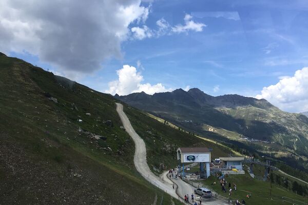
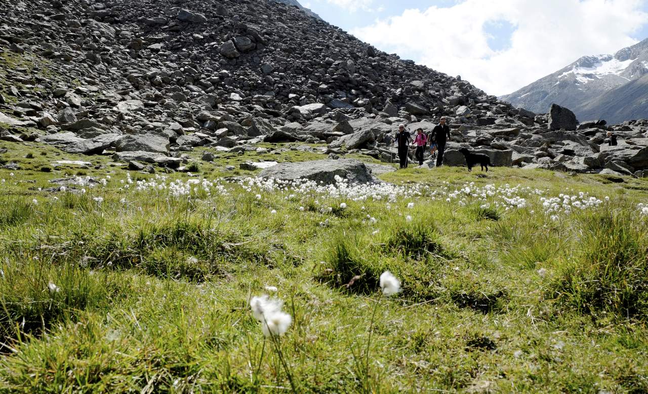
The wonderful hike starts at the base station of Wildspitze double chairlift in Vent. First you hike past the Mountaineering Chapel and, keeping to the left, you cross the bridge over the Venter Ache mountain brook. Continue walking on the signposted trail towards Mutsbühel area. Right at the beginning there are a few altitude meters to conquer but the truly varied route makes you forget all the effort.
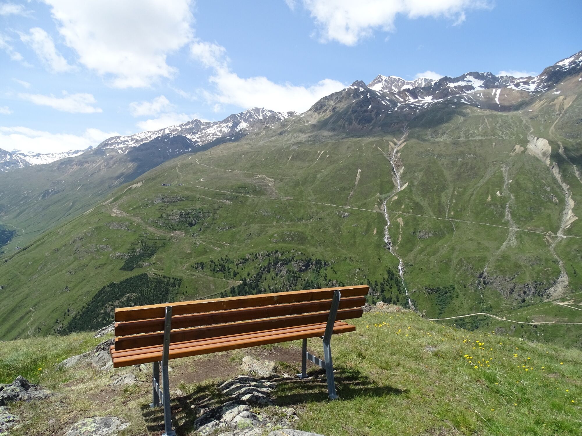
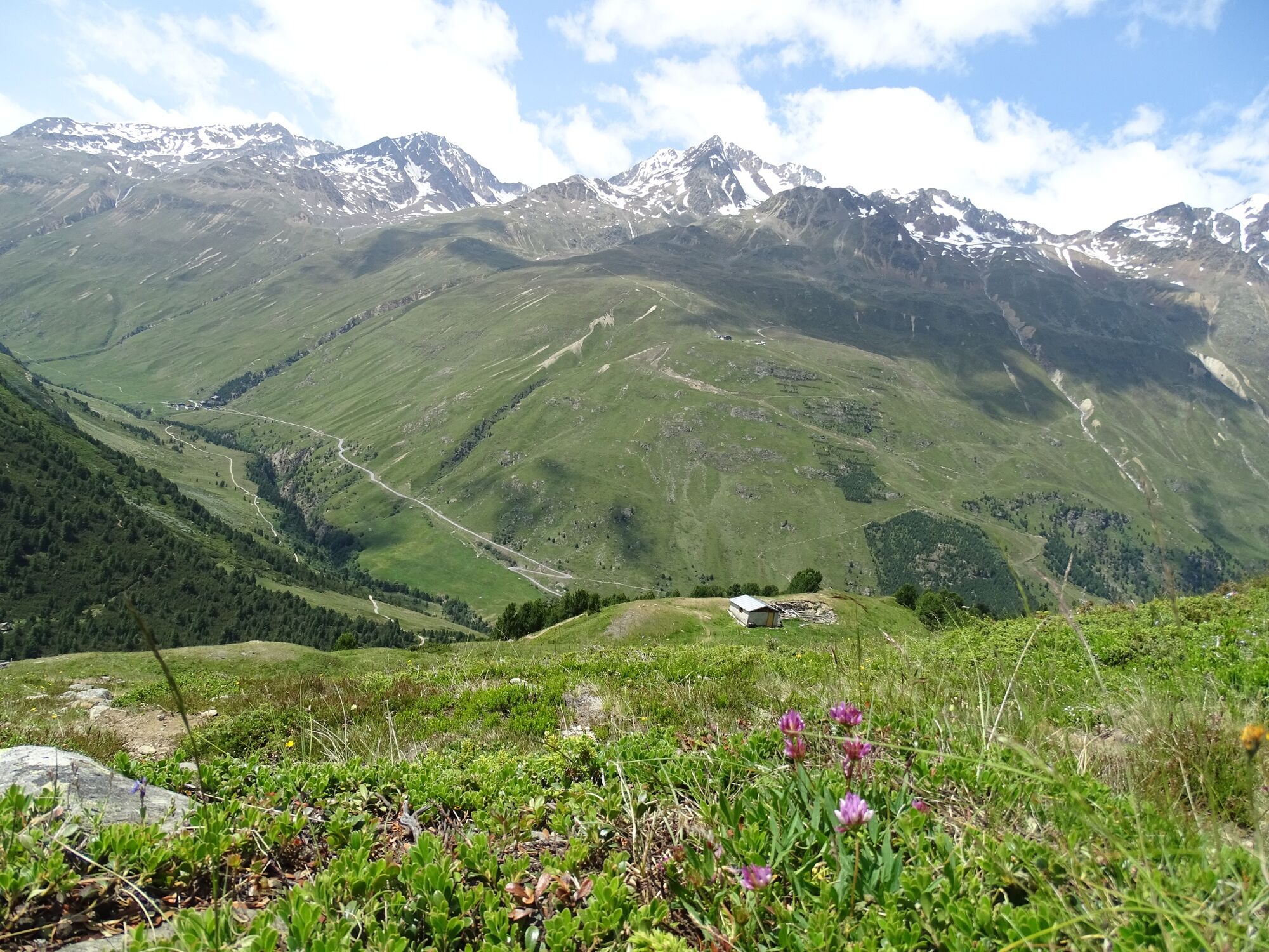
Slowly you leave the wooded area and walk uphill through lush green meadows. Once at the top, you will be rewarded with awe-inspiringpanoramic views.
From Mutsbühel you hike almost at the same height in the direction of Ramol-alm (not serviced), enjoying equally fantastic views. Walk straight across lush Alpine pastures and descend on a hiking path that branches off to the left. Hiking downhill through a wooded area, you soon reach the Zentralalpenweg trail which takes you back to Vent. - Directions
-
The wonderful hike starts at the base station of Wildspitze double chairlift in Vent. First you hike past the Mountaineering Chapel and, keeping to the left, you cross the bridge over the Venter Ache mountain brook. Continue walking on the signposted trail towards Mutsbühel area. Right at the beginning there are a few altitude meters to conquer but the truly varied route makes you forget all the effort.
Slowly you leave the wooded area and walk uphill through lush green meadows. Once at the top, you will be rewarded with awe-inspiringpanoramic views.From Mutsbühel you hike almost at the same height in the direction of Ramol-alm (not serviced), enjoying equally fantastic views. Walk straight across lush Alpine pastures and descend on a hiking path that branches off to the left. Hiking downhill through a wooded area, you soon reach the Zentralalpenweg trail which takes you back to Vent.
- Highest point
- 2,369 m
- Endpoint
-
Vent
- Height profile
-

- Equipment
-
It is recommended to wear hiking equipment such as breathable and weather-adapted outdoor clothing, ankle-high mountain boots, wind, rain and sun protection, cap and possibly gloves. It is also important to have enough food, as well as a first-aid package, a cell phone and a hiking map.
- Safety instructions
-
Surefootedness.
No particular difficulties
- Additional information
-
Rofner Ache Up to one third of Rofner Ache is made up of suspended sediments, sand, debris and gravel. The material carried by the natural flow of the river from the sediment areas in Gurgland Vent amounts up to about 260,000 cubic meters or 700,000 tons per year.
WATER IN THE ÖTZTAL VALLEY
Water, the element which has shaped the Ötztal valley.
The glaciers are melted by the sunshine, releasing fresh water which feeds into the meadows and the Ötztaler Ache river which winds its way along the 65 km long valley. The Ötztaler Ache catchment area extends over 893 km² with an elevation from 700 to 3,774 m. This glacial meltwater fills the reservoir used by the local population and provides a supply of drinking water.
Glaciers store ¾ of the world’s freshwater reserves and therefore represent the biggest natural waterstorage in the world.
In the year 1770, the advancing ice dammed many of the big lakes here which triggered catastrophic flooding across the entire Ötztal and Inntal regions when they burst their banks. Natural hazards and disaster made people want to know more about and better understand nature, which also facilitated glacier research. The many facets of water in the Ötztal is not just of interest for scientists. The Ötztal glaciers are recreational destinations for locals and guests alike as these ice worlds offer great hiking and skiing in surroundings of outstanding natural beauty. Crystal clear river waters swollen by icy glacier meltwater make for superb rafting, white water canoeing and other action-packed activitiesMore details about hiking In Ötztal: https://www.oetztal.com/wandern
- Directions
- Public transportation
- Parking
-
The following parking facilities are available in Vent:
In front of the village and at the valley station from the chair lift (payable € 6,00)

- Author
-
The tour Water Walk Mutsbühel Vent is used by outdooractive.com provided.


General info
-
Vinschgau
1290
-
Schnalstal
595
-
Vent
293