


- Brief description
-
UMHAUSEN CAR PARK BISCHOFFSPLATZ -> Waalweg Arzwinkel -> Stuibenfall -> Umhauser Höhenweg -> Steppsteig -> UMHAUSEN CAR PARK BISCHOFFSPLATZ
- Difficulty
-
easy
- Rating
-
- Starting point
-
Umhausen car park Bischoffsplatz
- Route
-
Waldcafe Stuböbele1.0 kmStuibenfall Platform 11.5 kmStuibenfall Platform 32.1 kmStuibenfall2.1 kmMühlkapelle2.6 kmGasthof Stuibenfall2.7 kmHöfle2.9 kmBichl3.4 km
- Best season
-
JanFebMarAprMayJunJulAugSepOctNovDec
- Description
-
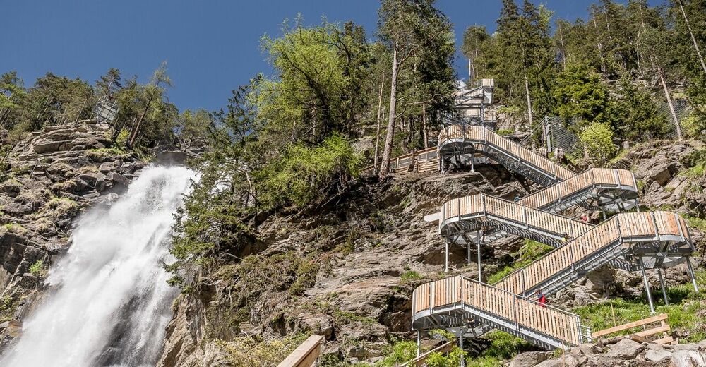
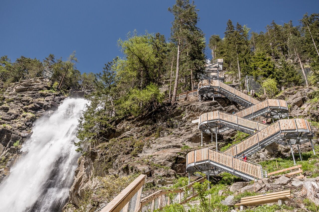
Start of the hike is the car park "Bischoffsplatz" in Umhausen. From there you follow the forest trail behind the Restaurant Kneipphäusl up until you reach the turnoff "Waalweg Arzwinkel". The leisurely pathwinds its way along the so-called „Waale“ (irrigation ditches) until you reach a gravel road. Keep to the right and follow the bubbling waters of Horlachbachup to the foot of the mighty waterfall, the Stuiben Falls. Always with a view of the fascinating nature spectacle, you walk to the right of the falling water masses, conquering some 700 steps on your way up to the origin of the Stuiben Falls. You also hike past a number of fabulous vantage platforms and the 80 meterlong suspension bridge.
A picturesque mountain meadow leads to Gasthof Stuibenfall. From there the hike continues up to the hamlet of Höfle and then down to the valley floor on Umhausen‘s high altitude trail. Down in the valley, you reach a huge intersection where you walk on the pleasant Steppsteig path towards popular Stuiben-Nannele. Then cross the gravel road and head towards a forest path that leads you back to the starting point car park Bischoffsplatz, past the Ötzi Village and Umhausen‘s swimming lake.
The Kneipp facilities at Bischoffsplatz make a perfect refreshment stop.
- Directions
-
Start of the hike is the car park "Bischoffsplatz" in Umhausen. From there you follow the forest trail behind the Restaurant Kneipphäusl up until you reach the turnoff "Waalweg Arzwinkel". The leisurely pathwinds its way along the so-called „Waale“ (irrigation ditches) until you reach a gravel road. Keep to the right and follow the bubbling waters of Horlachbachup to the foot of the mighty waterfall, the Stuiben Falls. Always with a view of the fascinating nature spectacle, you walk to the right of the falling water masses, conquering some 700 steps on your way up to the origin of the Stuiben Falls. You also hike past a number of fabulous vantage platforms and the 80 meterlong suspension bridge.
A picturesque mountain meadow leads to Gasthof Stuibenfall. From there the hike continues up to the hamlet of Höfle and then down to the valley floor on Umhausen‘s high altitude trail. Down in the valley, you reach a huge intersection where you walk on the pleasant Steppsteig path towards popular Stuiben-Nannele. Then cross the gravel road and head towards a forest path that leads you back to the starting point car park Bischoffsplatz, past the Ötzi Village and Umhausen‘s swimming lake.
The Kneipp facilities at Bischoffsplatz make a perfect refreshment stop.
- Highest point
- 1,542 m
- Endpoint
-
Umhausen car park Bischoffsplatz
- Height profile
-

- Equipment
-
Appropriate equipment such as breathable suitable outdoor clothes for the weather, is for all hikes and tours necessary.
- Safety instructions
- Additional information
-
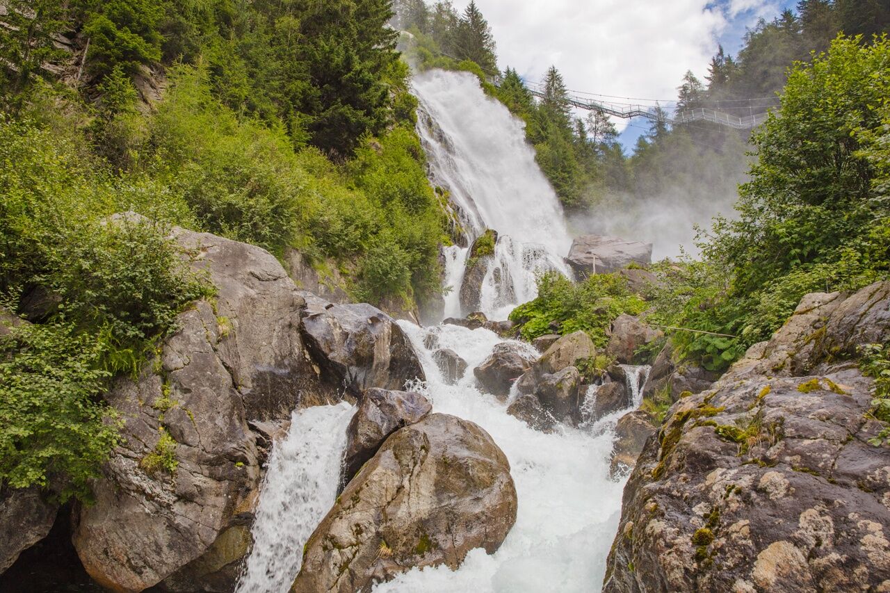
Stuibenfall A scientific study on the health benefits of Stuibenfall showed an 58% improvement in lung function in athletes with asthma. Spending one hour in the spray zone of the waterfall for a period of two to three weeks improved lung function more than cortisone spray.
WATER IN THE ÖTZTAL VALLEY
Water, the element which has shaped the Ötztal valley.
The glaciers are melted by the sunshine, releasing fresh water which feeds into the meadows and the Ötztaler Ache river which winds its way along the 65 km long valley. The Ötztaler Ache catchment area extends over 893 km² with an elevation from 700 to 3,774 m. This glacial meltwater fills the reservoir used by the local population and provides a supply of drinking water.
Glaciers store ¾ of the world’s freshwater reserves and therefore represent the biggest natural waterstorage in the world.
In the year 1770, the advancing ice dammed many of the big lakes here which triggered catastrophic flooding across the entire Ötztal and Inntal regions when they burst their banks. Natural hazards and disaster made people want to know more about and better understand nature, which also facilitated glacier research. The many facets of water in the Ötztal is not just of interest for scientists. The Ötztal glaciers are recreational destinations for locals and guests alike as these ice worlds offer great hiking and skiing in surroundings of outstanding natural beauty. Crystal clear river waters swollen by icy glacier meltwater make for superb rafting, white water canoeing and other action-packed activities. - Directions
-
The car drive to the Ötztal valley. Situated in Tirol, the Ötztal valley set off in southerly direction and is the longest side valley in the Eastern Alps. The journey with the car leads you through the Inntal valley to the entrance of the valley and further on through the valley. Among the toll motorways you can also use the country roads. A route planner will show you the easiest and convenient way: https://www.google.at/maps
- Public transportation
-
Travel safe and comfortable with the train to the Ötztal Bahnhof train station. Last stop and exit point is the train station Ötztal Bahnhof. Afterwards you can travel smootly and quick with the public transport or our local taxi companies the valley to your desired destiantion. Please find the current bus timetable here: http://fahrplan.vvt.at
- Parking
-
The following parking facilities are available in Umhausen:
- car park Mure | free of charge
-
car park Bischoffplatz | one day ticket for cars € 5,00, fee required from 7:00 am till 6:30 pm | the car park for people with handicap is free, please deposit your handicap ID apparent in your car | Buses park for free


- Author
-
The tour Loop trail Stuibenfall Umhausen is used by outdooractive.com provided.


General info
-
Pitztal
1066
-
Umhausen im Ötztal
401


