- Brief description
-
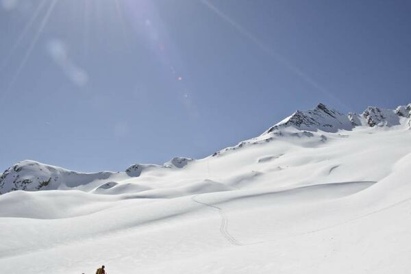
A massive ski mountain with a great steep descent.
- Difficulty
-
difficult
- Rating
-
- Route
-
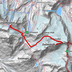
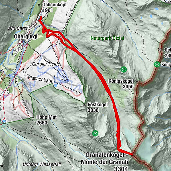
Ferwalltal3.8 kmGranatenkogel (3,304 m)6.2 kmFerwalltal8.9 km
- Best season
-
AugSepOctNovDecJanFebMarAprMayJunJul
- Description
-
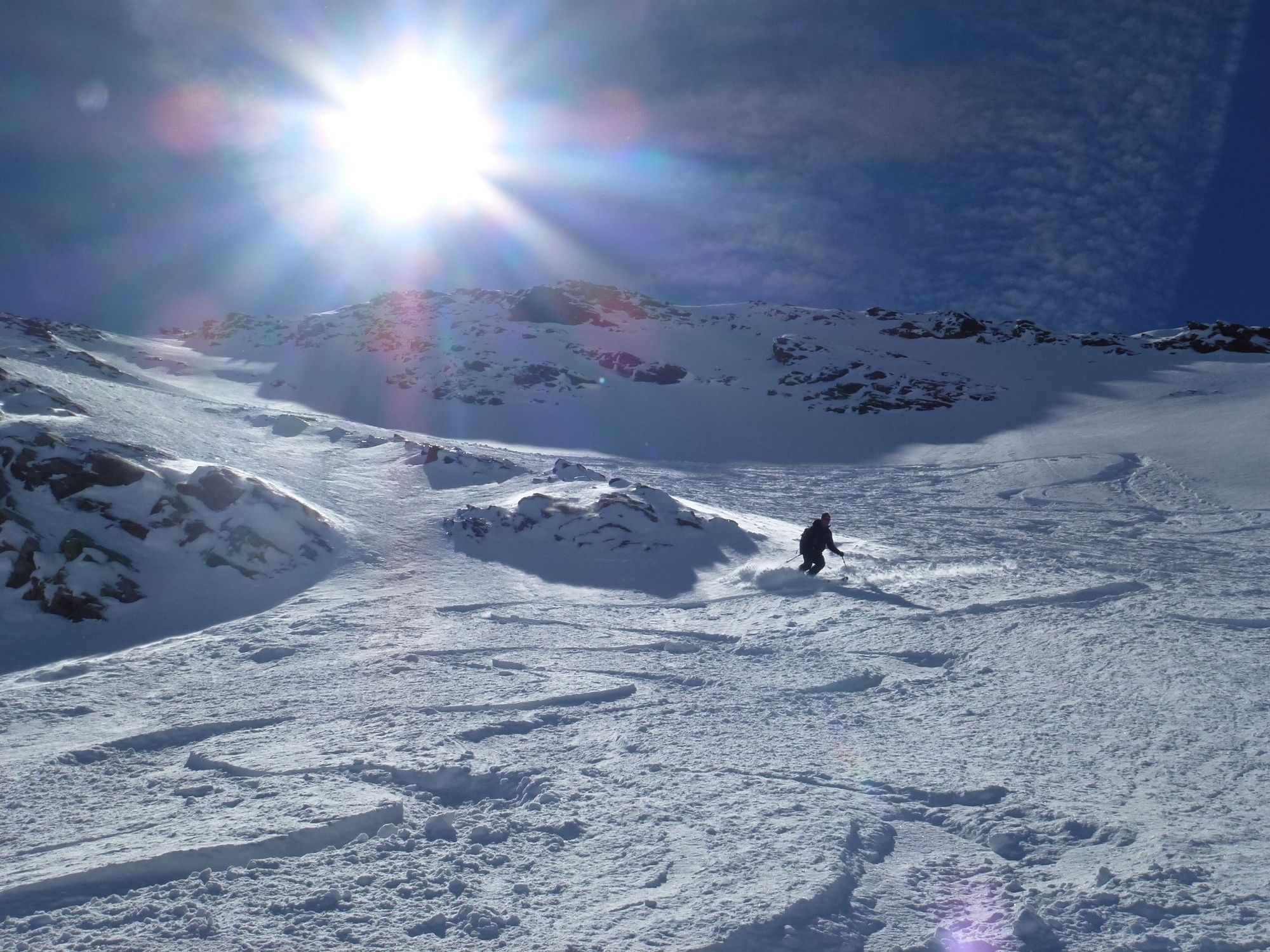
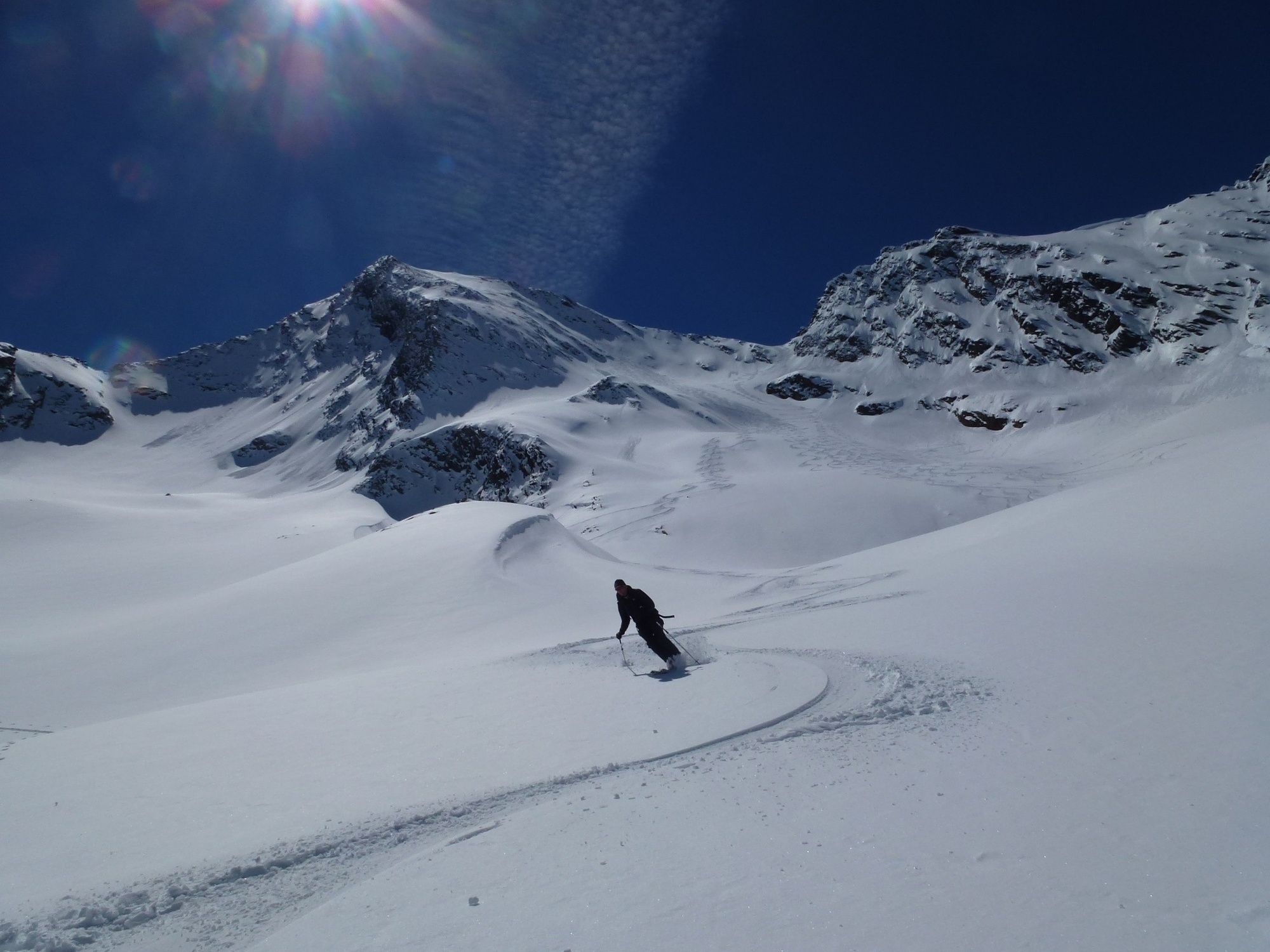
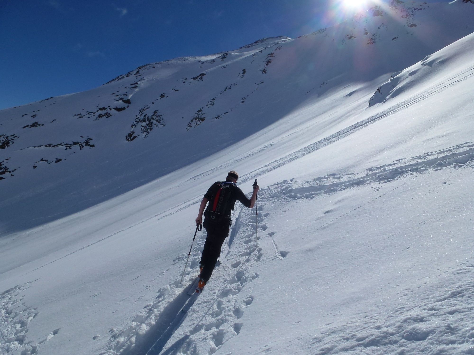
The Granatenkogel 3304m is one of the most challenging ski tours in the ski region Obergurgl. The inclination is up to 40 °. The descent over the Ferwallferner and subsequently through the Ferwalltal remains a never-ending moment of swing.
- Directions
-
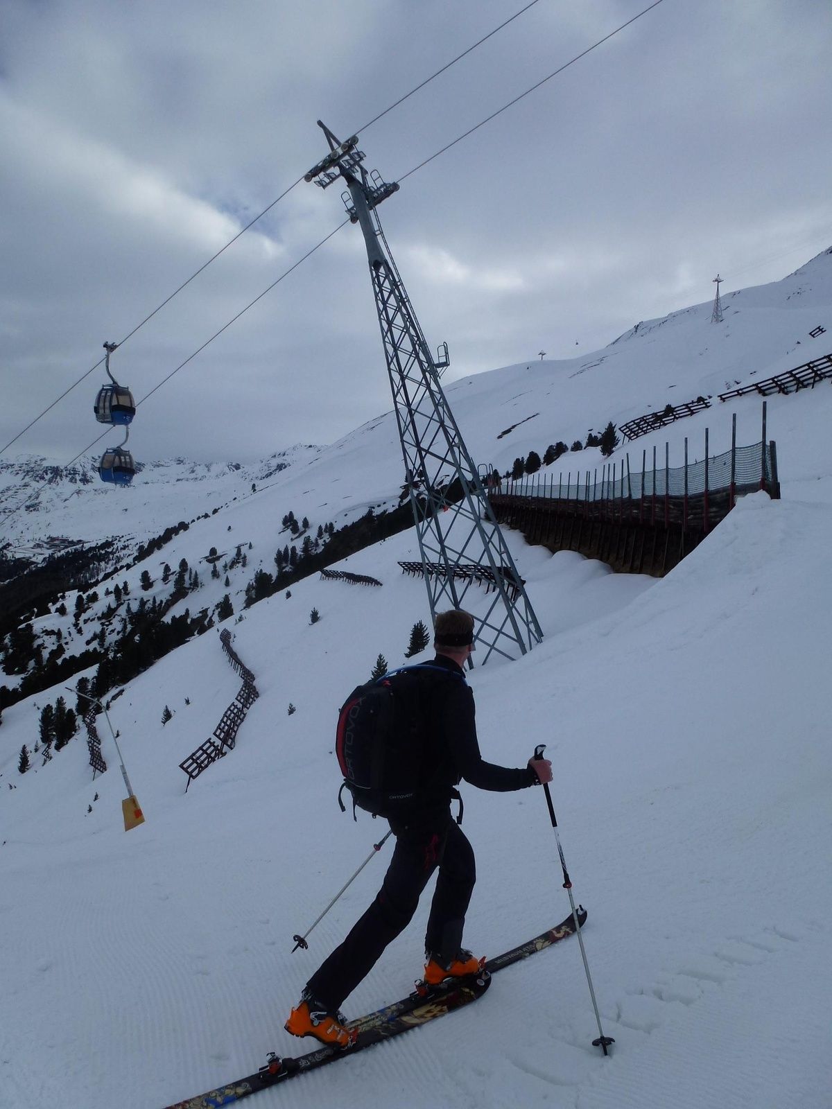
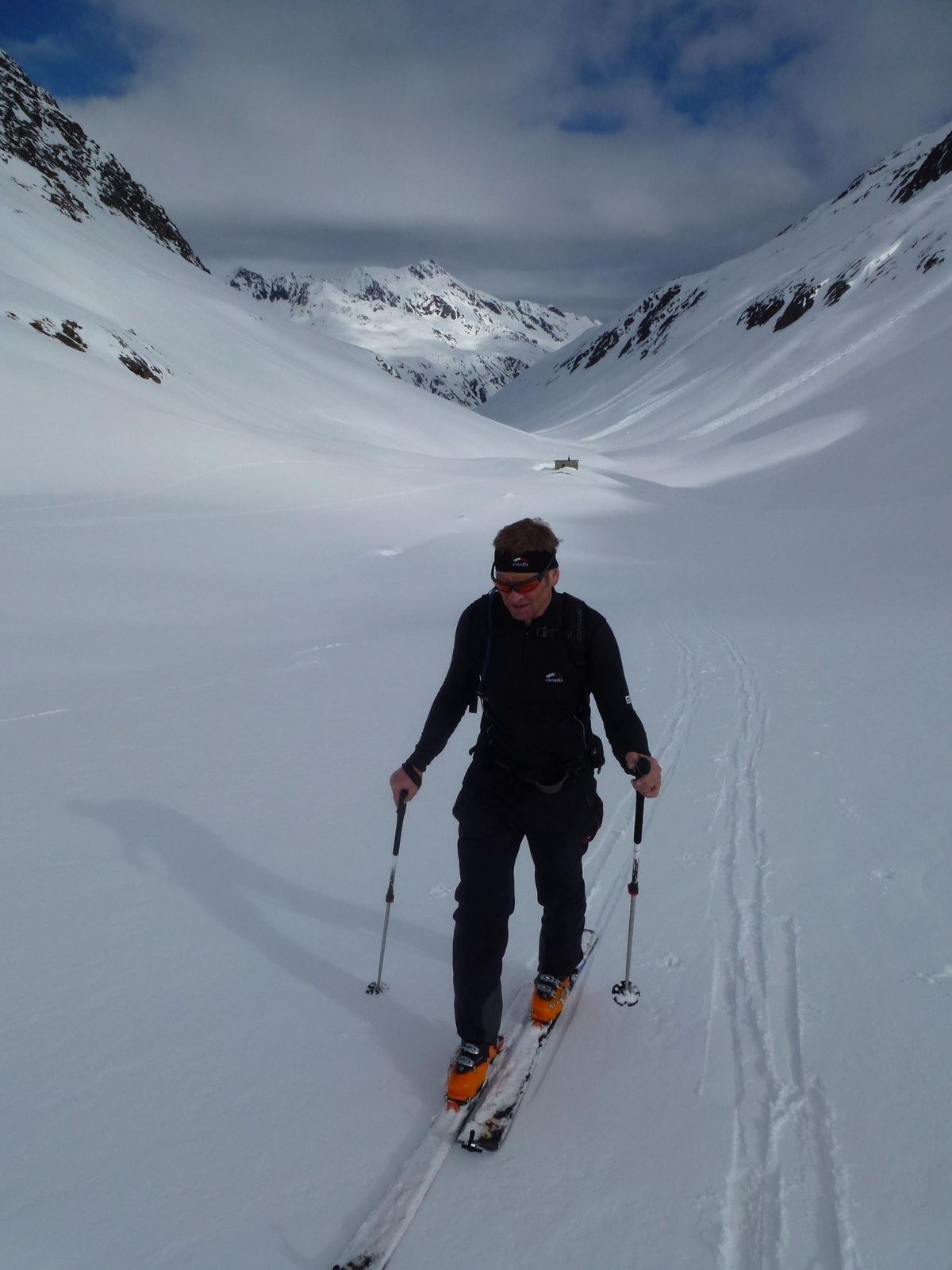
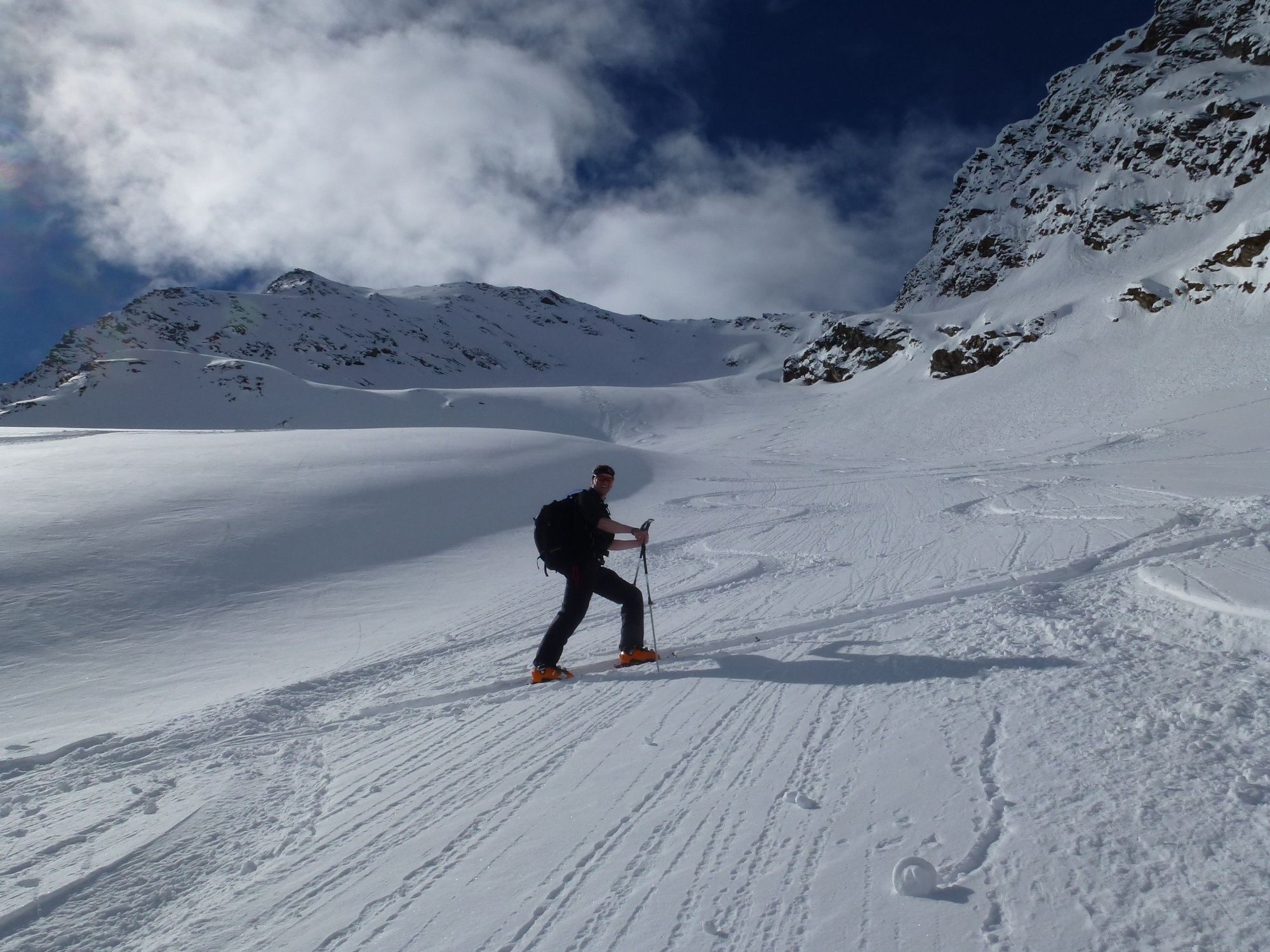
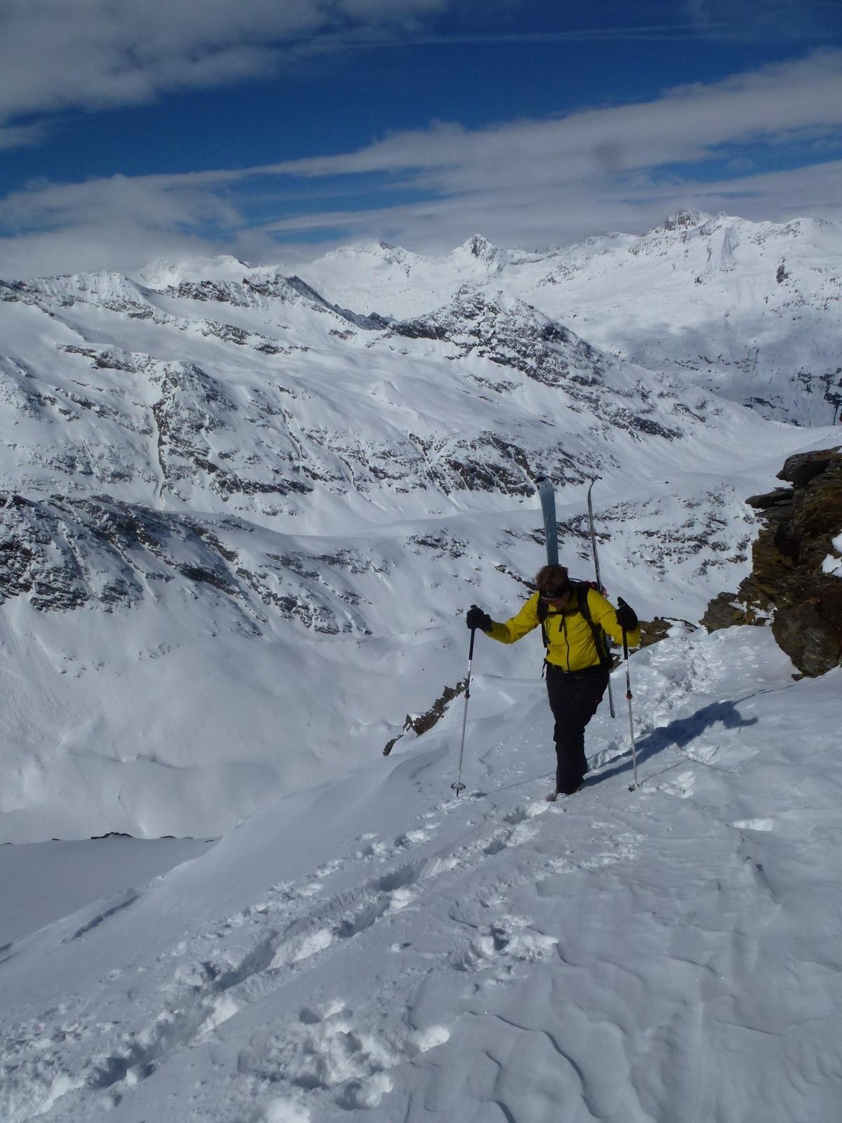
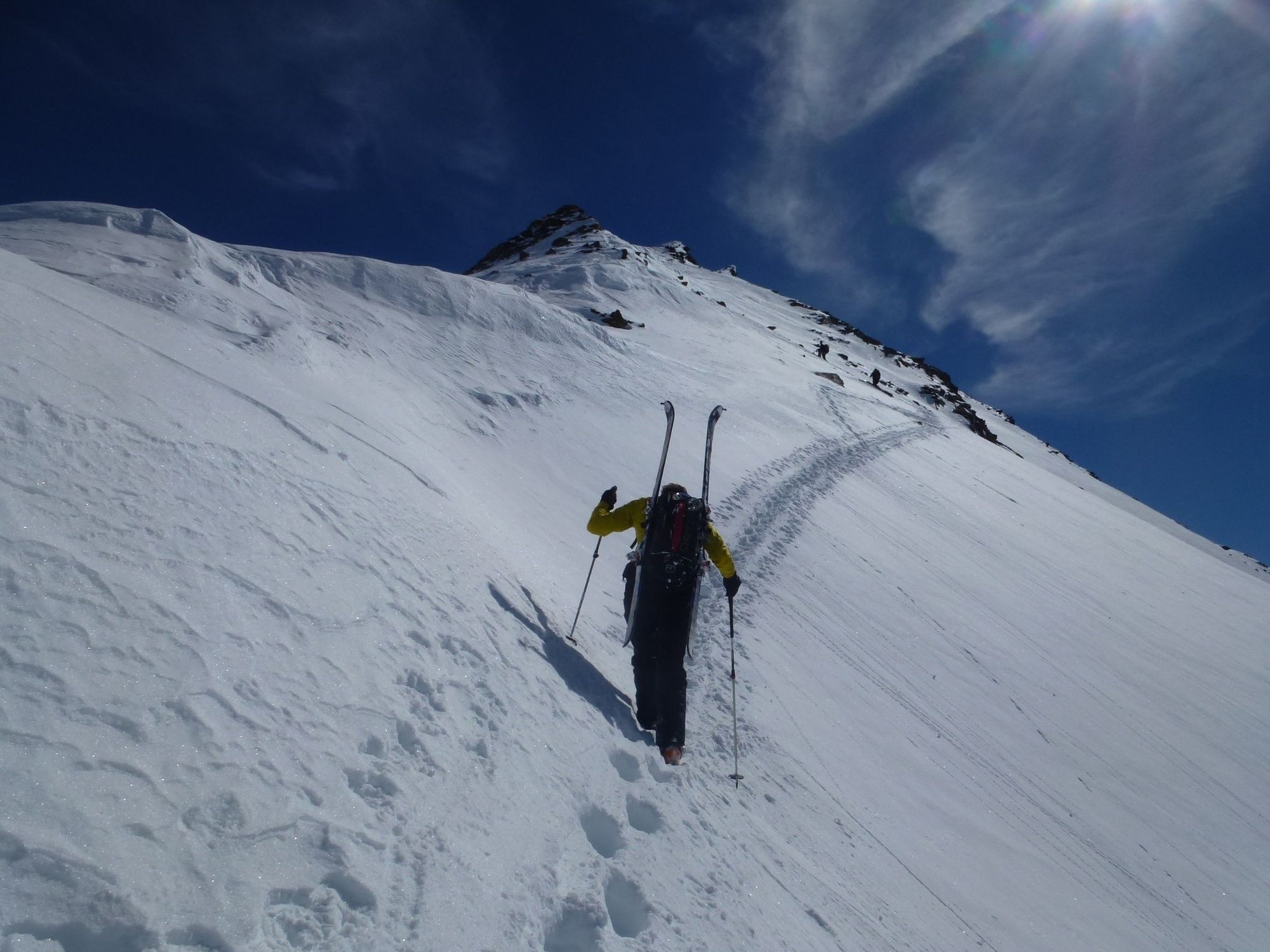
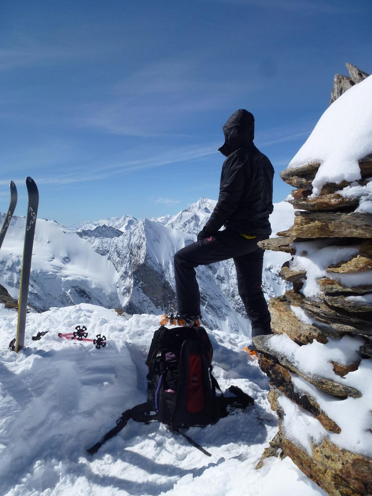
From the valley station of the Festkogelbahn you can get to the Ferwall Valley via the ski slopes. In the valley of the river Ferhal, one should keep as far as possible in the region of the valley floor and rise with a scarcely significant gain in altitude towards the south. The mighty summit of the Granatenkogel 3304m is soon being built before us. Ascent and descent routes can already be studied well and give the impression that you should be here only with absolutely safe avalanche conditions. Via the Ferwallferner one rises in increasing steepness in many peaks to the upper glacier basin, where one stops in the direction of Einsattelung at the beginning of the NW ridge. The inclination here rises above 40 °. In good snow conditions you can ascend to peak levels. However, in unfavorable conditions, ice axs or crampons could perform well. However, on this north-flanked flank without sunshine, the snow does not change so quickly into a hard melt resin cap. The situation is different in the area of the NW ridge. There is with a sufficient snowboard a ascent with skinned skis, but also a departure well possible. However, one must be aware that here the NW ridge falls with more than 40 ° steepness over 500 heights into the Gaisbergtal. As a result of skiing, one must be on the way to the ascent, or the snow conditions have to be favorable. In contrast to the northern slopes in the region of Ferwallfern, these westward exposed snow slopes can already be transformed into hard meltwater in spring and represent a corresponding hazard potential. Many touring enthusiasts are already setting up their ski depot at the saddle and are consciously continuing the summit ascent on foot. The ascent with skis is especially worthwhile if a descent over the direct summit on the northern flank seems possible. This is the real highlight of this tour. However, perfect snow and avalanche conditions must prevail in the northern flank. In addition, the danger of falling must be taken into account in the lower part of the flank which is up to 45 ° steep. Fatal accidents underpin this danger potential. But if the conditions allow, you will experience an impressive steep descent. The further descent over the Ferwallferner and subsequently through the Ferwalltal remains a never ending swinging experience.
- Highest point
- 3,297 m
- Endpoint
-
Obergurgl
- Height profile
-

- Equipment
-
Recommended Ski Mountaineering Equipment
The „standard ski mountaineering equipment“ is: touring skis with touring bindings, telescopic poles, climbing skins, ski crampons, digital avalanche transceiver, avalanche shovel, avalanche probe, firstaid kit and mobile phone. A „complete glacier equipment set“ contains: sit harness, two prusik loops of different lengths and ascenders, two HMS biners, icepick, climbing irons and rope. Pack your rucksack carefully and don‘t forget extra clothes for the descent, sun protection/cream, cold protection, enough food and drink. If you stay overnight at a mountain hut take toiletry articles and a hut sleeping bag with you!
LEVELS OF DIFFICULTY
Easy: Short or moderately long tours, always easy, with ascents not steeper than 25° or slightly steeper only on short sections. Intermediate: Moderately long or long tours of intermediate difficulty with ascents up to 35° or slightly steeper only on short sections. Difficult: Very challenging and long or very long tours with ascents that can exceed 40°, comprising also climbing sections up to difficulty grade II (UIAA). - Safety instructions
-
Avalanche Hazard Scale
1 (LOW)
Triggering is generally possible but only from high additional load in isolated areas of extremely steep terrain. Only small-sized sluffs and natural avalanches are expected. Snow layers are generally stable.
2 (MODERATE)
Avalanches may be triggered in case of truly heavy loads, especially on a few explicitly indicated, steep slopes. Large spontaneous avalanches are not expected. In general, the snowpack is well bonded except on some very steep slopes. Choose your route carefully, avoid the indicated slopes and exposed sections.
3 (CONSIDERABLE)
Triggering is very probable even from low additional loads, particularly on the indicated steep slopes. On some steeper slopes, medium or even fairly large spontaneous avalanches may occur. On most steepslopes the snow layer is only moderately or weakly stable. Expertavalanche knowledge is required. You must avoid the indicated steepslopes and highly exposed sections.
4 (HIGH)
Avalanches are likely to be triggered on many of the indicated steepslopes even if only light loads are applied. In some places, numerous medium-sized and also large-sized natural avalanches are expected.The snowpack is poorly bonded on most steep slopes. Choose your route according to these criteria, select only moderately steep terrain by avoiding the avalanche runout zones. Very expert avalanche knowledge is required.
5 (EXTREMELY HIGH)
Numerous huge or very large-sized natural avalanches are expected also in moderately steep terrain. Safe skiing is not possible anymore, not even in the marked ski area. The snowpack is poorly bonded and largely unstable. Don‘t go ski mountaineering at all!
- Additional information
-
Ascent assistance: Yes (ascent with the Festkogl cable car)
Max. Slope gradient: over 40 °
Glacier: Yes
Tour type: high alpine glacier tour
Skitechnik: difficult
Climbing technique: none
Maps: AV card Ötztaler Alps - Gurgl 1:25 000
Best season: Mar, Apr, May
Ski Mountaineering Rules
If you enjoy activities amid nature always respect the local guidelines when you set out on a ski tour (for example: wildlife preserves, hunting enclosures, reforestation areas, information boards, etc.). Don‘t enter protected wildlife zones or feeding areas amid naturelandscapes, and avoid noise. Cross forest areas in winter only on sign posted trails or marked routes as wild animals can panic if they hear loud voices or noise. Learn more about the habitat of wild animals in the mountains, avoid getting too close to them. Watch them only from a safe distance. Please put your dog on a lead, it is absolutely irresponsible to take dogs into the forest without leashing them because wild animals suffer from food deficiency and weakness in winter. Excellent planning and time management: start your tour early enough and return before darkness. In spring you should be back on the hut or in the valley at 12 noon (avalanche hazard!) at the latest. Never cross forestation zones and areas with young plants and trees.Ötztal Tourismus doesn‘t take any responsibility for the suggested tours. It is strongly recommended to enlist a certified local mountainguide. Glacier crossings are allowed only in a group by using a rope.
Before you set out on a tour you should inform someone down in the valley about the tour‘s destination and when you plan to be back. Anavalanche transceiver is an absolute must for Alpine ski mountaineering tours.
More details about ski mountaineering tours in Ötztal: https://www.oetztal.com/skitouren
- Directions
- Public transportation
- Parking
-
In Obergurgl-Hochgurgl the following parking facilities are available:
- Car park Village center Obergurgl (in front of the church on the right, behind the multi-purpose building where the information office is located)
- Parking lot with coin entrance Parking Place entrance - valley station Festkoglbahn, free of charge
- Parking Hochgurglbahn valley station, free of charge - no parking at night
- Parking Top Mountain Crosspoint, free of charge
- Parking Hochgurgl, free of charge (very small parking)


- Author
-
The tour Granatenkogel is used by outdooractive.com provided.


-
Meraner Land
91
-
Passeiertal
49
-
Obergurgl - Hochgurgl
34