- Brief description
-
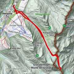
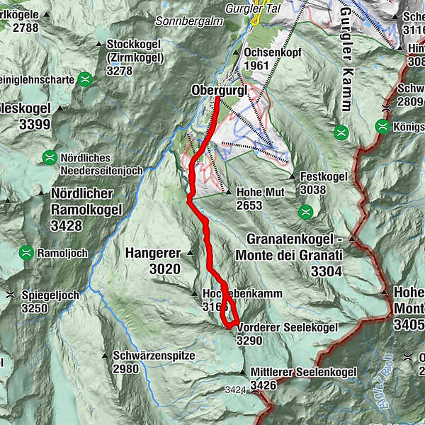
OBERGURGL -> Rotmoostal valley -> Eiskögele -> OBERGURGL
The Eiskögele from the Rotmoostal as a day trip
- Difficulty
-
difficult
- Rating
-
- Starting point
-
Obergurgl
- Route
-
Obergurgl (1,907 m)Hohe Mut Bahn (1,930 m)0.0 kmBruggenbodenbahn1.3 kmBruggenbodenbahn11.8 km
- Best season
-
AugSepOctNovDecJanFebMarAprMayJunJul
- Description
-
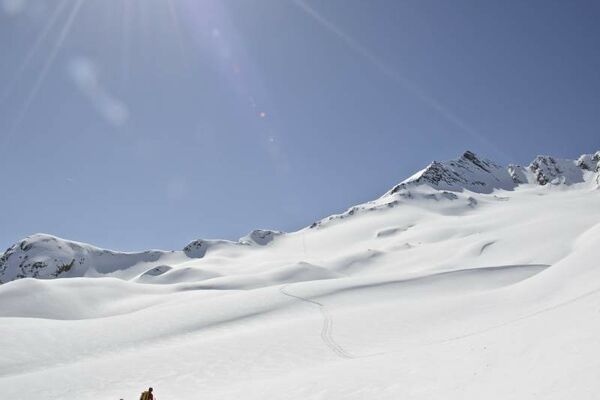
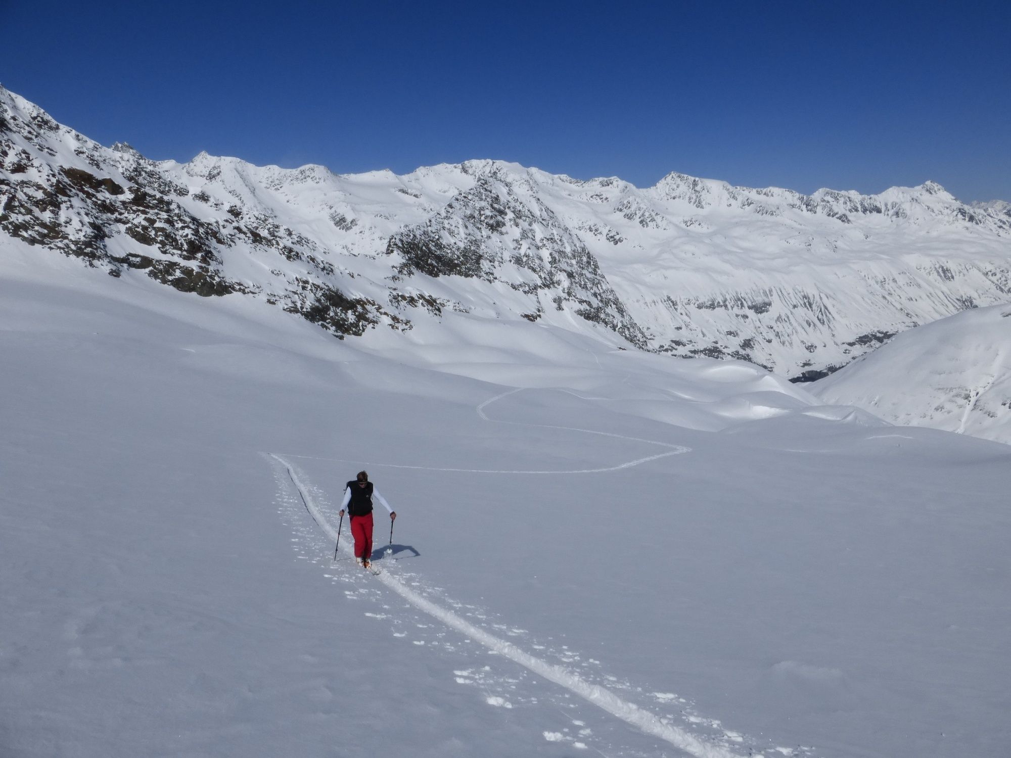
The route from the Redmoostal is often commemorated to a height of 2800m, as it follows the route to the icecock 3233m. The Eiskögele 3233m is one of the most popular ski mountaineers in the area around Obergurgl. The route from the Rotmoostal is not only a day trip, but also as a transition to the Langtaleregghütte 2430m, or many touring skiers still take the icebergs 3233m on their way from the Langtaleregghütte 2430m back to Obergurgl.
- Directions
-
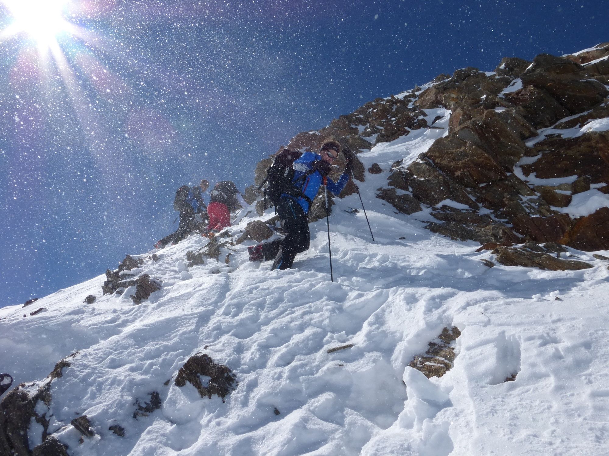
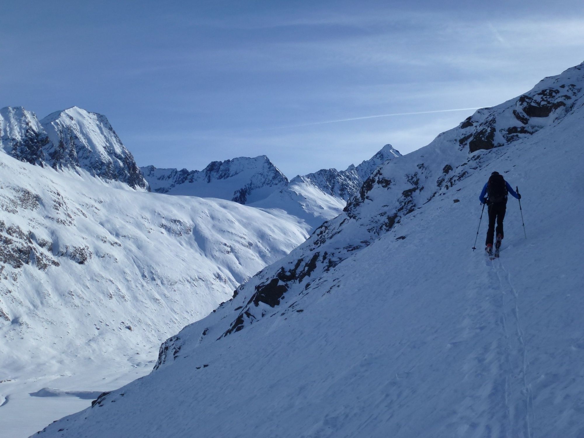
As a result, the slopes of the icebergs 3233m over the Hangererferner down into the Rotmoostal. From the valley, a good 1380 meters of altitude can be overcome. In the case of favorable avalanche conditions, especially in the spring, when the western slopes at the Hohen Mut 2659m are severely dented in the morning, you can save yourself a good 300 altitude climb. Take the train "Mut Mut I + II" up to the Hohen Mut 2659m and then you have to drive 400 meters into the Rotmoostal over 35 ° to 40 ° steep terrain. In this case, you will be able to start in Obergurgl at the earliest, but a delayed start on the northern slopes of the Vorderer Seelsenkogel 3286m is usually not a major problem with regard to the daily warming. The departure from the Hohenmut 2659m into the Rotmoostal Should not be underestimated. The danger of avalanches must be taken into account when using pulleys. A good skiing season or good skiing skills is necessary in the case of hard snowing in spring. From the Rotmoostal, one of the most delicate passages of the tour begins with the avalanche danger. The 200-meter-high and 35-degree, sometimes even 40-degree, steep north slope up to the Kar of the iceberg 3233m requires absolutely stable avalanche conditions. In addition, the possibility of self-tripping of avalanches must always be considered from the northeast flank of the Hangerer 3020m. Afterwards it goes over beautiful and not too steeply inclined terrain up to an altitude of 2800m, where is located approximately the Hangerersee. But here the two ascent routes separate. We are now heading south-east over softly inclined, as well as beautifully cobbled terrain, whereby we gain for the time only little. We are increasingly touching the tongue of that part of the Hanger beetle, which flows from the Northkar at the Vorderer Seelsenkogel 3286m to the valley. We are heading for an easy access to which we reach a further glacier surface of the Hangerbeferner at the northeast flank of the Vorderer Seelsenkogel 3286m. Due to the warming of the climate, the surface of the ice grows steadily further, so that the glacier slopes can be further and more problematic on this steep, steep glacier slope. After coping with this upturn, we are able to get to the ice-free east flank of our tour area without any problems. Here we make height and try to get to the beginning of the north back. At this point, we can climb a few more heights with skied-on skis. Shortly before the summit, however, is finished and the last meters are partly in the foot, partly in easy climbing (post II difficulty). Also the terrain on the last meters shows that this tour should be very safe avalanche conditions should prevail and the spring is basically the best time for this. If such conditions already apply for a climb, then in this case it is probably also possible to choose a different departure variant, which is much more ski-friendly, in the upper part of the tour. From the beginning of the northern bridge, you will cross the north side of the Soderenkogel at the north end of the Haren River, where you will pass the northern part of the Hanger River. Here the snow conditions are usually more favorable and one finds also in the spring always Pulverschnee. A descent in the upper area along the ascent trail would also make some descent into the niece through crossings. In the north you can choose a direct departure line.
- Highest point
- 3,268 m
- Endpoint
-
Obergurgl
- Height profile
-

- Equipment
-
Recommended Ski Mountaineering Equipment
The „standard ski mountaineering equipment“ is: touring skis with touring bindings, telescopic poles, climbing skins, ski crampons, digital avalanche transceiver, avalanche shovel, avalanche probe, firstaid kit and mobile phone. A „complete glacier equipment set“ contains: sit harness, two prusik loops of different lengths and ascenders, two HMS biners, icepick, climbing irons and rope. Pack your rucksack carefully and don‘t forget extra clothes for the descent, sun protection/cream, cold protection, enough food and drink. If you stay overnight at a mountain hut take toiletry articles and a hut sleeping bag with you!
LEVELS OF DIFFICULTY
Easy: Short or moderately long tours, always easy, with ascents not steeper than 25° or slightly steeper only on short sections. Intermediate: Moderately long or long tours of intermediate difficulty with ascents up to 35° or slightly steeper only on short sections. Difficult: Very challenging and long or very long tours with ascents that can exceed 40°, comprising also climbing sections up to difficulty grade II (UIAA). - Safety instructions
-
Avalanche Hazard Scale
1 (LOW)
Triggering is generally possible but only from high additional load in isolated areas of extremely steep terrain. Only small-sized sluffs and natural avalanches are expected. Snow layers are generally stable.2 (MODERATE)
Avalanches may be triggered in case of truly heavy loads, especially on a few explicitly indicated, steep slopes. Large spontaneous avalanches are not expected. In general, the snowpack is well bonded except on some very steep slopes. Choose your route carefully, avoid the indicated slopes and exposed sections.3 (CONSIDERABLE)
Triggering is very probable even from low additional loads, particularly on the indicated steep slopes. On some steeper slopes, medium or even fairly large spontaneous avalanches may occur. On most steepslopes the snow layer is only moderately or weakly stable. Expertavalanche knowledge is required. You must avoid the indicated steepslopes and highly exposed sections.4 (HIGH)
Avalanches are likely to be triggered on many of the indicated steepslopes even if only light loads are applied. In some places, numerous medium-sized and also large-sized natural avalanches are expected.The snowpack is poorly bonded on most steep slopes. Choose your route according to these criteria, select only moderately steep terrain by avoiding the avalanche runout zones. Very expert avalanche knowledge is required.5 (EXTREMELY HIGH)
Numerous huge or very large-sized natural avalanches are expected also in moderately steep terrain. Safe skiing is not possible anymore, not even in the marked ski area. The snowpack is poorly bonded and largely unstable. Don‘t go ski mountaineering at all! - Additional information
-
Ski Mountaineering Rules
If you enjoy activities amid nature always respect the local guidelines when you set out on a ski tour (for example: wildlife preserves, hunting enclosures, reforestation areas, information boards, etc.). Don‘t enter protected wildlife zones or feeding areas amid naturelandscapes, and avoid noise. Cross forest areas in winter only on sign posted trails or marked routes as wild animals can panic if they hear loud voices or noise. Learn more about the habitat of wild animals in the mountains, avoid getting too close to them. Watch them only from a safe distance. Please put your dog on a lead, it is absolutely irresponsible to take dogs into the forest without leashing them because wild animals suffer from food deficiency and weakness in winter. Excellent planning and time management: start your tour early enough and return before darkness. In spring you should be back on the hut or in the valley at 12 noon (avalanche hazard!) at the latest. Never cross forestation zones and areas with young plants and trees.Ötztal Tourismus doesn‘t take any responsibility for the suggested tours. It is strongly recommended to enlist a certified local mountainguide. Glacier crossings are allowed only in a group by using a rope.
Before you set out on a tour you should inform someone down in the valley about the tour‘s destination and when you plan to be back. Anavalanche transceiver is an absolute must for Alpine ski mountaineering tours.
More details about ski mountaineering tours in Ötztal: https://www.oetztal.com/skitouren
- Directions
- Public transportation
- Parking
-
In Obergurgl-Hochgurgl the following parking facilities are available:
- Car park Village center Obergurgl (in front of the church on the right, behind the multi-purpose building where the information office is located)
- Parking lot with coin entrance Parking Place entrance - valley station Festkoglbahn, free of charge
- Parking Hochgurglbahn valley station, free of charge - no parking at night
- Parking Top Mountain Crosspoint, free of charge
- Parking Hochgurgl, free of charge (very small parking)


- Author
-
The tour Vorderer Seelenkogel - Obergurgl is used by outdooractive.com provided.


-
Meraner Land
91
-
Ötztal
146
-
Obergurgl - Hochgurgl
34