- Brief description
-
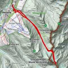
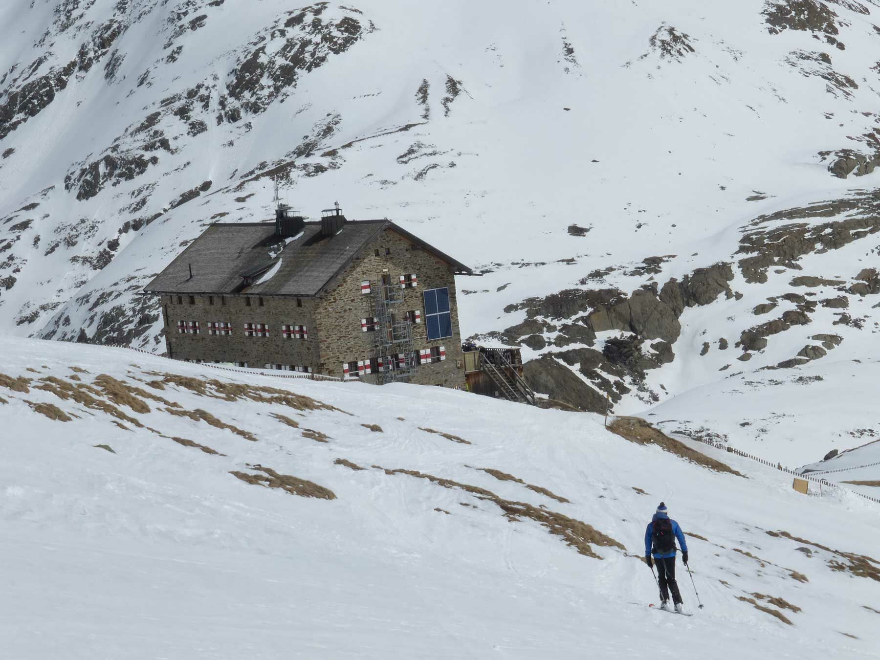
MARTIN BUSCH HÜTTE -> SIMILAUN
- Difficulty
-
medium
- Rating
-
- Starting point
-
Martin Busch Hütte
- Route
-
Similaun (3,606 m)6.5 kmMartin-Busch-Hütte12.1 km
- Best season
-
AugSepOctNovDecJanFebMarAprMayJunJul
- Description
-
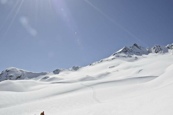
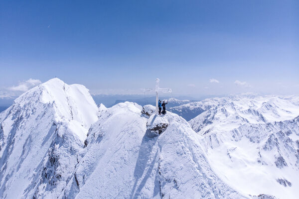
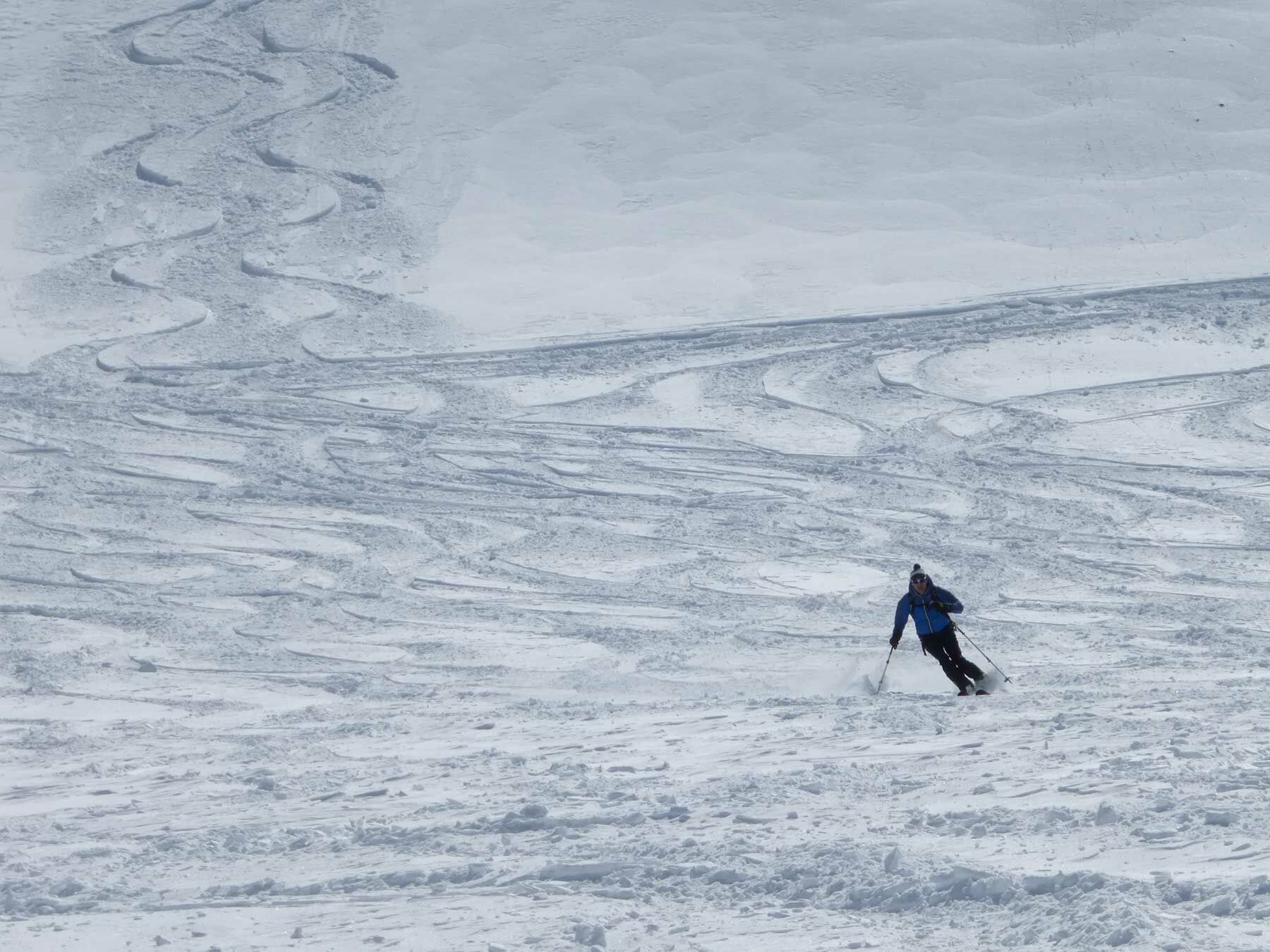
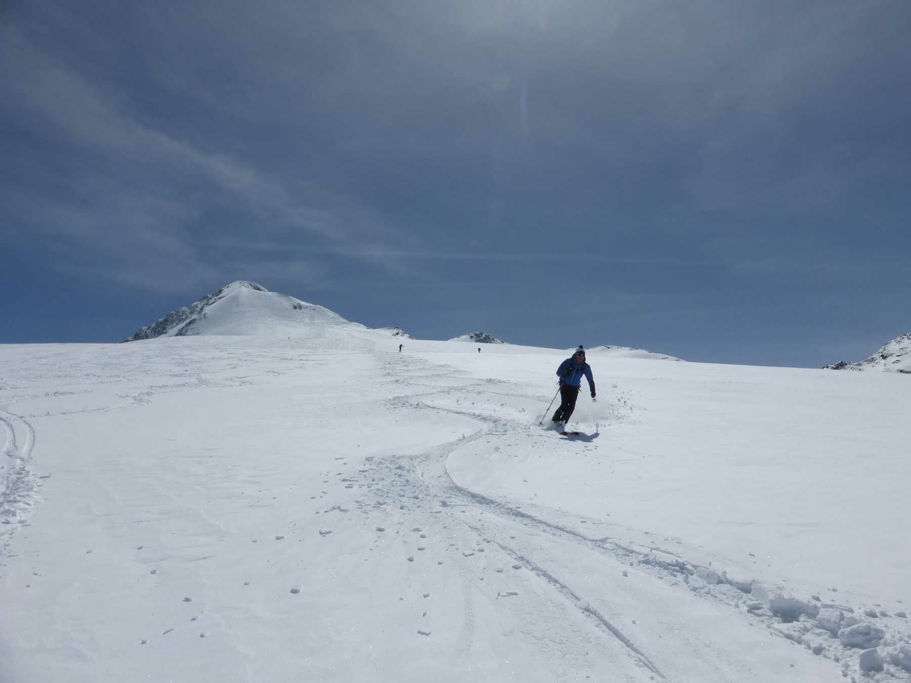
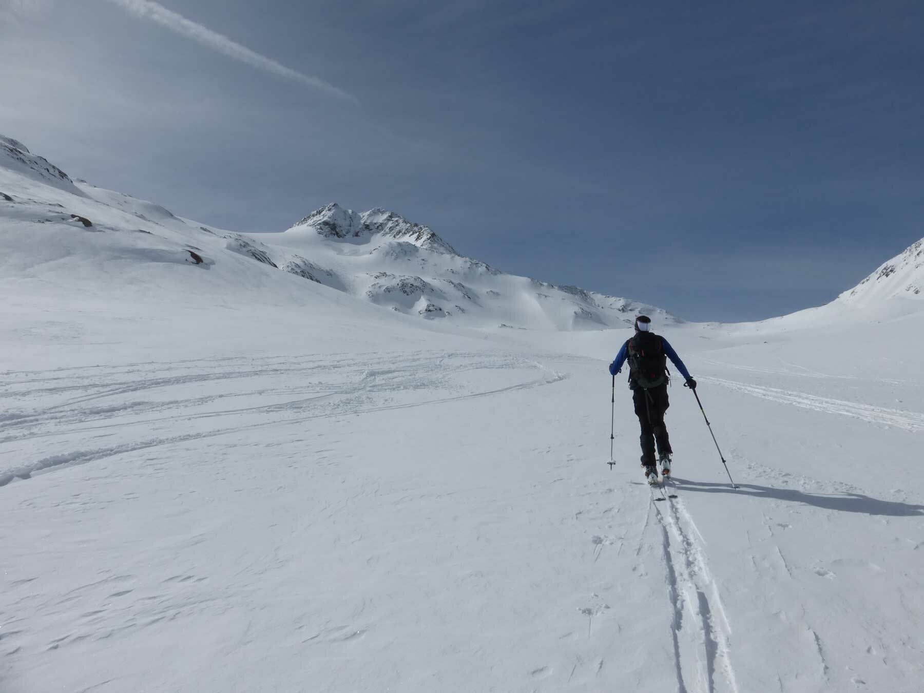
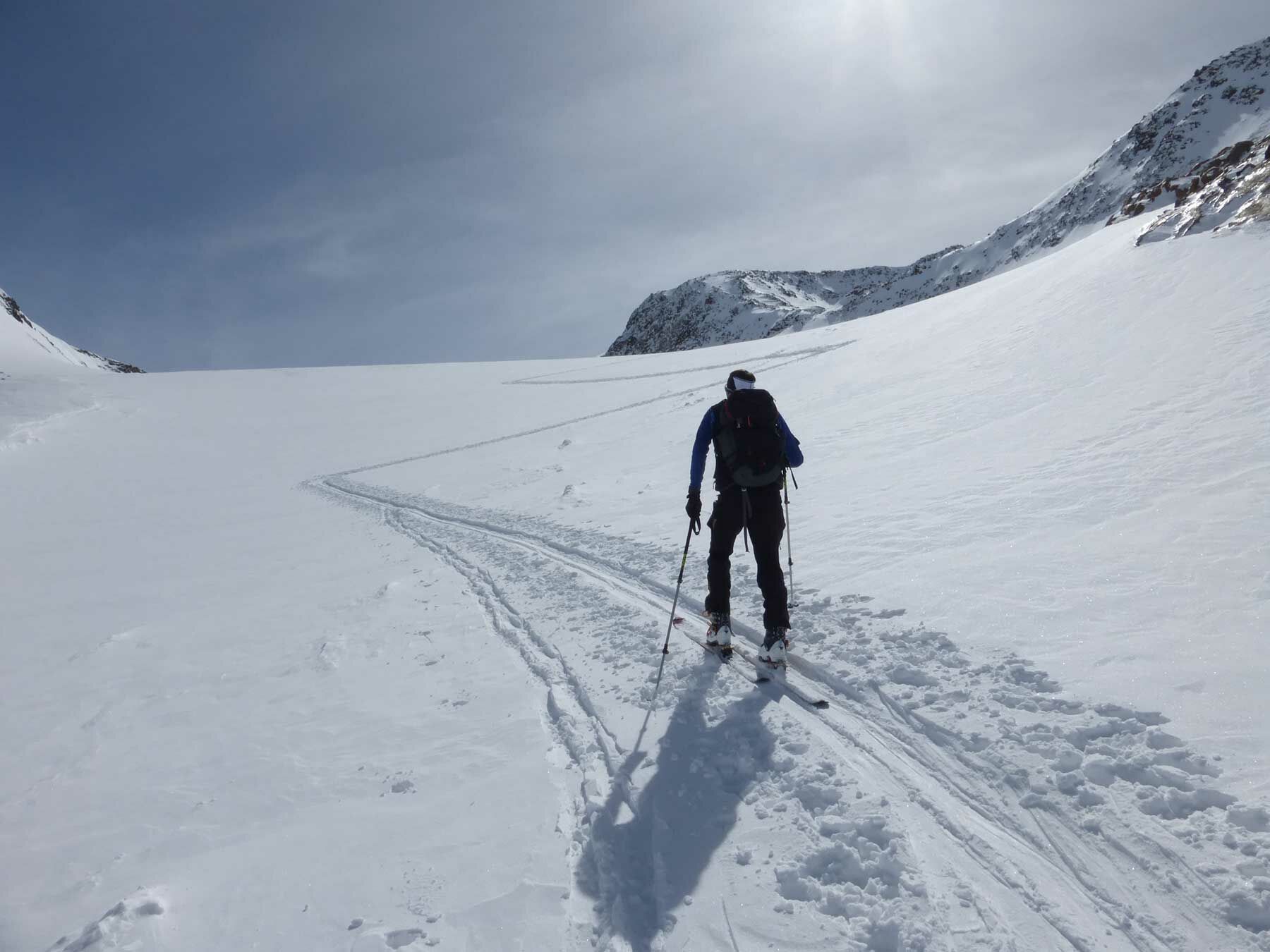
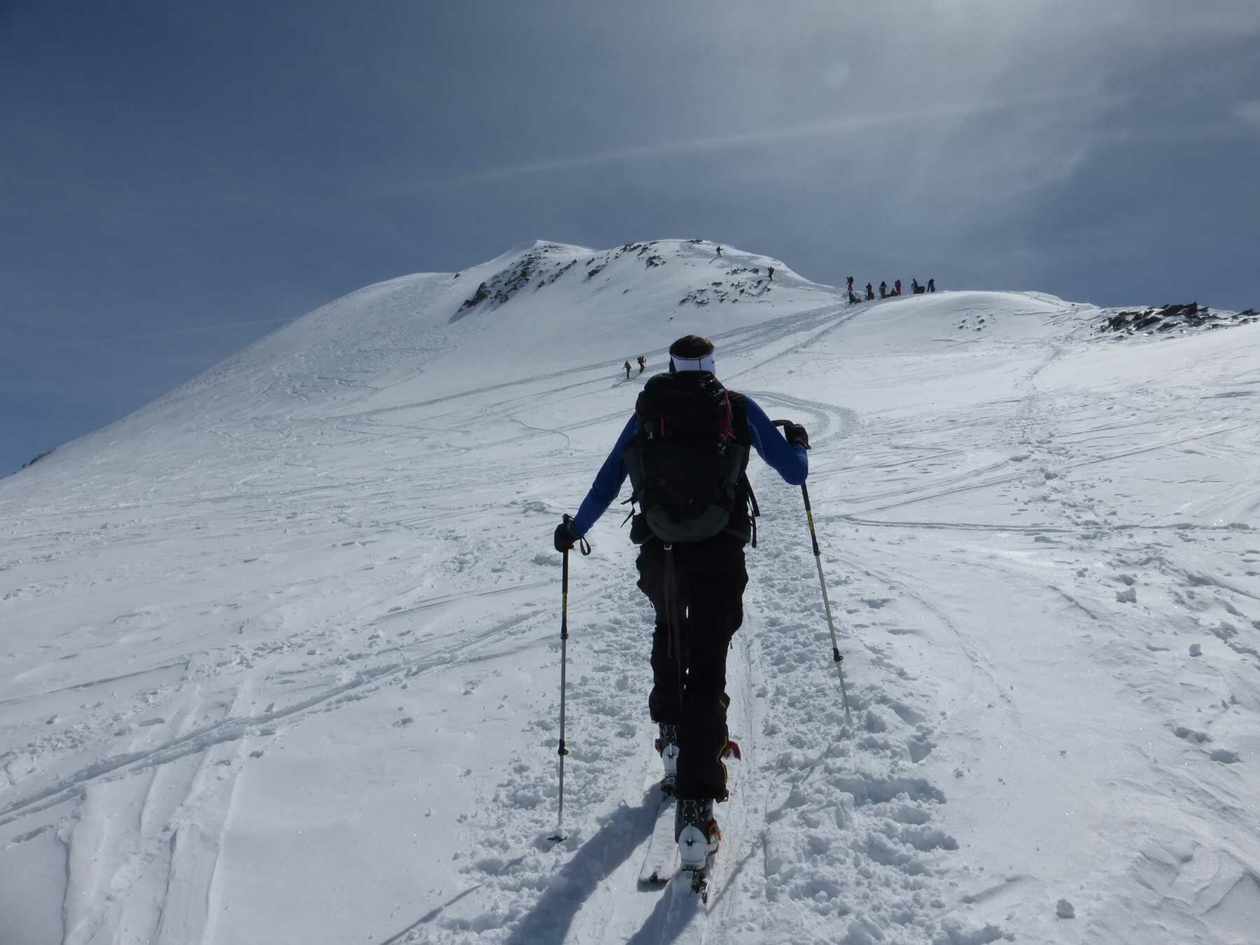
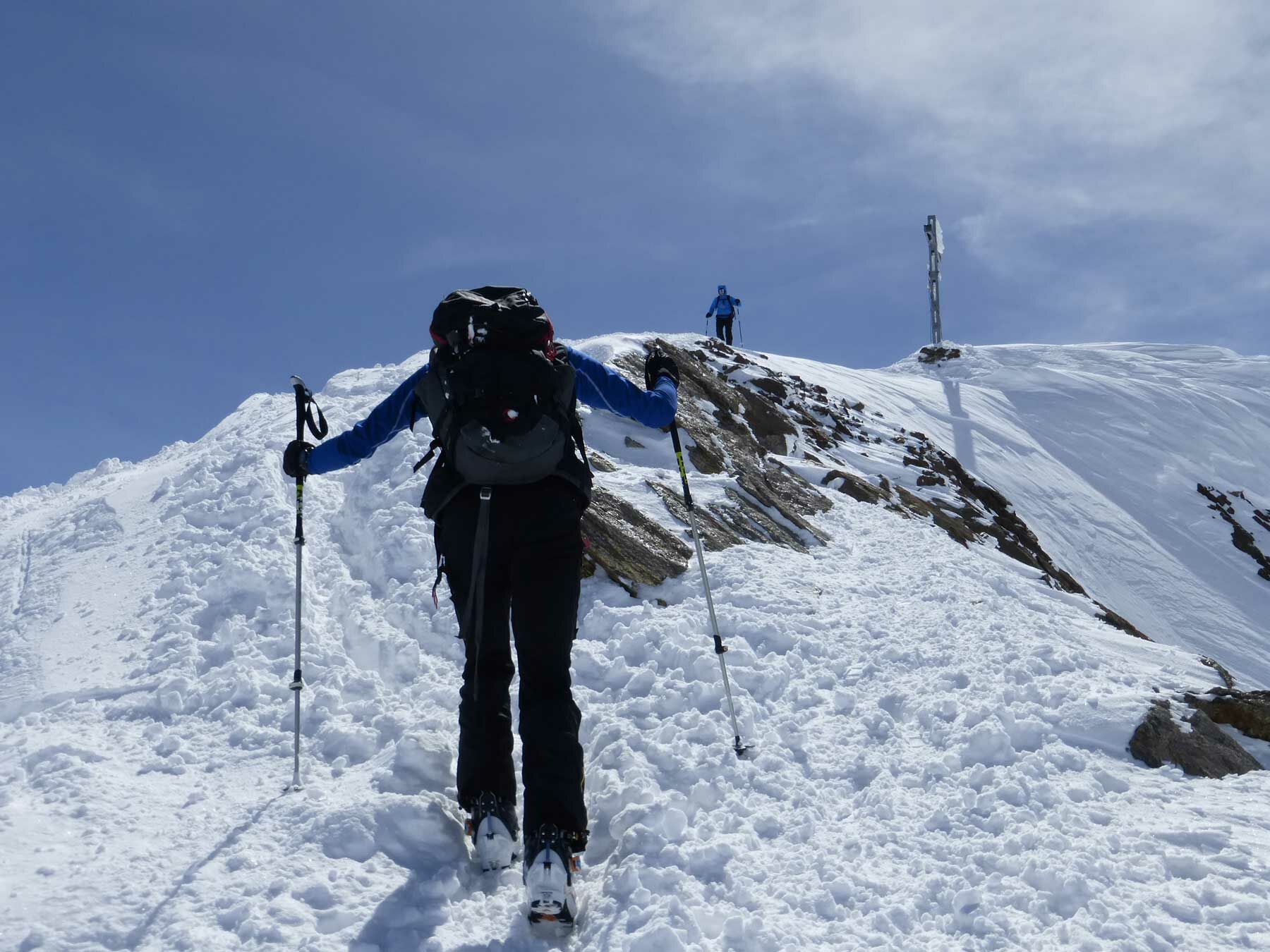
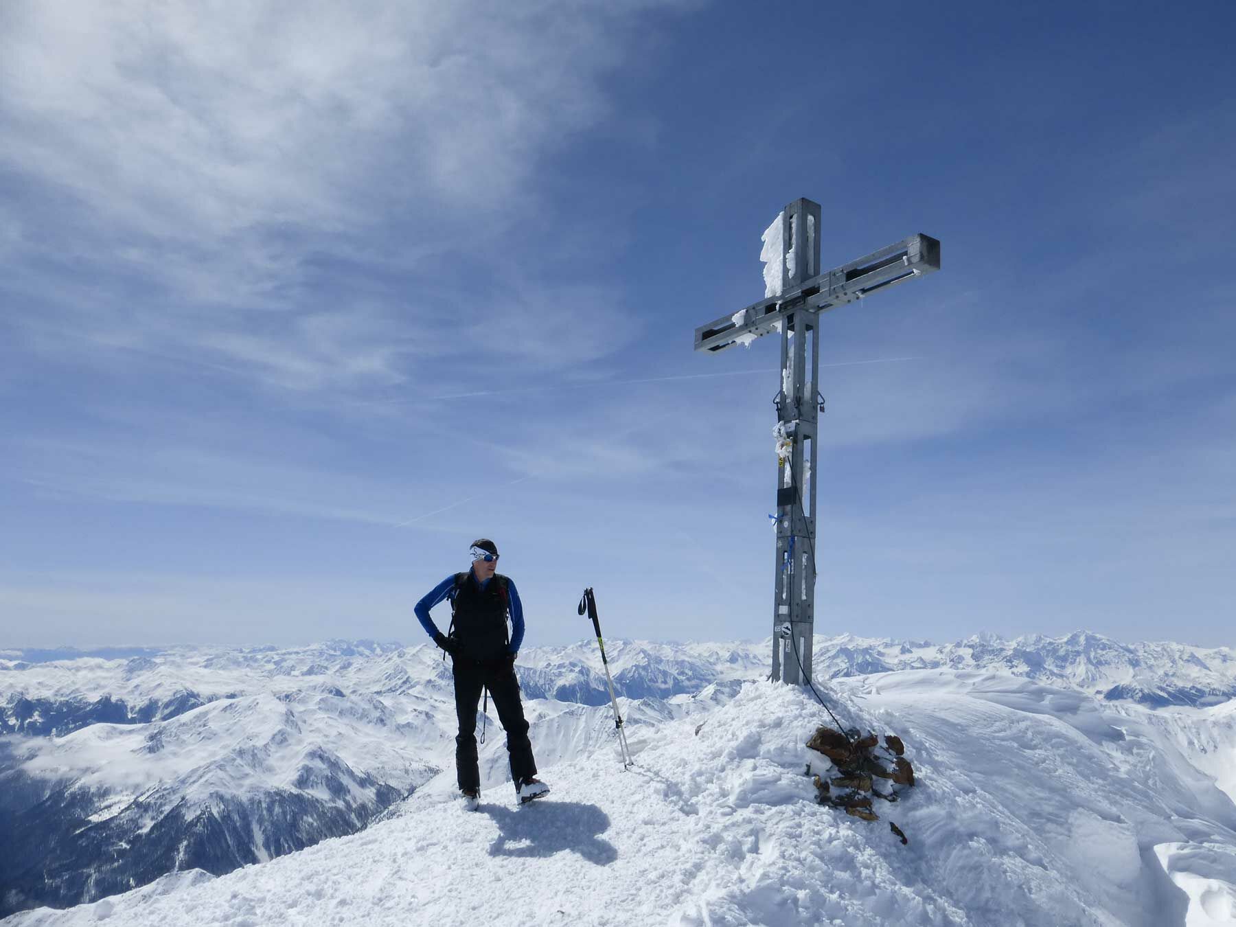
Majestic Similaun peak at 3.606 m probably ranks among the most popular ski touring destinations within the area of Martin Busch Hütte - on the one hand because the high Alpine summit has a sounding name and on the other hand the tour is not that much exposed to avalanches, provided you ski down the ascent route.
- Directions
-
Majestic Similaun peak at 3.606 m probably ranks among the most popular ski touring destinations within the area of Martin Busch Hütte - on the one hand because the high Alpine summit has a sounding name and on the other hand the tour is not that much exposed to avalanches, provided you ski down the ascent route. But be careful if you choose the more direct and more challenging northerly downhill skiing route over the glacier fields of Niederjochferner where favorable avalanche conditions should prevail. In such cases, many also choose the same ascent route. Here and now, however, we present the classic, very pleasant and objectively safer ascent past Niederjoch col. This route leads to the foothills of the north-western ridge in a broadly unproblematic way as it can be climbed a few meters further on skis in good snow conditions. Only the last few meters you have to trudge on foot towards the fairly easy north-western ridge, with or without crampons depending on snow conditions. If avalanche conditions are quite problematic, you should ski down on the ascent route. On the other hand, if avalanche conditions are considered favorable, the downhill route across the northern glacier field of Niederjochferner is a very good option. Here you also have to conquer a few steeper sections. With sufficient snow and good visibility the risk of crevasses on Niederjochferner can be rated as low. Nevertheless, it is always strongly recommended to bring along appropriate ski touring equipment for high Alpine terrain.
- Highest point
- 3,590 m
- Endpoint
-
Martin Busch Hütte
- Height profile
-

- Equipment
-
Recommended Ski Mountaineering Equipment
The „standard ski mountaineering equipment“ is: touring skis with touring bindings, telescopic poles, climbing skins, ski crampons, digital avalanche transceiver, avalanche shovel, avalanche probe, firstaid kit and mobile phone. A „complete glacier equipment set“ contains: sit harness, two prusik loops of different lengths and ascenders, two HMS biners, icepick, climbing irons and rope. Pack your rucksack carefully and don‘t forget extra clothes for the descent, sun protection/cream, cold protection, enough food and drink. If you stay overnight at a mountain hut take toiletry articles and a hut sleeping bag with you!
- Safety instructions
-
Avalanche Hazard Scale
1 (LOW)
Triggering is generally possible but only from high additional load in isolated areas of extremely steep terrain. Only small-sized sluffs and natural avalanches are expected. Snow layers are generally stable.
2 (MODERATE)
Avalanches may be triggered in case of truly heavy loads, especially on a few explicitly indicated, steep slopes. Large spontaneous avalanches are not expected. In general, the snowpack is well bonded except on some very steep slopes. Choose your route carefully, avoid the indicated slopes and exposed sections.
3 (CONSIDERABLE)
Triggering is very probable even from low additional loads, particularly on the indicated steep slopes. On some steeper slopes, medium or even fairly large spontaneous avalanches may occur. On most steepslopes the snow layer is only moderately or weakly stable. Expertavalanche knowledge is required. You must avoid the indicated steepslopes and highly exposed sections.
4 (HIGH)
Avalanches are likely to be triggered on many of the indicated steepslopes even if only light loads are applied. In some places, numerous medium-sized and also large-sized natural avalanches are expected.The snowpack is poorly bonded on most steep slopes. Choose your route according to these criteria, select only moderately steep terrain by avoiding the avalanche runout zones. Very expert avalanche knowledge is required.
5 (EXTREMELY HIGH)
Numerous huge or very large-sized natural avalanches are expected also in moderately steep terrain. Safe skiing is not possible anymore, not even in the marked ski area. The snowpack is poorly bonded and largely unstable. Don‘t go ski mountaineering at all!
Also visit lawine.tirol.gv.at
- Additional information
-
Ski Mountaineering Rules
If you enjoy activities amid nature always respect the local guidelines when you set out on a ski tour (for example: wildlife preserves, hunting enclosures, reforestation areas, information boards, etc.).
Don‘t enter protected wildlife zones or feeding areas amid naturelandscapes, and avoid noise.
Cross forest areas in winter only on sign posted trails or marked routes as wild animals can panic if they hear loud voices or noise.
Learn more about the habitat of wild animals in the mountains, avoid getting too close to them. Watch them only from a safe distance. Please put your dog on a lead, it is absolutely irresponsible to take dogs into the forest without leashing them because wild animals suffer from food deficiency and weakness in winter.
Excellent planning and time management: start your tour early enough and return before darkness. In spring you should be back on the hut or in the valley at 12 noon (avalanche hazard!) at the latest.
Never cross forestation zones and areas with young plants and trees.
Ötztal Tourismus doesn‘t take any responsibility for the suggested tours. It is strongly recommended to enlist a certified local mountainguide. Glacier crossings are allowed only in a group by using a rope.
Before you set out on a tour you should inform someone down in the valley about the tour‘s destination and when you plan to be back. Anavalanche transceiver is an absolute must for Alpine ski mountaineering tours.
More details about ski mountaineering tours in Ötztal: https://www.oetztal.com/skitouren
- Arrival
-
The car drive to the Ötztal valley. Situated in Tirol, the Ötztal valley set off in southerly direction and is the longest side valley in the Eastern Alps. The journey with the car leads you through the Inntal valley to the entrance of the valley and further on through the valley. Among the toll motorways you can also use the country roads. A route planner will show you the easiest and most convenient way: www.google.at/maps
- Public transportation
-
Travel safe and comfortable with the train to the Ötztal Bahnhof train station. Last stop and exit point is the train station Ötztal Bahnhof. Afterwards you can travel smoothly and quick with the public transport or our local taxi companies through the valley to your desired destination. Please find the current bus timetable here: fahrplan.vvt.at
- Parking
-
The following parking options are available in the mountaineering village Vent
- In summertime in front of the village (parking machine, only coins or EC card) and at the chairlift (at the ticket office of the mountain railways)
- In wintertime only at the chairlift
Cost: € 5,00 per day/car

- Author
-
The tour Similaun 3.606 m is used by outdooractive.com provided.


General info
-
Vinschgau
146
-
Schnalstal
60
-
Unser Frau
18