
- Brief description
-
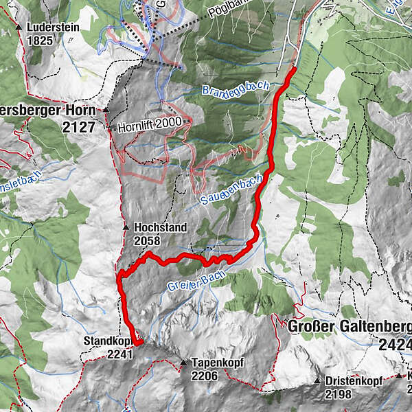
Medium ski tour to the Sagtaler peak in Inneralpbach through backcountry terrain offering a beautiful panorama.
- Difficulty
-
medium
- Rating
-
- Starting point
-
Leitner car park, Inneralpbach
- Route
-
Greiter Graben0.6 kmGreitalm2.5 kmStandkopf (2,241 m)6.1 km
- Best season
-
AugSepOctNovDecJanFebMarAprMayJunJul
- Description
-
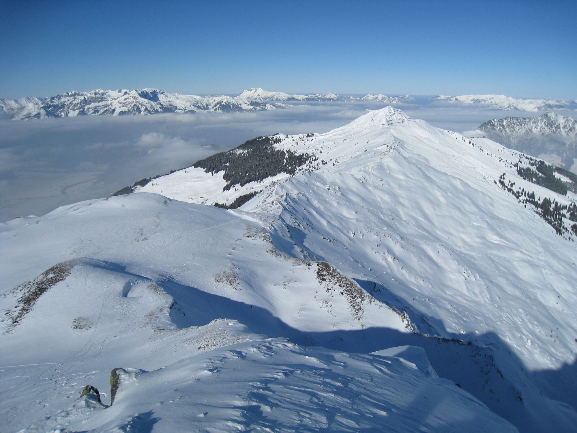
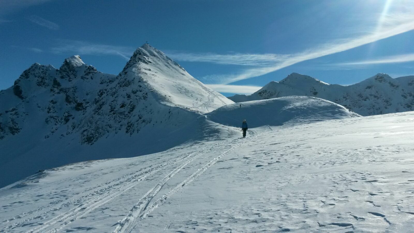
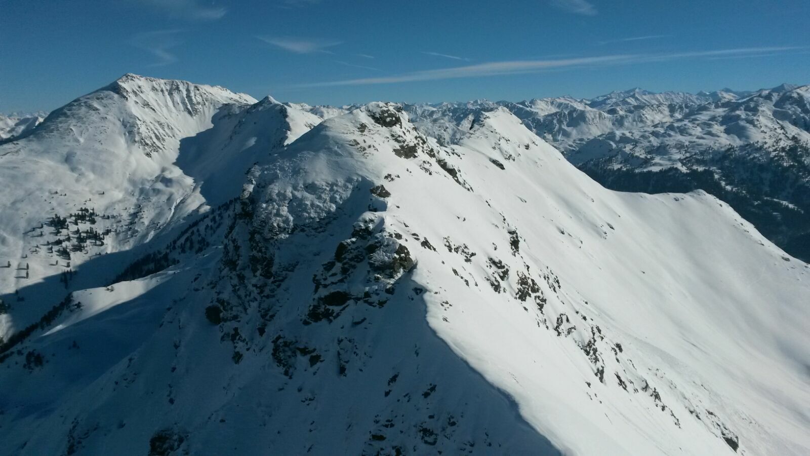
Ascent: From the Leitner car park (fees apply) in the Greiter Valley in Inneralpbach along the cross-country ski trail up valley. Later continue on the road south to the Greiteralm-Niederleger (1,320 m). Directly after some Alpine huts, turn right gently ascending in a westerly direction up the Greiter Valley to the east of the Sagtaler Spitze. Soon after, keep to the right across wide Alpine slopes up to the Hochalm. Above the huts, the tour leads through a sparse forest belt upwards into extensive terrain under the connecting ridge to the Hochstand (highest peak south of the Wiedersberger Horn) and to the Sagtaler Spitze.
Above the forest belt straight uphill, whereby the short steep slopes can be skilfully avoided. In a wide hollow below the ridge, turn southwest and climb out onto the ridge at the lowest point (if you get it right, right by some signposts). Turn left towards the south, keeping mostly to the right of the ridge, exactly towards the steep Sagtaler Spitze. Finally, take a wide left turn into the peak's western flank and, depending on conditions, ski or walk to the Standkopf summit (2,241 m).
Descent: In case of unsafe conditions, back towards the ascent track and keep close to those tracks back down into the valley. In safer conditions, descend directly below the summit through steep north-east facing terrain into the Greiter Valley and the Greitalm. Due to several rock-strewn ditches the route can be very difficult to negotiate and is only recommended in the safest conditions!
- Directions
-
Car park - up the valley - Greiteralm-Niederleger - westerly direction - bear right crossing slopes to the Hochalm - forest belt - connecting ridge to the Hochstand - ridge - Standkopf. Safest descent - via ascent.
- Highest point
- 2,220 m
- Endpoint
-
Leitner car park, Inneralpbach
- Exposition
- Height profile
-

- Equipment
-
Ski touring equipment, snack and sufficient drinks
- Safety instructions
-
Exposed to avalanches – in good visibilty, the few short steep slopes can easily be avoided. Please be prudent in the steep slopes before the peak. Before setting out please consult the avalanche bulletin/report!
- Tips
-
Admire the panorama towards the Hohe Tauern
- Directions
-
A12 - motorway exit Kramsach - Brixlegg - Inneralpbach past the Pöglbahn bottom station, past Galtenberg Resort - turn right over the bridge - continue a further kilometre up the Greiter Valley to the Leitner car park (Greitereck).
- Parking
-
Parking fees apply for the Greiter Valley Leitner (former Gasthaus Leitner) car park
- Author
-
The tour Standkopf ski tour - Sagtaler Spitze 2.241 m is used by outdooractive.com provided.


General info
-
Alpbachtal
111
-
Alpbach
42