- Brief description
-
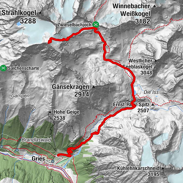
GRIES -> Winnebach -> Winnebachseehütte -> direction Zwieselbachjoch -> BREITER GRIESKOGEL
- Difficulty
-
difficult
- Rating
-
- Starting point
-
Gries
- Route
-
Pension Winnebach0.3 kmWinnebachseehütte4.1 kmBreiter Grieskogel (3,287 m)8.9 km
- Best season
-
AugSepOctNovDecJanFebMarAprMayJunJul
- Description
-
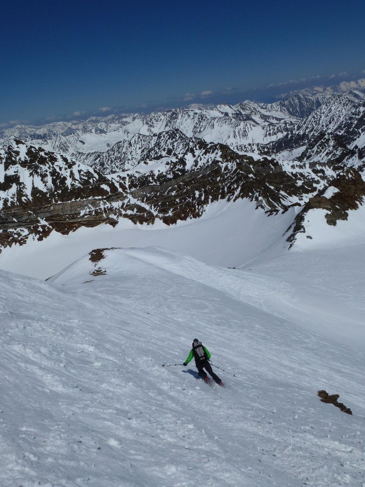
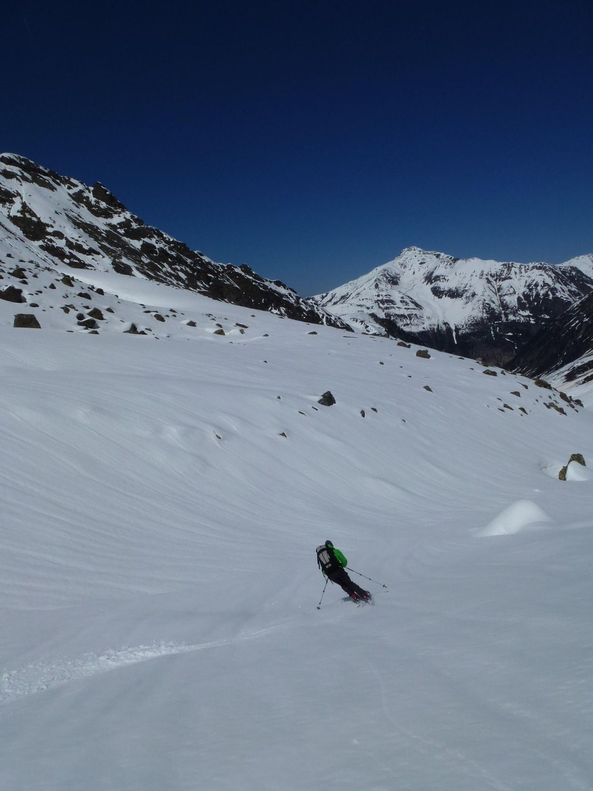
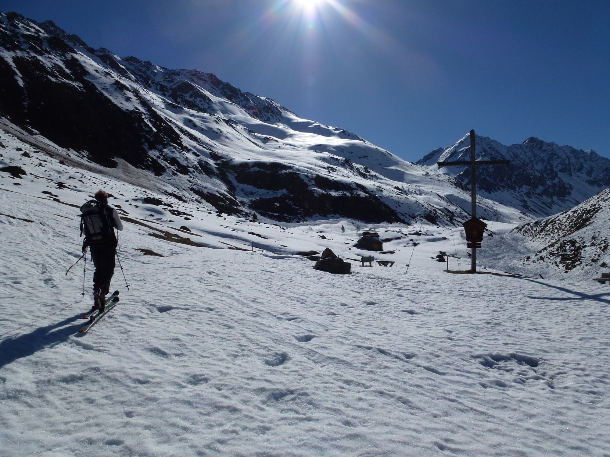
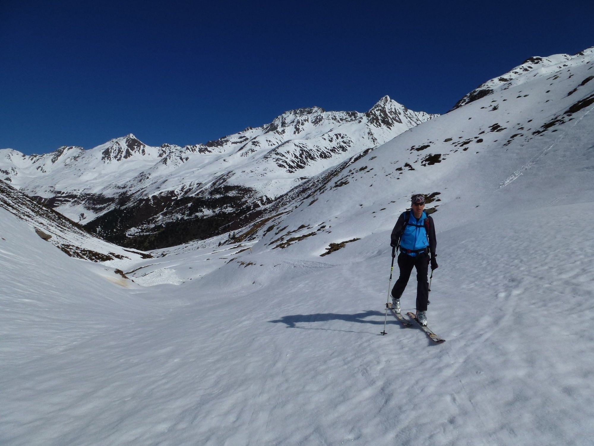
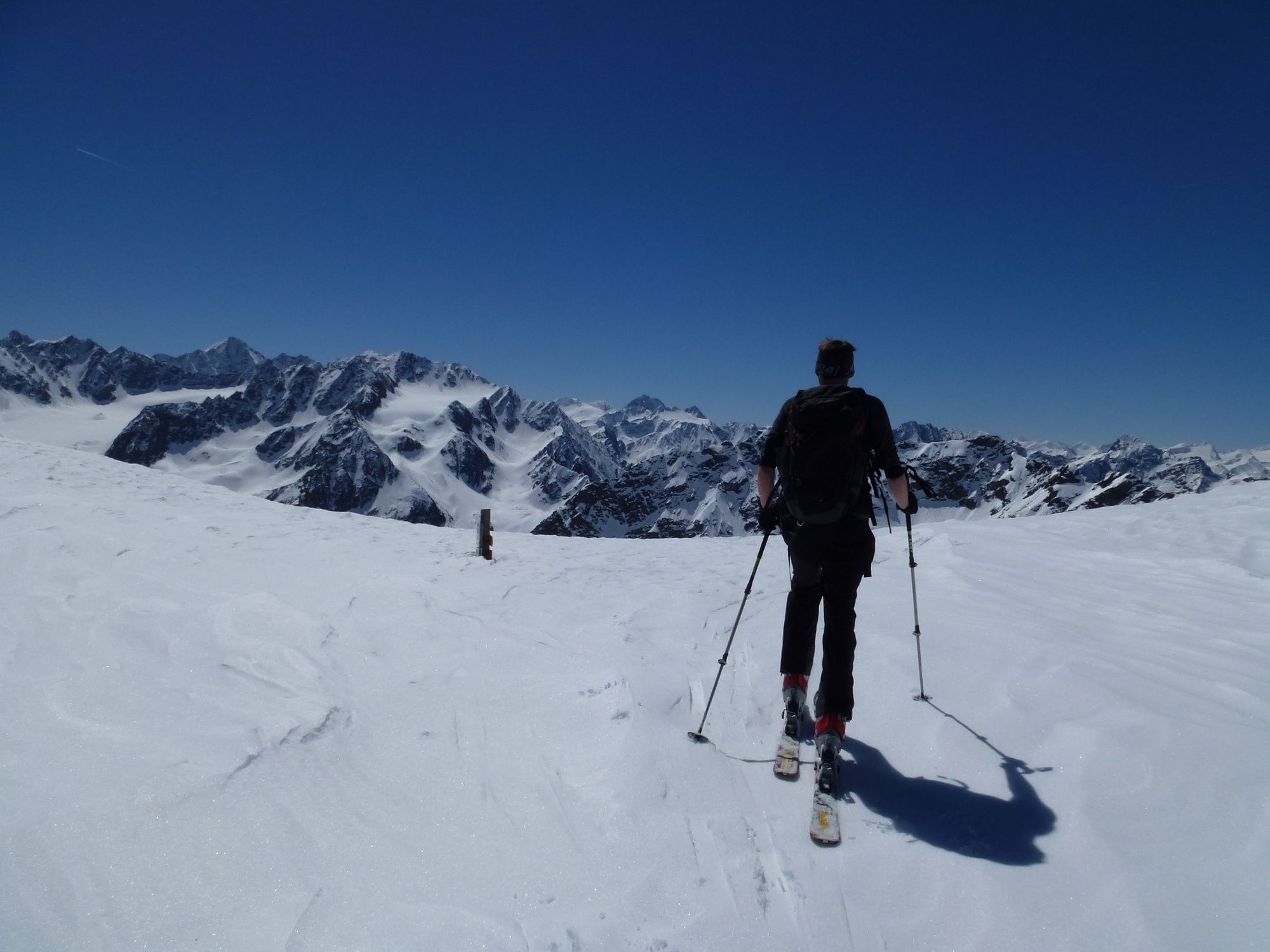
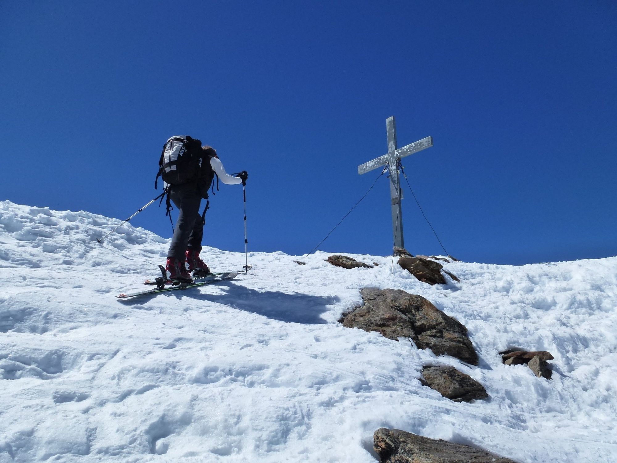
From the car park at the end of Gries, the ascent via the hamlet Winnebach into the Winnebachtal. Plan for about 2 hours walking time. From the Winnebachseehütte on the left side of the lake, the path continues north to the Winnebachkar. After a few minutes, keep to the left and ascend northwest until you find a pass between the rocks bordering the kar. In a beautiful hollow, we continue towards Zwieselbachjoch. Before the steep climb towards Zwieselbachjoch, however, you keep to the left and thus avoid the steep slopes from the Zwieselbachjoch and reach the Grieskogelferner. Via the initially flat direction to the west, passing a steep step with glacial ruptures on the left, you reach the north ridge and along this path you reach the summit without difficulty. The descent is on the ascent or over the Grastalferner direction Niederthai.
- Directions
-
Hut access:
From the small town Winnebach (above Gries) on the very well marked summer path in some hairpin bends higher in the Winnebachtal. After a good 20 minutes, the summer and the winter increase separate at a small house . Depending on the level of snow, either on the summer path straight out or, if there is enough snow, cross the brook here and follow the mostly existing ascent tracks along the stream or under the material cable car. After a terrain level flat in the basin, before in a left bend the last climb to the hut is mastered (as a guide, the cable car is ideal).To the hut about 2 hours and a good 700 meters.
Access to the peak:
From the hut in a northerly direction into the sprawling Winnebachkar. In a large left bend around the Lechhorn and over hilly terrain, partly steep to the Zwieselbachjoch. Here strong left and over the gentle slopes to Grießkogelferner. As you pass the highly visible glacier break on the left, you reach the upper part of the glacier, which now leans back slightly. Depending on the conditions with skis on the once more steep summit slope or the last meters on foot. From the summit you can enjoy a fantastic view of the highest mountain in Tyrol, the Wildspitze and the Wilder Kaiser in the east.Ascent from the hut to the summit in 3 hours for almost 950 vertical meters. - Highest point
- 3,270 m
- Endpoint
-
Gries or Niederthai
- Exposition
- Height profile
-

- Equipment
-
Recommended ski mountaineering equipment:
The "standard ski mountaineering equipment" is: touring skis with touring bindings, telescopic poles, climbing skins, ski crampons, digital avalanche transceiver, avalanche shovel, avalanche probe, first aid kit and mobile phone. A ski helmet can prevent severe head injuries.
A "complete glacier equipment set" contains: sit harness, two prusik loops of different lengths and ascenders, two HMS carabiners, ice pick, climbing irons, bivouac bag, airbag system and rope.
Pack your rucksack carefully and don't forget extra clothes for the descent, sun protection/cream, cold protection, enough food and drink. If you stay overnight at a mountain hut take toiletry articles and a hut sleeping bag with you.
DIFFICULTY RATING
Easy: easy, short to moderate long tours with climbs that do not exceed 25 ° or only for a short time.
Medium: Moderate, moderately long to long tours with climbs that do not exceed 35 ° or only for a short time.
Difficult: Difficult, long to very long tours with climbs that reach 40 ° or more, and climbing passages up to the II degree of difficulty (UIAA).
- Safety instructions
-
Avalanche Hazard Scale
1 (LOW) Triggering is generally possible but only from high additional load in isolated areas of extremely steep terrain. Only small-sized sluffs and natural avalanches are expected. Snow layers are generally stable.
2 (MODERATE) Avalanches may be triggered in case of truly heavy loads, especially on a few explicitly indicated, steep slopes. Large spontaneous avalanches are not expected. In general, the snowpack is well bonded except on some very steep slopes. Choose your route carefully, avoid the indicated slopes and exposed sections.
3 (CONSIDERABLE) Triggering is very probable even from low additional loads, particularly on the indicated steep slopes. On some steeper slopes, medium or even fairly large spontaneous avalanches may occur. On most steepslopes the snow layer is only moderately or weakly stable. Expertavalanche knowledge is required. You must avoid the indicated steepslopes and highly exposed sections.
4 (HIGH) Avalanches are likely to be triggered on many of the indicated steepslopes even if only light loads are applied. In some places, numerous medium-sized and also large-sized natural avalanches are expected.The snowpack is poorly bonded on most steep slopes. Choose your route according to these criteria, select only moderately steep terrain by avoiding the avalanche runout zones. Very expert avalanche knowledge is required.
5 (EXTREMELY HIGH) Numerous huge or very large-sized natural avalanches are expected also in moderately steep terrain. Safe skiing is not possible anymore, not even in the marked ski area. The snowpack is poorly bonded and largely unstable. Don‘t go ski mountaineering at all!
Always check the current avalanche danger level before setting out on a ski tour! A daily updated avalanche report is available (in the winter months) on the official website of Tirol's avalanche warning service www.lawine.tirol.gv.at
- Tips
-
Although it is not the typical increase to tackle the wide Grieskogel through the Zwieselbachtal, it is still the safest ascent in uncertain avalanche conditions.
Since the ascent requires a lot of time and energy from one, an overnight stay on the Winnebachseehütte is recommended.
- Additional information
-
SKI MOUNTAINEERING RULES
The right tour planning and schedule: start the tour early enough and return before dark. In spring you should be back at the hut for lunch (avalanche danger). Short breaks in-between are necessary to maintain concentration and stamina Keep dogs always on a leash Don't throw away things and don't feed wild animals Pay attention to danger signs and avoid danger spots Groups should ascend one behind the other with a minimum distance of 10 meters in order to avoid heavy loads on the snow layer. While skiing downhill a distance of about 30 meters is strongly recommended. The most common cause of accidents: falling on downhill stretches. The right skiing technique and moderate speed according to the abilities and the snow conditions reduce this risk considerably. If you enjoy activities amid nature always respect the local guidelines when you set out on a ski tour (e.g. wildlife preserves, hunting enclosures, reforestation areas, information boards, etc.). Cross only approved routes and respect protected wildlife areas Don't enter feeding areas and avoid noise Observe wild animals only from a distance and avoid getting in close contact with animals whenever possibleÖtztal Tourismus assumes no liability for the tours listed and recommends taking along a mountain guide.
Before starting a tour you should announce in the valley the destination and the time of the expected return. It is strongly recommended to bring an avalanche transceiver.
- Directions
-
Arriving by car leads holidaymakers over the Inntal to the valley entrance and further along the Ötztal. In addition to the motorway can also be used on rural roads. With the route planner, your journey can be quickly and easily determined. To the route planner: https://www.google.at/maps
- Public transportation
-
Public transportation
Travel comfortably and safely by train. Endstation or exit point is the station ÖTZTAL. Then you drive comfortably and quickly by public transport or the
local taxi company through the entire valley to your desired destination. The current bus timetable can be found at: http://fahrplan.vvt.at
- Parking
-
The following parking facilities are available:
- at the end of Gries (chargeable)


- Author
-
The tour Wide Grieskogel is used by outdooractive.com provided.


General info
-
Ötztal
146
-
Längenfeld - Huben - Gries
43