- Brief description
-
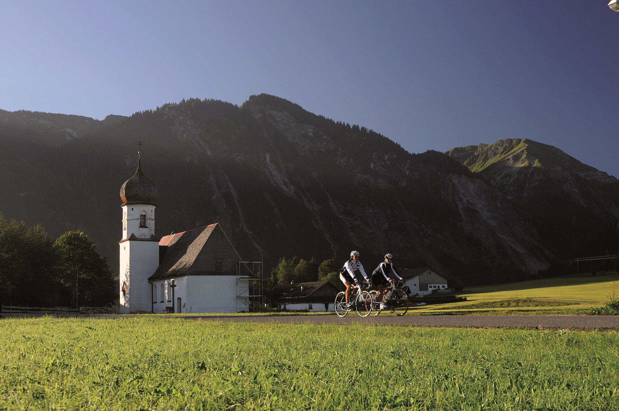
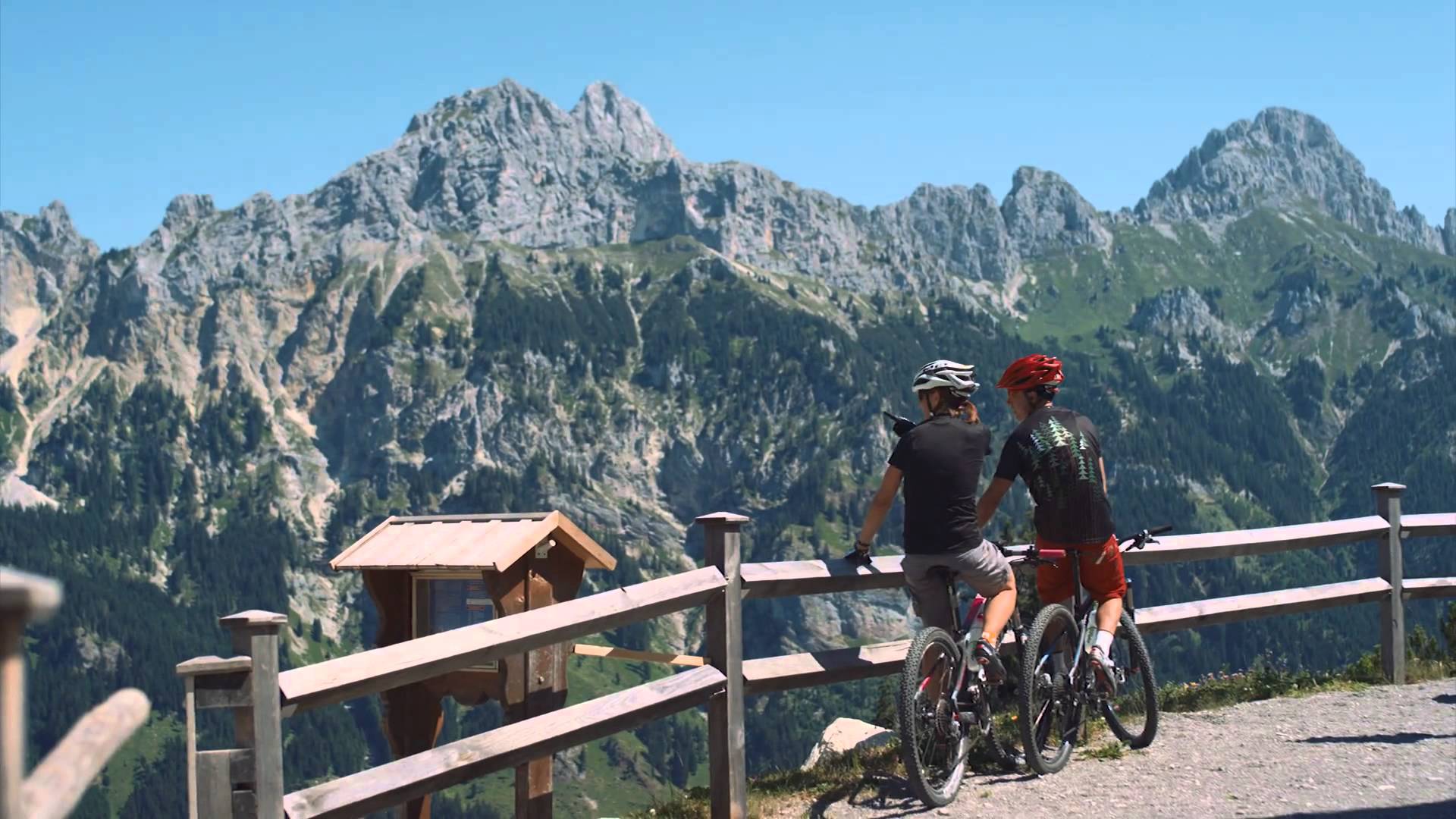
Fantastic route into the beautiful Lech valley, enjoy the fantastic landscape of the nature park region Tiroler Lech
- Difficulty
-
medium
- Rating
-
- Starting point
-
Tannheim
- Route
-
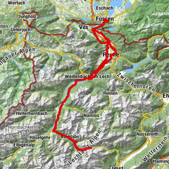
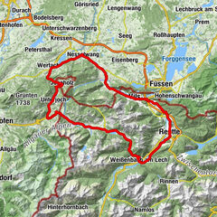
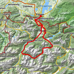
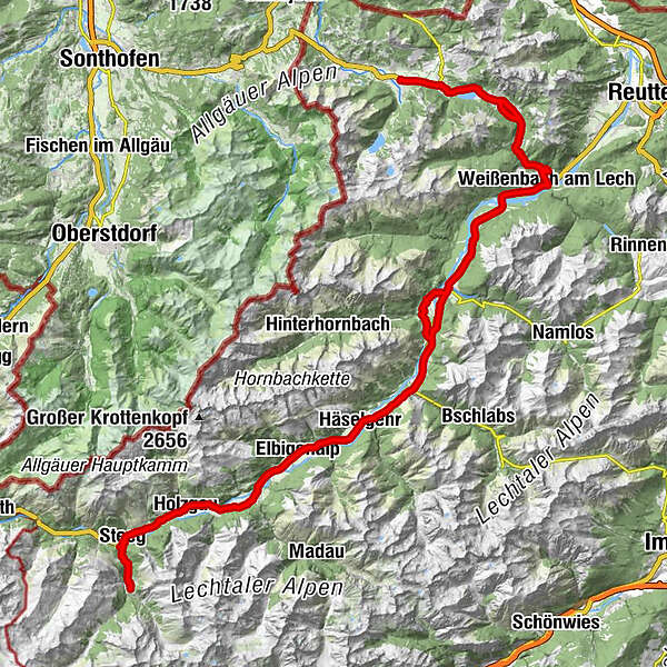
Tannheim (1,097 m)0.0 kmSt. Jakobus3.2 kmHaldensee3.2 kmVia Salina Hotel am See5.0 kmSt. Johannes5.1 kmHaller5.2 kmSchmittekapelle6.0 kmSchmitte6.2 kmNesselwängle (1,136 m)7.3 kmMariahilf Kapelle9.0 kmGasthof Klausenstüberl9.9 kmStegmühlkapelle9.9 kmRauth10.0 kmWeißenbach am Lech (885 m)14.9 kmDorfkirche14.9 kmForchach (910 m)20.5 kmBlockau24.4 kmStanzach (940 m)25.2 kmPfarrkirche Stanzach25.3 kmGasthaus Post25.3 kmVorderhornbach (973 m)28.1 kmPfarrkirche Vorderhornbach28.2 kmGasthof Rose28.2 kmFilialkirche Martinau29.4 km14-Nothelfer Kapelle30.1 kmElmen (976 m)31.9 kmPfarrkirche St. Martin37.0 kmHäselgehr (1,006 m)37.5 kmGrießau39.9 kmElbigenalp (1,039 m)42.1 kmObergiblen45.0 kmGrüner Baum45.7 kmGasthof Post45.8 kmAntoniuskapelle46.6 kmUnterstockach47.3 kmStockach48.0 kmGasthof Alte Schule48.1 kmPfarrkirche Stockach48.1 kmBildstock Maria la Salette49.3 kmHolzgau (1,114 m)50.9 kmDürnau51.9 kmHotel Styrolerhof52.9 kmFriedhofskapelle54.2 kmSebastian-und-Rochus-Kirche54.2 kmGasthof Schwarzer Adler54.4 kmHotel Post55.5 kmSteeg (1,124 m)55.6 kmStearawirt's Hauserei55.7 kmDickenau55.8 kmGasthaus Alpenhof57.5 kmKienberg57.5 kmKaisers (1,518 m)59.6 kmKienberg61.8 kmGasthaus Alpenhof61.9 kmDickenau63.4 kmStearawirt's Hauserei63.6 kmSteeg (1,124 m)63.7 kmHotel Post63.8 kmGasthof Schwarzer Adler64.8 kmFriedhofskapelle65.0 kmSebastian-und-Rochus-Kirche65.1 kmHotel Styrolerhof66.3 kmDürnau67.0 kmHolzgau (1,114 m)68.2 kmBildstock Maria la Salette69.9 kmStockach71.0 kmPfarrkirche Stockach71.1 kmGasthof Alte Schule71.1 kmUnterstockach71.9 kmAntoniuskapelle72.6 kmGrüner Baum73.4 kmGasthof Post73.4 kmObergiblen74.2 kmElbigenalp (1,039 m)77.0 kmGrießau79.3 kmHäselgehr (1,006 m)81.6 kmPfarrkirche St. Martin82.1 kmElmen (976 m)87.2 km14-Nothelfer Kapelle89.0 kmStanzach (940 m)92.6 kmGasthaus Post92.6 kmPfarrkirche Stanzach92.7 kmBlockau93.4 kmForchach (910 m)97.2 kmWeißenbach am Lech (885 m)102.9 kmDorfkirche103.0 kmRauth107.8 kmStegmühlkapelle107.9 kmGasthof Klausenstüberl107.9 kmMariahilf Kapelle108.9 kmNesselwängle (1,136 m)110.3 kmGasthof Köllenspitze110.5 kmPfarrkirche Mariä Himmelfahrt110.6 kmSchmitte111.7 kmSchmittekapelle111.8 kmWasserscheide Vils/Lech (1,150 m)111.9 kmHaller112.8 kmSt. Johannes112.9 kmVia Salina Hotel am See113.0 kmHaldensee114.7 kmSt. Jakobus114.8 kmTannheim (1,097 m)118.0 km
- Best season
-
JanFebMarAprMayJunJulAugSepOctNovDec
- Description
-
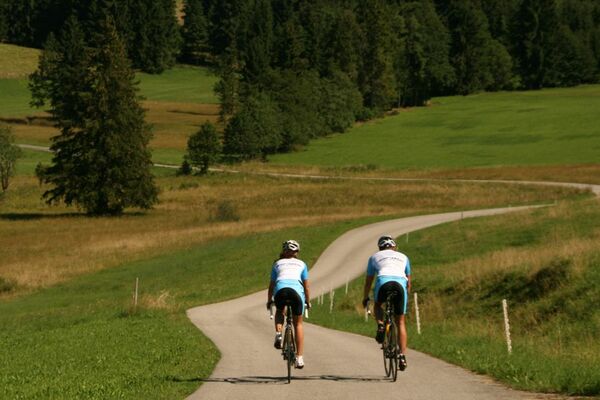
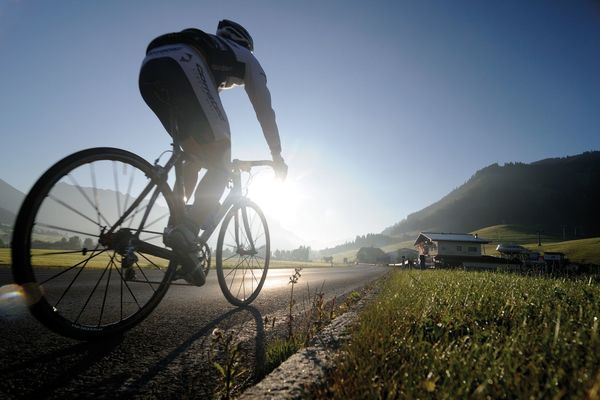
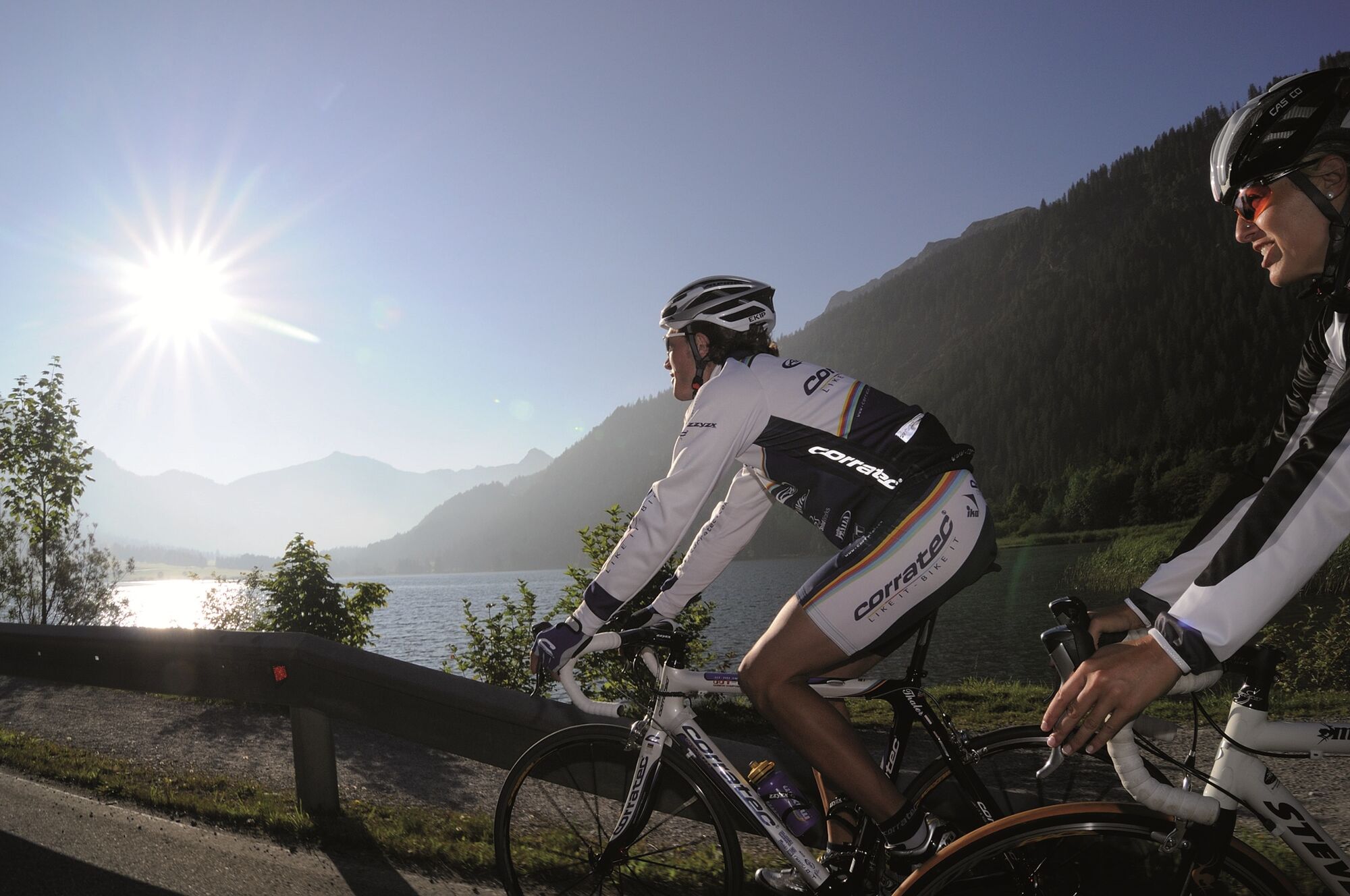
The Tannheimer Tal has been known among cyclists for quite some time, because in 2001 the retinue of the Tour of Austria Bicycle Tour went through the valley. In 2005 the cycling pros of the Tour of Bavaria came to Tyrolean soil at the opening stage and were rewarded with the mountain classification Tannheimer Tal and the mountain classification Jungholz. And even professionals noticed the scenic attractions of the "probably most beautiful high valley in Europe". Lush green meadows, the Haldensee and a beautiful mountain scenery accompanied the cycling pros on their competition kilometres. And thus the Tannheimer Tal has also advertised itself as an ideal region for specific training or extended tours. "The Tannheimer Tal is an ideal starting point for long racing bike tours to the surrounding regions such as Lake Constance or the Arlberg", says Michael Keller, managing director of the tourism association Tannheimer Tal and former national mountain bike coach of Austria. Cyclists find in the Tannheimer Tal not only the ideal starting point but also a wide range of accommodation. You can choose your accommodation from a 5-star house to a private room. After a nice ride you can relax and recharge your batteries. - The Tannheimer Tal
- Directions
-
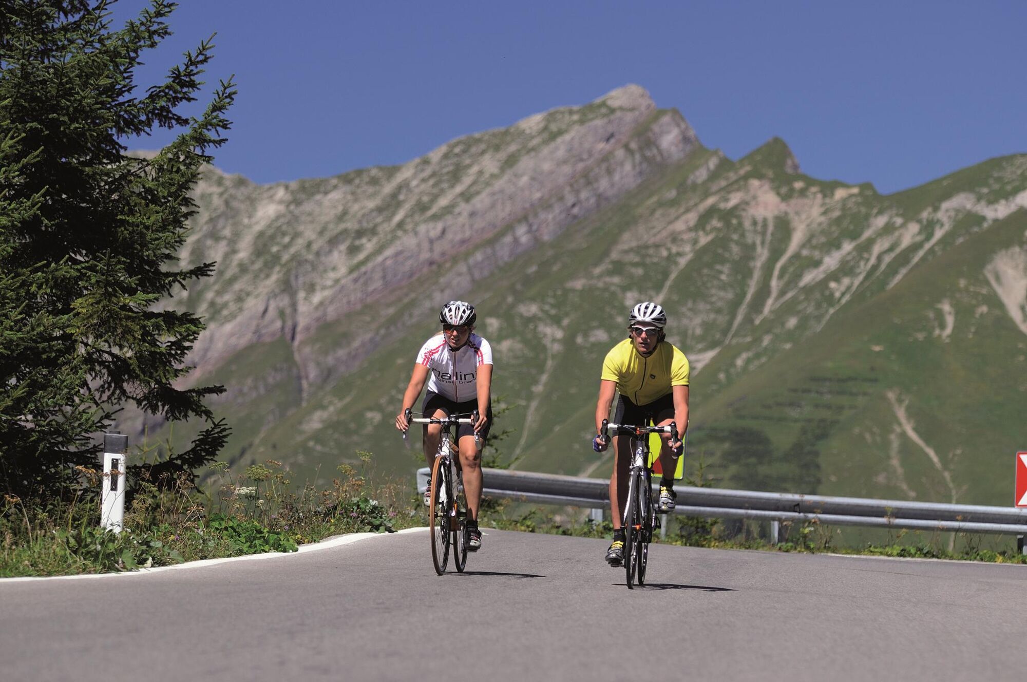
Start at the tourist information in Tannheim in eastern direction, passing Nesselwängle over the Gaichtpaß to Weißenbach. At the roundabout turn right into the Lechtal, past Forchach and continue on the slightly ascending B 198. After Stanzach turn right towards Vorderhornbach. Follow the road towards Martinau/Elmen. Cross the Lech bridge and turn right towards Elmen. Continue on the main road to Steeg. In Steeg turn left, there is a 4.4 kilometre long ascent with 400 metres in altitude and a maximum gradient of 15% to Kaisers. Arrived in Kaisers, take the same route back to Weißenbach and at the roundabout turn right into the Tannheimer Tal and back to the starting point.
- Highest point
- 1,476 m
- Endpoint
-
Tannheim
- Height profile
-

- Equipment
-
The personal equipment must be safe and serviceable and meet the relevant technical standards. Every racing cyclist is recommended to obtain information about the planned tours from specialist literature or on site. Complete racing bike equipment is strongly recommended, even for experienced cyclists!
- Safety instructions
-
The StVO applies. General valid and customary rules of conduct. It should be noted that in road cycling there is an increased risk of accidents and injuries. Despite careful tour planning, a basic risk always remains. Tour preparation through endurance sports, appropriate training and further education as well as personal prudence reduces the risk of accidents and injuries.
- Additional information
-
Tourismusverband Tannheimer Tal,
- Directions
-
On the motorway A7 at the exit "Oy-Mittelberg" on the B310 towards Wertach and to Oberjoch. There follow the signposting "Tannheimer Tal" B199, exit Tannheim. From the Tyrolean side via Reutte on the B198 towards Lechtal until Weißenbach, over the Gaichtpass along the B199 until exit Tannheim.
- Public transportation
-
By train to Sonthofen, Pfronten/Ried or Reutte, then by bus to Tannheim.
- Parking
-
Parking spaces at the Neunerköpfle gondola lift in Tannheim - subject to charges.


- Author
-
The tour Steeg-Kaisers is used by outdooractive.com provided.


General info
-
Lechtal
36
-
Hinterhornbach
13