- Brief description
-
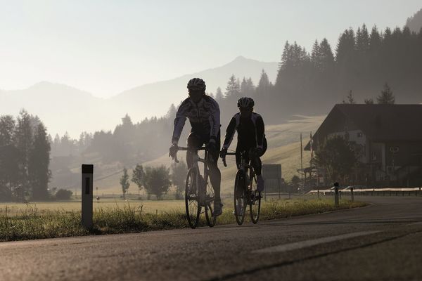
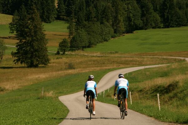
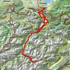
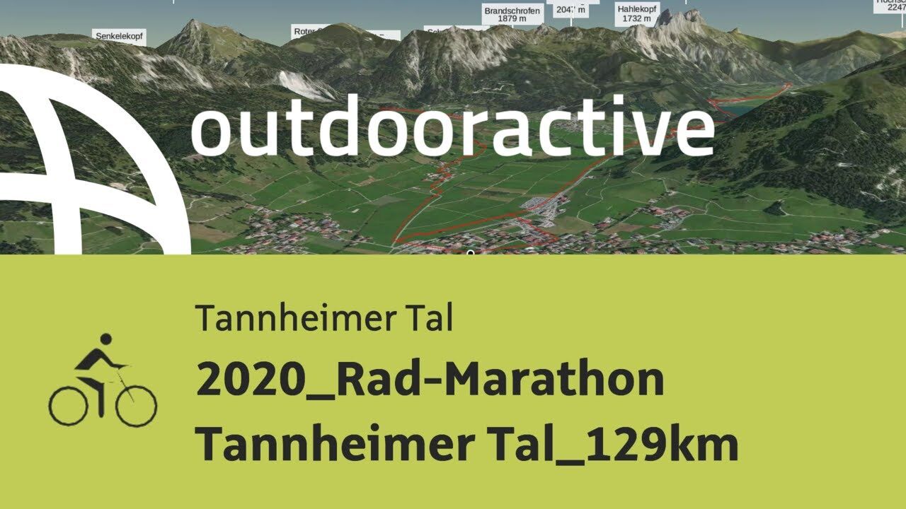
On Sunday, 5 July 2020 the 12th edition of the RAD-MARATHON Tannheimer Tal should take place. The 129 kilometres route leads from Tannheim via Grän to Pfronten in the Allgäu and further via Reutte into the nature park region Lechtal to Holzgau and back along the river Lech via the Gaicht pass into the Tannheimer Tal.
- Difficulty
-
medium
- Rating
-
- Starting point
-
6675 Tannheim / Tannheimer Tal / Tyrol - Local centre Tannheim municipal office
- Route
-
Tannheim (1,097 m)0.0 kmSt. Nikolaus0.1 kmSt. Martin2.0 kmInnergschwend2.2 kmLumberg4.3 kmMichaelskapelle4.6 kmWasserscheide Vils/Steinacher Achen (1145m)4.8 kmEnge5.1 kmSeealp7.2 kmÖsch14.8 kmSteinach15.4 kmSt. Michael15.6 kmSchönbichl17.9 kmSchwarzer Adler20.8 kmVils (826 m)20.9 kmKrone21.1 kmRiedle24.9 kmMusau (821 m)25.1 kmLeite25.7 kmBrandstatt (842 m)26.4 kmHl. Antonius26.5 kmMariae Heimsuchung27.1 kmRoßschläg27.2 kmOberletzen28.5 kmMariahilfkapelle28.9 kmOberletzen29.0 kmHinterbichl30.5 kmReutte (853 m)32.2 kmLechaschauer Kirche32.3 kmLechaschau (846 m)32.5 kmBuchenort32.6 kmGraben33.7 kmPlatten33.9 kmSoyers Sennerland34.5 kmHöfen (868 m)34.6 kmThermic Ranch34.6 kmHornberg35.6 kmWeißenbach am Lech (885 m)39.8 kmStuibenhütte (920 m)43.7 kmViele Brunnen45.3 kmJagdthüttenalpe47.2 kmStanzach (940 m)50.1 kmVorderhornbach (973 m)52.5 kmPfarrkirche Vorderhornbach52.5 kmGasthof Rose52.5 kmFilialkirche Martinau53.8 kmGasthof Klimm56.4 kmLechzeit56.5 kmPfarrkirche St. Martin61.4 kmHäselgehr (1,006 m)61.9 kmSchönauerkapelle63.4 kmGrießau64.3 kmElbigenalp (1,039 m)66.5 kmObergiblen69.3 kmGrüner Baum70.0 kmGasthof Post70.1 kmAntoniuskapelle71.0 kmUnterstockach71.6 kmStockach72.4 kmGasthof Alte Schule72.5 kmPfarrkirche Stockach72.5 kmBildstock Maria la Salette73.7 kmHolzgau (1,114 m)75.2 kmDreifaltigkeitskapelle78.2 kmStockach80.4 kmPfarrkirche Stockach80.5 kmGasthof Alte Schule80.5 kmUnterstockach81.3 kmAntoniuskapelle82.0 kmGrüner Baum82.8 kmGasthof Post82.8 kmObergiblen83.5 kmElbigenalp (1,039 m)86.4 kmGrießau88.6 kmHäselgehr (1,006 m)90.9 kmPfarrkirche St. Martin91.5 kmElmen (976 m)96.6 km14-Nothelfer Kapelle98.4 kmStanzach (940 m)102.0 kmGasthaus Post102.0 kmPfarrkirche Stanzach102.1 kmBlockau102.8 kmForchach (910 m)106.7 kmDorfkirche112.4 kmWeißenbach am Lech (885 m)112.4 kmRauth117.2 kmStegmühlkapelle117.3 kmGasthof Klausenstüberl117.3 kmMariahilf Kapelle118.3 kmNesselwängle (1,136 m)119.9 kmSchmitte121.0 kmSchmittekapelle121.1 kmWasserscheide Vils/Lech (1,150 m)121.2 kmHaller122.0 kmSt. Johannes122.3 kmVia Salina Hotel am See122.4 kmHaldensee124.1 kmSt. Jakobus124.1 kmTannheim (1,097 m)128.0 km
- Best season
-
JanFebMarAprMayJunJulAugSepOctNovDec
- Description
-
Start in the centre of Tannheim to Grän, then downhill to Pfronten in Ostallgäu and back to Tyrol. Through Vils and Musau, further in the middle of the Lechauen to Lechaschau on the B198 turn right to Weißenbach am Lech. Before the Johannes Bridge turn right into Schwarzwasser and continue to Vorderhornbach to the first refreshment station. In Martinau turn right onto the cycle path, continue over the Klimmbrücke bridge in Elmen to Häselgehr and through Elbigenalp on the B198 towards Bach, continue to Holzgau and at the end of the village you will reach the turning point. Follow the cycle path until you reach the second refreshment station at Stockacher Hof. Back on the B198 the route leads to Bach, there turn right onto the cycle path towards Untergrünau, past Elbigenalp to the Grießauer bridge. From there back on the B198 through Häselgehr to Weißenbach to the third refreshment stop. Then enter the roundabout, exit in the direction of Tannheimer Tal and via the Gaichtpaß along the B199 back to Tannheim.
- Directions
-
Start in Tannheim, in the village centre to the church through the village and at the exit Berg in the direction of Innergschwend to Grän/Lumberg. There turn left onto the L261 through the Engetal downhill to Pfronten until the main road, in Pfronten Steinach. There turn right and follow the sign Vils/Reutte. After the border crossing through the small town of Vils and further on to Stegen and turn right onto the L69 towards Musau, after Roßschläg/Bärenfalle onto the cycle path towards Oberletzten (motor vehicle ban) and in the middle of the Lechauen to Lechaschau. Turn right there in front of the church onto the B198 and through Höfen to Weißenbach am Lech. There, at the roundabout, go straight on into the Lech Valley, before turning right just before the Johannis Bridge onto the cycle path into the Schwarzwasser (no motor vehicles allowed). The single-lane road rises slightly there and leads into the forest, where the cycle path runs along the Lech river. Scenically wonderful impressions and a diversified road until Stanzach, where the cycle path is left again and the village Vorderhornbach (1st refreshment stop after 54 km) is passed. Continue to Martinau, where you turn right onto the cycle path towards Klimmbrücke near Elmen and continue along the cycle path to Häselgehr. There the route continues for one kilometre on the B198 before the village of Häselgehr is bypassed on a very nice cycle path and is then returned to the B198. The route continues to Elbigenalp, Bach, Stockach and through Holzgau. At the end of Holzgau turn left and follow the Lechtal cycle path, along the Lechfuß, towards Stockacher Hof to the second refreshment stop after 79 kilometres. Then along the B198 through Stockach to Bach, there before the Lech bridge turn right towards Ober- and Untergrünau, past the main village of the Lech valley, Elbigenalp. The cycle path continues on to the Grießauer Brücke, where you take the B198 again past Elmen and on through Stanzach to Weißenbach. Here, after 112 km, the third and last refreshment stop on the route is waiting. From there continue to the roundabout in Weißenbach, turn left towards Tannheimer Tal on the B199 to the Gaichtpass and along the picturesque Haldensee back to the starting point to Tannheim.
- Highest point
- 1,151 m
- Endpoint
-
6675 Tannheim / Tannheimer Tal / Tyrol - Local centre Tannheim municipal office
- Height profile
-

- Equipment
-
Road bikes are recommended, the route can also be ridden on touring bikes.
Wearing a crash helmet is mandatory.
Every participant has to carry a spare tube on his own.
Escort vehicles are undesirable - please keep to this!
!!! No motor vehicles are allowed in the black water and on some sections of the cycle paths!
- Safety instructions
-
It should be noted that in road cycling there is an increased risk of accidents and injuries. Despite careful tour planning, a basic risk always remains. Tour preparation through endurance sports, appropriate training and further education as well as personal prudence reduces the risk of accidents and injuries
- Additional information
-
Tourismusverband Tannheimer Tal
- Arrival
-
On the motorway A7 at the exit "Oy-Mittelberg" on the B310 towards Wertach and to Oberjoch. There follow the signposting "Tannheimer Tal" B199, exit Tannheim, Neunerköpfle mountain railway.
From the Tyrolean side via Reutte on the B198 towards Lechtal to Weißenbach, over the Gaichtpass along the B199 to the exit Tannheim, Neunerköpfle Bergbahn.
- Public transportation
-
By train to Sonthofen, Pfronten/Ried or Reutte, then by bus to Tannheim.
- Parking
-
car park P3 in Tannheim - with costs
- Author
-
The tour 2020_Rad-Marathon Tannheimer Tal_129km is used by outdooractive.com provided.


-
Tannheimer Tal
52
-
Stanzach
16